
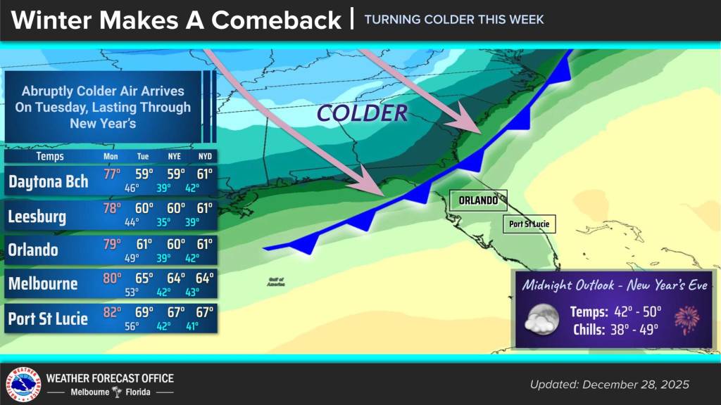
Central Florida will get one more full day with warm weather before a cold front slides across the region on Monday night, according to the National Weather Service.
Clear conditions with highs in the upper 70s are expected across the region with overnight lows dipping into the 50s much as has been the pattern for the last couple of weeks.
Another sunny, warm day is on tap Monday before cold front moves across the state Monday night into Tuesday morning.
Winds will increase from 10-15 mph during the day and veer northwest in the evening behind the boundary with increased cloud cover moving through.
Expect highs to only hit in the 60s on Tuesday with the overnight into Wednesday likely the coldest of the week.
Temperatures could drop into the 30s for the Volusia coast and west of I-95 with the lowest values across much of Lake County and interior Volusia County, the NWS stated.
The wind chill will be at its worst into Wednesday morning with winds near 10 mph and feels-like temperatures of the low to mid 30s. Some wind chill temperatures could drop to the upper 20s in portions of Lake and northwest Volusia counties, the NWS warned.