
ORLANDO, Fla. – Central Florida is in for a fantastic stretch of weekend weather, with dry air sitting high above the peninsula and keeping rain chances at bay.
The humidity levels are expected to remain low throughout the day and into early Sunday, allowing for plenty of sunshine and a break from recent storms.
Today’s highs
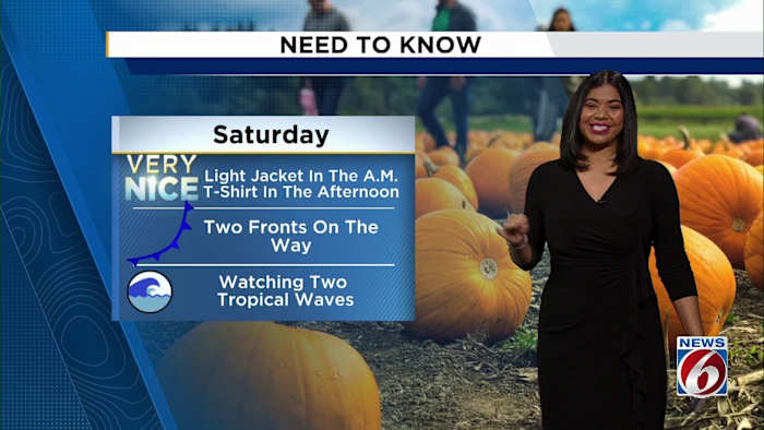
Mornings could feel a bit cool, so a light jacket might come in handy, but you’ll likely want to swap it for a T-shirt by the afternoon as daytime highs rise into the lower 80s.
High pressure remains the main weather player, keeping things breezy along the coast and downright pleasant for anyone heading out to events like Biketoberfest in Daytona Beach.
Biketoberfest forecast
The current dry pattern won’t last forever, though. Two cold fronts are set to move through Central Florida over the next several days. The first front is expected to arrive Sunday evening, bringing a 20% chance of passing showers before moving out of the area.
First front
As this front passes, temperatures are forecast to ramp up Sunday afternoon, possibly reaching 88 degrees ahead of the change. Another area of high pressure is expected to build over Georgia behind the front, leading to more dry and breezy weather for Monday through Wednesday.
A second front is forecast to move through Wednesday night into Thursday, which is likely to bring cooler, drier air back into the region. Overnight lows are expected to dip to the mid 60s and even the low 60s by late week.
Keeping watch on the tropics
The National Hurricane Center is highlighting two areas of possible development.
One non-tropical wave over the northern Atlantic has a low (10%) chance of development over the next week. Meanwhile, another tropical wave in the central Atlantic — moving west toward the Leeward Islands — is expected to bring heavy rain and gusty winds to those islands, regardless of development.
8 a.m.
The Caribbean Sea has been highlighted for potential tropical development, with a 30% chance of formation by the end of the week. For now, these disturbances are not expected to directly impact Central Florida.
If a tropical system does form, the next storm names on the list are Melissa and Nestor.
With clearer skies and dry weather, don’t forget to share your fall weather photos and videos with News 6 by using PinIt!
News 6 Weather Insider
More Stories Like This In Our Email Newsletter
Copyright 2025 by WKMG ClickOrlando – All rights reserved.