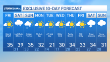
Brrrrr, it’s cold outside! Very, VERY cold outside — and it will only get worse next week!
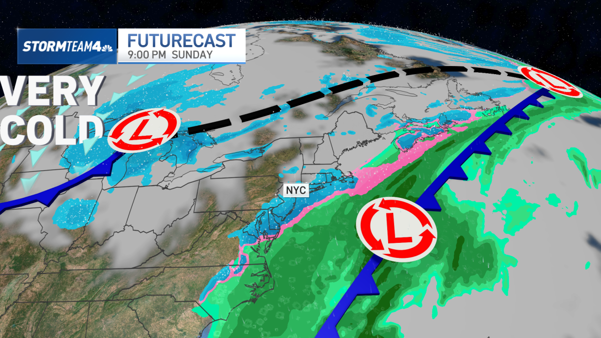
After a very cold day Friday, temperatures take a slight upturn on Saturday as a system passes through the tri-state area leaving the area with a threat of precipitation.
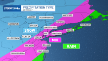
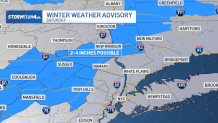
This system will bring us some light snow just after midnight Friday that will continue into Saturday, with most spots seeing under an inch except for the Lower Hudson Valley and western Connecticut where up to 1–3 inches can accumulate with a small chance totals could creep higher toward advisory levels. At the coast, temperatures will be above freezing pretty much all day, so a mix of rain and snow is most likely, which will keep coastal snow totals low to zero.
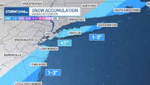
Another round of snow is possible Sunday, mainly for eastern Connecticut and eastern Long Island, as a coastal low passes offshore. This light snow will most likely taper off and leave the ys with a sunny but very cold MLK Jr. Day on Monday.
The cold trend will stay with us next week.
Another arctic blast will arrive next week with daytime highs struggling to get above freezing and overnight lows dropping into the teens—possibly single digits in spots, especially where snow remains on the ground.
The coldest temperatures of the season is expected Tuesday and Wednesday morning with lows in the mid to upper teens before the wind chill. The second half of next week won’t be as cold, but still below normal for late January.