
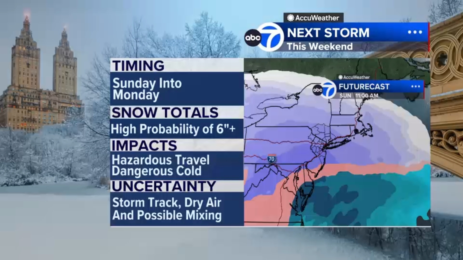
NEW YORK (WABC) — New York City and the Tri-State area find themselves in the path of a sprawling and powerful winter storm that is threatening to leave a trail of snow, ice and inescapable travel mayhem across dozens of states, from the Southwest through the Southeast, the Mid-Atlantic and Northeast.
The storm, with a potential historic sweep unlike any seen in recent years, could arrive at the doorstep of the Tri-State area as early as Sunday morning.
The current thinking is for snow to begin falling Sunday morning and continue into early Monday, setting up colossal complications for travel and commutes as the work week looms.
RELATED | Live updates on the storm
Locked-in Arctic air will limit any potential melting in the days after the storm pulls out to sea.
It is far too early to say with certainty just how much snow will fall, as that determination will be storm-track dependent, but governmental agencies across the Tri-state area are taking the threat seriously and are preparing for a significant snow storm just in case.
One thing we can say for sure is that it will be brutally cold and blustery as the snow pushes up from the South.
The high on Saturday will be 19 with a low of just 12. Sunday will be just about the same.
New York will be on the northern fringe of a large coastal low that could deliver significant snow to the Mid-Atlantic states.
Light to moderate snow is likely across the region, with heavier snow to the south, but it’s still too early to know for sure.
RELATED | Latest AccuWeather forecast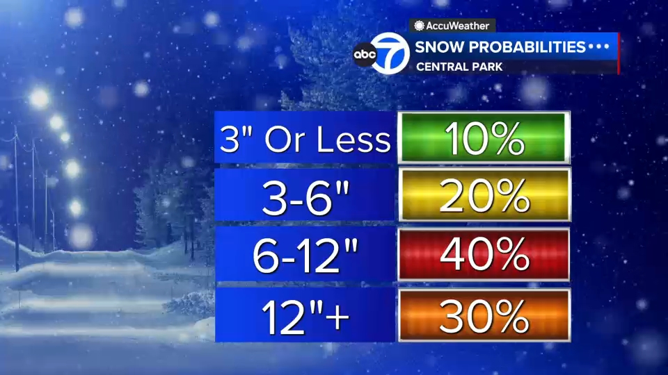
———-
* Sign up for free newsletters
* Download the abc7NY app for breaking news alerts
Submit Weather Photos and Videos
Have weather photos or videos to share? Send to Eyewitness News using this form. Terms of use apply.
Copyright © 2026 WABC-TV. All Rights Reserved.