
STATEN ISLAND, N.Y. — Meteorologists eyeing a snow storm headed toward Staten Island on Sunday agree that conditions throughout the day and night could be treacherous.
What they can’t agree on is the inch count.
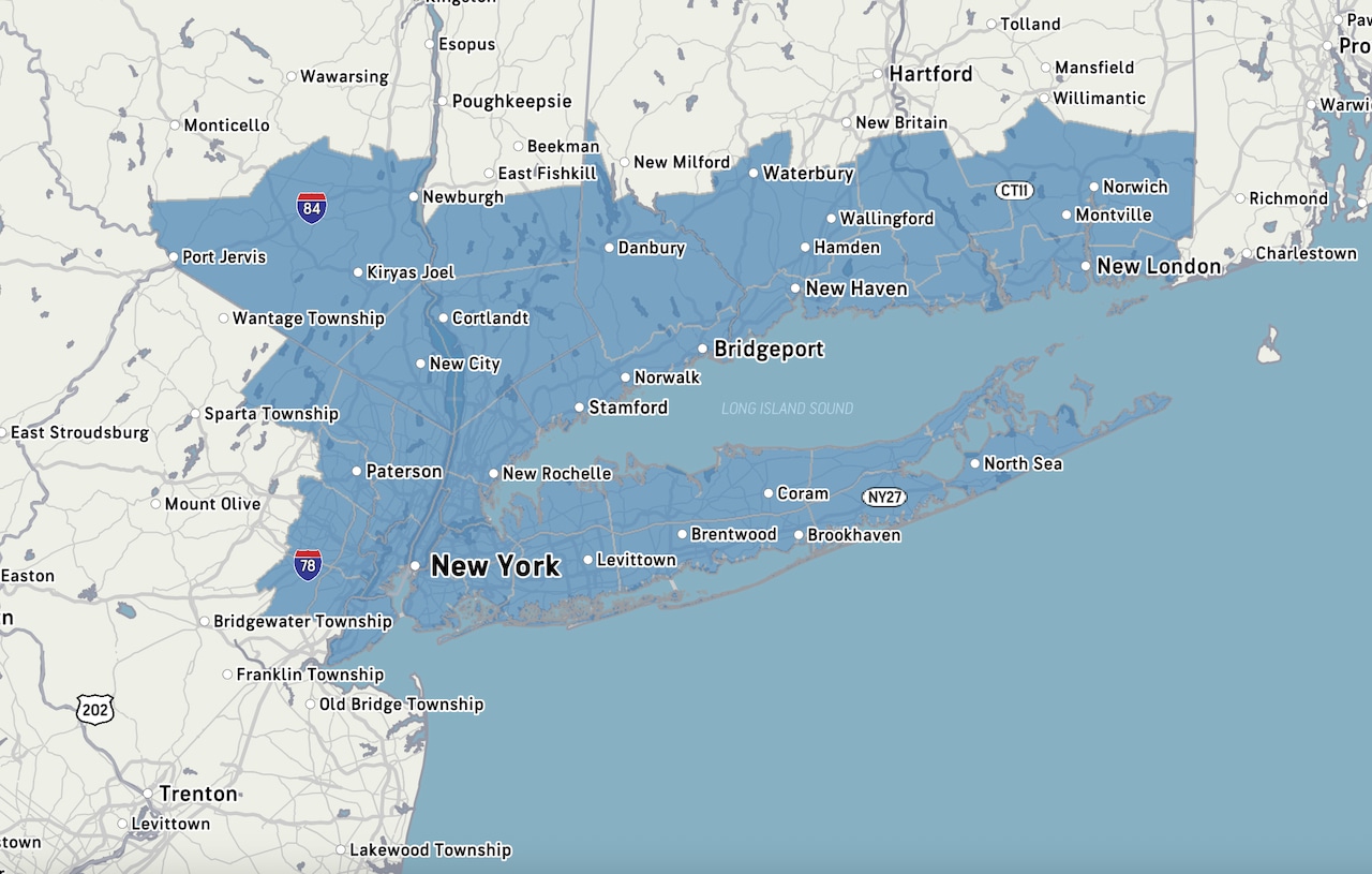
While the National Weather Service is calling for anywhere from 8 to 14 inches of snow in and around the borough, Accuweather is leaning more toward 4 to 8 inches of snow.
The key factor, according to AccuWeather meteorologist Tom Kines, will be whether the snow turns to sleet in the evening, which would reduce the inch count.
Staten Island has a better chance of sleet than other parts of the city that are located further away from the coastline, Kines said Friday.
Either way, the roads could be a mess for the morning commute Monday, according to multiple forecasts.
“That stuff could freeze,” said Kines, referring to what could be a wintry mix Sunday night. “If possible, hunker down Sunday, and wait to see what the situation is like Monday.”
When will the snow arrive? Snowstorm preparations are underway at Atlantic Salt at 561 Richmond Terrace in New Brighton, on the morning of Friday, Jan. 23, 2026.(Advance/SILive.com | Jan Somma-Hammel)
With snowfall expected to begin as early as late Saturday night, experts agree the heaviest snow likely won’t arrive until later Sunday morning and through the afternoon.
The National Weather Service also indicates a chance for sleet to mix with snow Sunday evening along coastal areas, including Staten Island.
By Monday morning, the snow is expected to taper off, according to meteorologists with both weather services.
“This is increasingly likely to be a major winter storm with significant disruption to travel and daily life early next week,” the Weather Service warns.
Minor coastal flooding, meanwhile, is possible during Sunday night’s high tide in areas including New York Harbor, though any flooding impacts are expected to be minor.
Frigid temperatures on tap The sun rises over Casa Belvedere on Howard Avenue on Grymes Hill on the morning of Friday, Jan. 23. The Verrazzano-Narrows Bridge is seen in the distance. (Advance/SILive.com | Jan Somma-Hammel)
Borough residents should also prepare for frigid temperatures this weekend, as a Cold Weather Advisory will take effect overnight.
Arctic air is expected to move into the area Friday evening, with temperatures plunging into the single digits and teens overnight. Wind chill values could fall as low as 10 degrees below zero into Saturday morning, according to the National Weather Service.
The Cold Weather Advisory will remain in effect through 10 a.m. Saturday. It is forecast to be one of the coldest days in several years, with highs only reaching the teens, potentially breaking record low maximum temperatures.
Subfreezing temperatures are expected to persist through late next week, with daytime highs in the lower 20s. Wind chills may fall below zero at times, and the fresh snowpack will likely help maintain the cold conditions.