
NEW YORK (WABC) — A powerful winter storm will spread snow and dangerous ice across a vast expanse of the United States this weekend, with New York City and the Tri-State area facing down snow, heavy at times, for much of Sunday and lingering into early Monday.
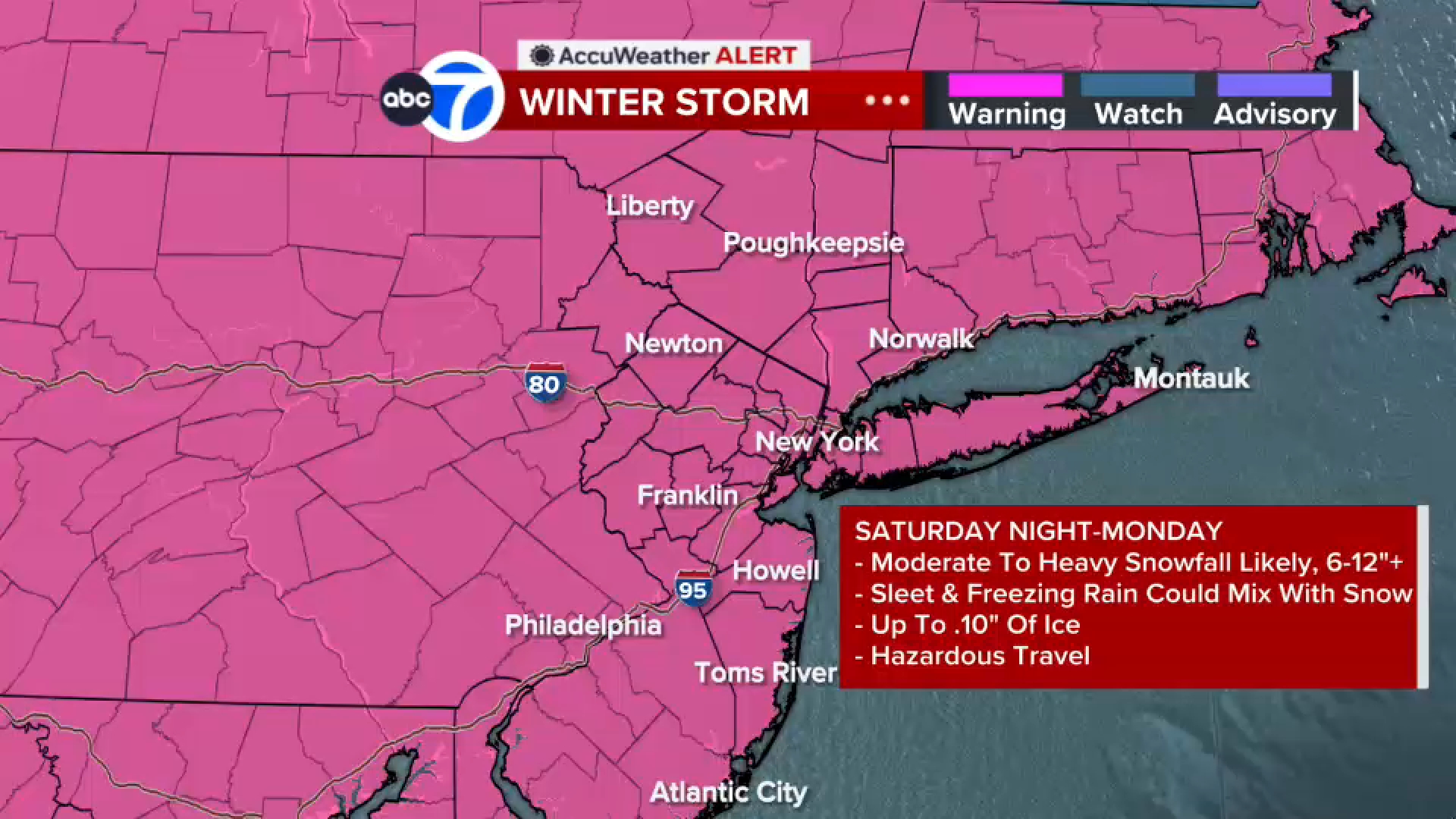
A Winter Storm Warning has been issued for New York City and the Tri-State area early Sunday morning to Monday night, in addition to a Cold Weather Advisory that goes into effect Friday night.
Click here for the latest advisories, watches and warnings from the National Weather Service
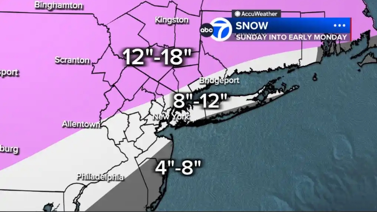
Areas well north and west of New York City could see accumulations of a foot or more of snow, potentially reaching 18 inches, with bullseye regions including northwestern New Jersey, the Hudson Valley and eastern Pennsylvania.
The area around the city and Long Island, as well as much of New Jersey, could land in the 8-to-12-inch range.
We’ve also introduced a 4-to-12-inch zone for southeastern Monmouth County, most of Ocean County, and the south shore of Long Island. These areas will likely mix in sleet earlier, cutting down on higher totals.
Snow moves in during Sunday morning with the heaviest snow around midday. Sleet and freezing rain could mix in after the initial round of snow during the afternoon. Snow continues through the evening but it won’t be as heavy. Snow will linger into Monday, but it will be light.
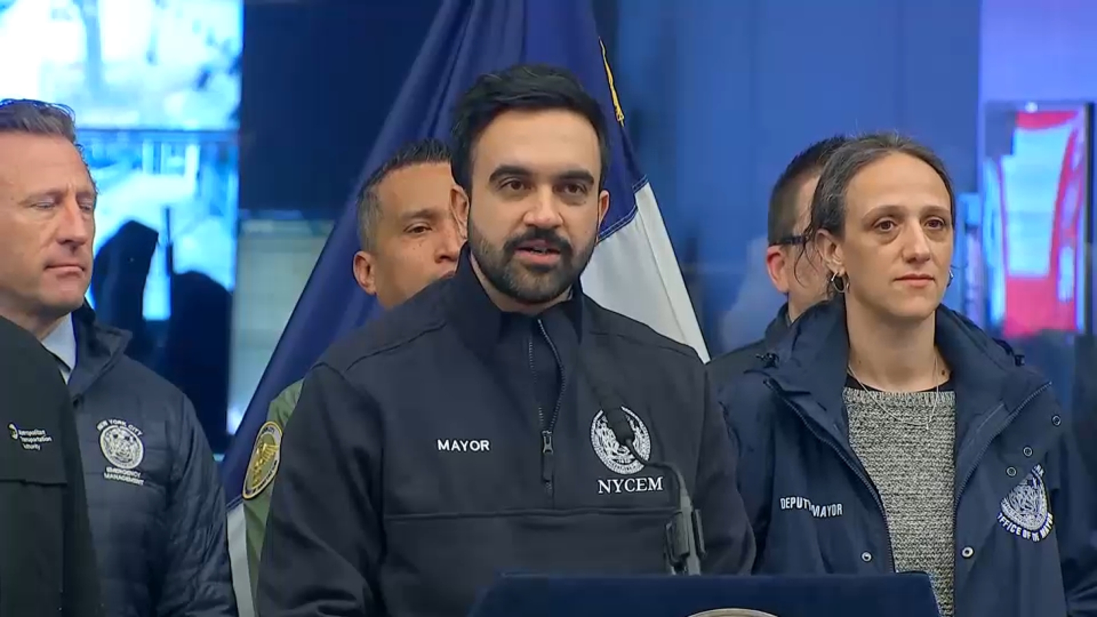
Governmental agencies across the Tri-State area are taking the threat seriously and are preparing for a significant storm, as residents stock up on food and supplies in anticipation of one of the biggest winter storms in many years.
The Channel 7 Eyewitness News AccuWeather team has issued AccuWeather Alerts for three days in a row, starting on Saturday for extreme cold, Sunday for the winter storm, and Monday for early snow and deep cold that will linger.
Refresh this post regularly for the latest updates from the Eyewitness News team, including an updated forecast discussion.