
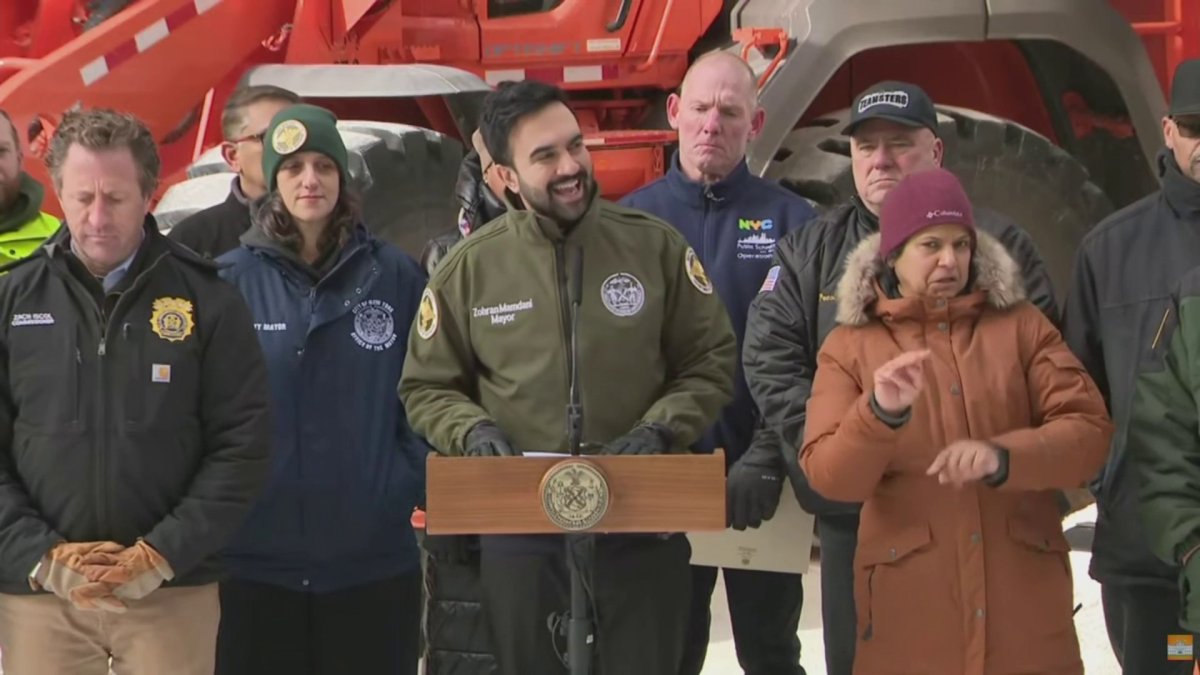
New York City Mayor Zohran Mamdani spoke about the city’s preparations ahead of the anticipated snowstorm, warning that temperatures will be more chilling this weekend than they have been in eight years.
Snowfall is expected to start around midnight and fall at its heaviest rate tomorrow morning and early afternoon, Mamdani said.
“By early Monday morning, the heaviest of the weather will have passed, although some precipitation could continue through the day,” Mamdani said. “We expect at least 8 to 9 inches of snow, and likely more. This will not just be snow. This storm will also bring with it intense cold, a prolonged period of frigid temperatures that will last through the next week.”
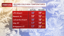
Many locations across the tri-state on Saturday recorded seeing record high temperatures, including reporting sites at JFK and LaGuardia airports.
In preparation for the storm, teams from New York’s Department of Sanitation have brined highways and roads in the city, while the Emergency Management Department has activated its winter weather plan, Mamdani said. The city previously activated a Code Blue, deploying teams to reach out to homeless residents and connect them to shelter options.
Plowing operations will start in the city shortly after snow starts to fall, Mamdani said.
“Make no mistake, we are taking every precaution, and we are prepared for every possible amount of snow,” he said.
Wind chills Saturday were expected to fall between 0-10 all day, making for brutal conditions as New Yorkers prepared for the approaching snow storm.
Snow arrives around sunrise Sunday and hits hard through the mid-afternoon. Snowfall rates of 1-2″ an hour will be common.