

NEW YORK (WABC) — The sprawling winter storm that has been marching across the nation is poised to arrive in New York City and the Tri-State area Sunday morning, unleashing a crippling brew of snow and ice.
Ahead of the storm’s arrival, the region is under a Winter Storm Warning as the powerful storm gets set to spread snow, heavy at times, and dangerous ice in our area for much of Sunday and lingering into early Monday.
Meteorologist Jeff Smith times out the snow expected on Sunday
Click here for the latest advisories, watches and warnings from the National Weather Service
Areas well north and west of New York City could see accumulations of 12 to 18 inches, while the vicinity around the city and Long Island, as well as coastal New Jersey, could land in the 6-to-12-inch range.
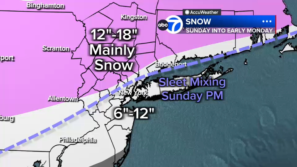
Those lower amounts reflect the intrusion of sleet and freezing rain later in the day, but that will happen after considerable snow has already fallen, adding a dangerous dimension to travel and the stability of power lines.
Governmental agencies and regional transit agencies are gearing up as residents stock up on food and supplies in anticipation of one of the biggest winter storms in many years.
The Channel 7 Eyewitness News AccuWeather team has issued AccuWeather Alerts for Sunday for the winter storm, and Monday for early snow and deep cold that will linger into early February, ensuring the snow and ice won’t melt anytime soon.
Refresh this post regularly for the latest updates from the Eyewitness News team, including an updated forecast discussion.