
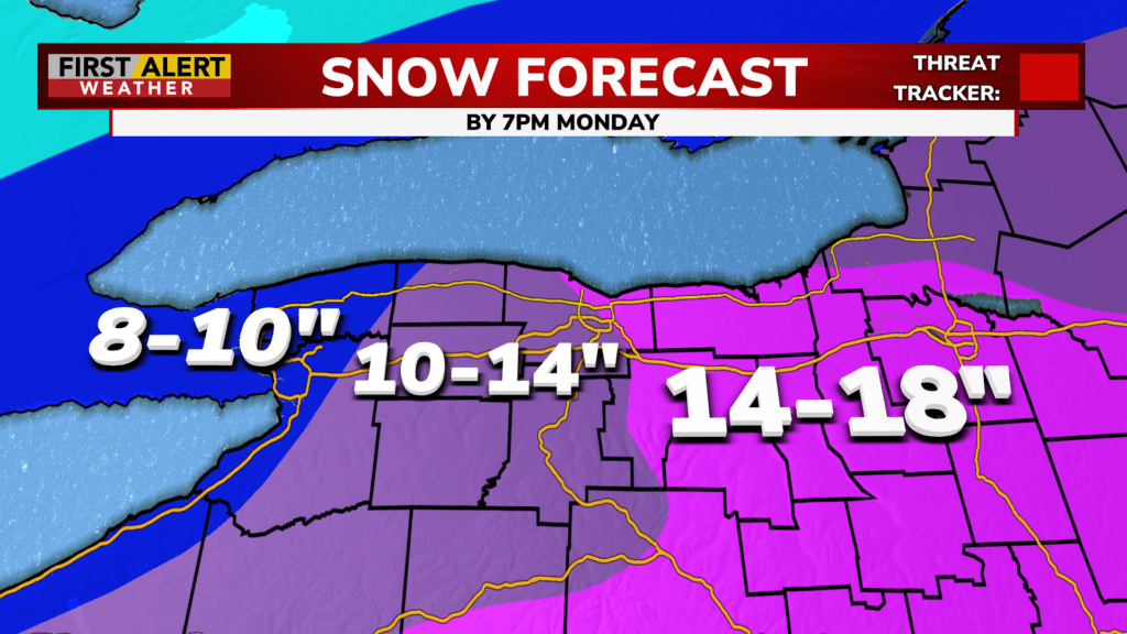
ROCHESTER, N.Y. – Our Red Alert continues as a snowstorm passes through our region. Significant accumulations are expected as the snowfall begins to pick up.
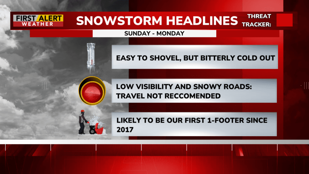
Snowfall was light and manageable to start, but the heavy portion of the storm is now entering from the south. Snowfall rates will climb to 1.5″ per hour and remain heavy through the evening into the overnight hours. Visibility will be reduced and roads will be snowy, which means stay home today. Due to the bitterly cold temperatures, the snow itself will be light and fluffy and easy to shovel.
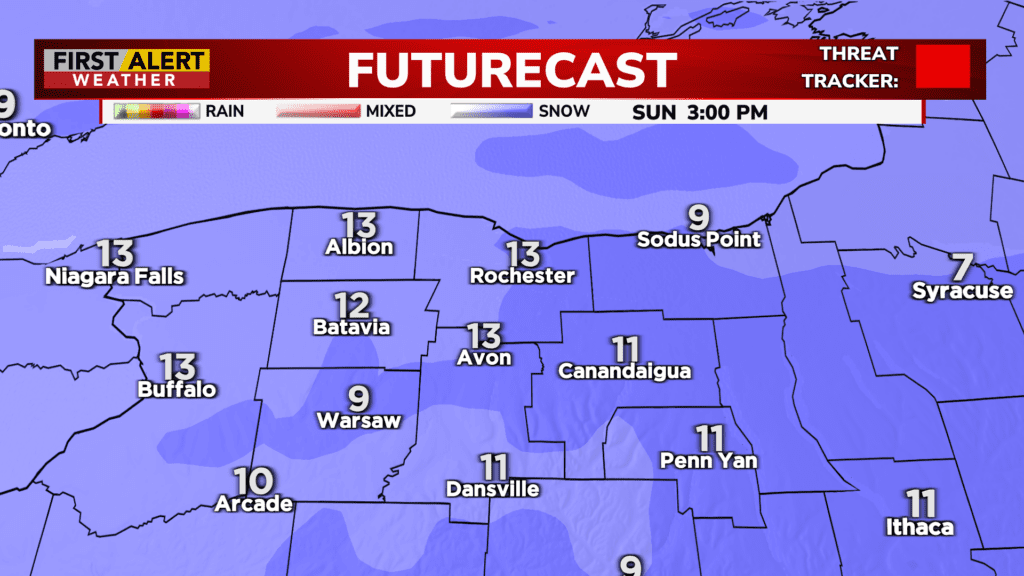
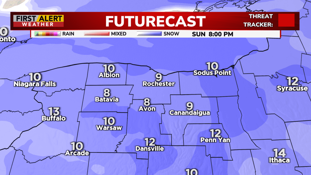
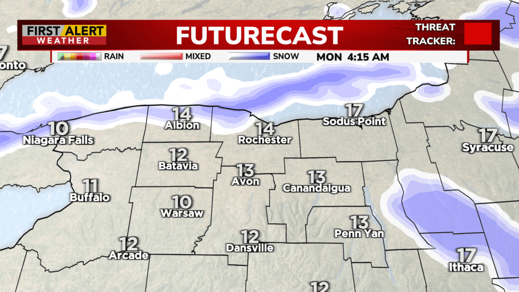
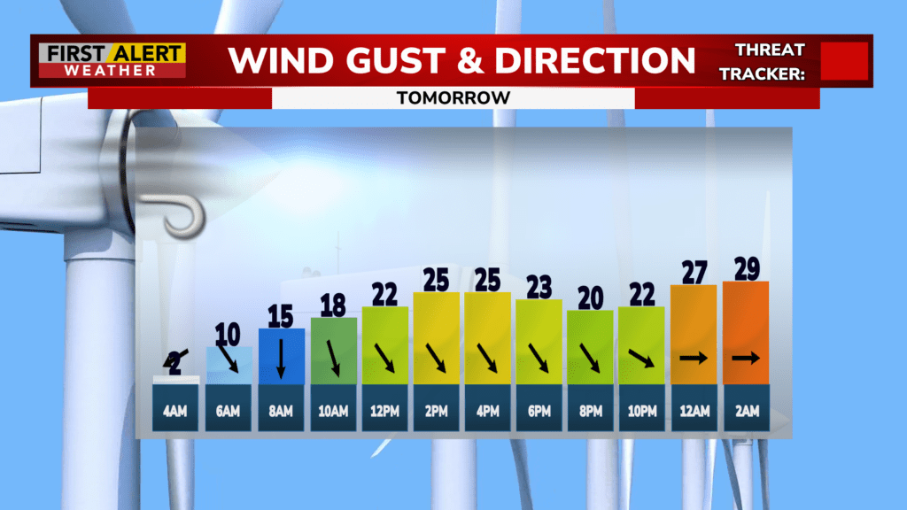
Overnight the wind direction will become more northerly which will cause some lake enhancement, increasing the snowfall totals along the lakeshore. By tomorrow morning most of the region will have at least a foot of snow on the ground.
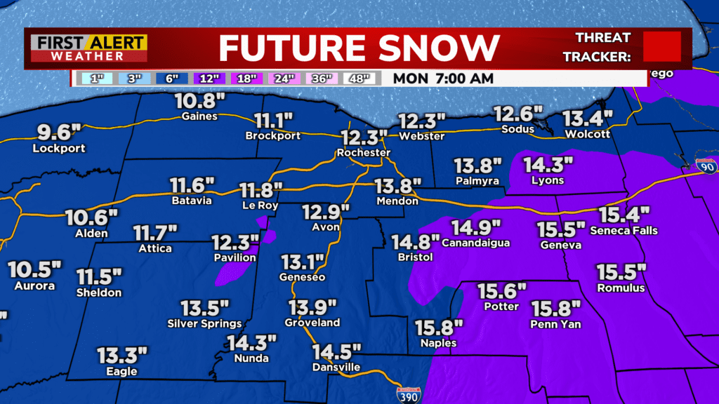
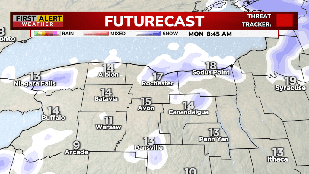
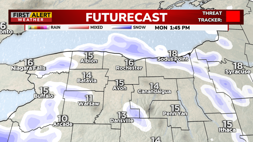
Snow will taper off tomorrow morning, then transition to lake effect snow showers which will increase snow totals at the local level, especially in Wayne County where the lake snow will focus in on by Monday night. Winds will increase, which will pick up the light fluffy snow and throw it through the air, recoating roads and decreasing visibility.
We are closely tracking the storm as it moves through the region today and will continue to send out updates. Stay safe, stay warm, and stay tuned.
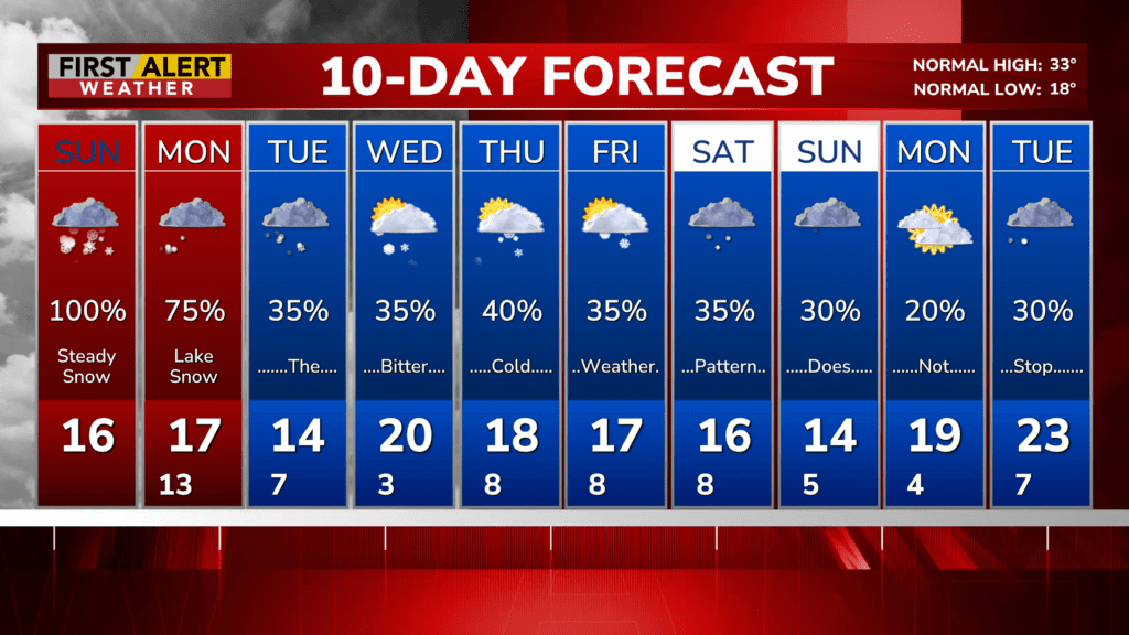
After the storm… Comes more bitter cold weather. We will stay below freezing the rest of the week, and with more lake effect snow expected at times, some towns southeast of Lake Ontario in Wayne County could see up to ANOTHER foot of snow by the end of the week.
For Related Stories: forecast storm weather Red Alert snow amount snow