
Jan 25, 2026, 12:04 AM GMT
Big winter storm carving icy, 2,000-mile path across US targets NYC, Tri-State with heavy snow, ice
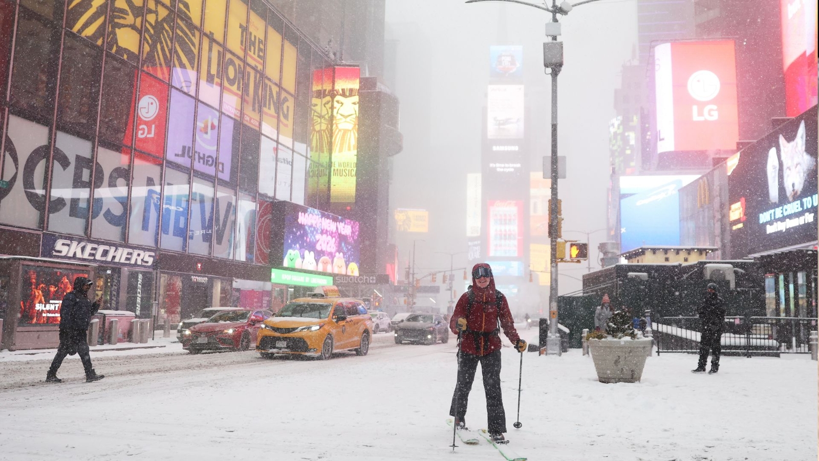
It is a monstrous winter storm, the likes of which we haven’t seen in years, spanning 2,000 miles from New Mexico to Virginia, and the system that is leaving a disruptive path of snow and ice across the nation is now making a beeline toward New York City and the Tri-State area.
With bone-chilling Arctic temperatures setting the table, the first flakes are expected to fall around dawn in New York City on Sunday morning as the storm pushes into the Northeast.
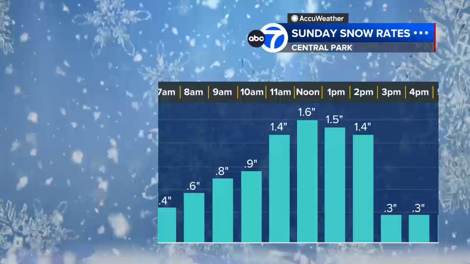
Those early flurries quickly morph into heavy snow that could unleash whiteout conditions as snow falls at a clip of 1 to 2 inches an hour during its most forceful window from late morning into early afternoon.
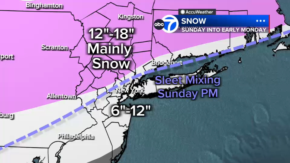
The storm is poised to deliver a whopping 12 to 18 inches of snow well north and west of New York City, but totals could be limited to a still hefty 6 to 12 inches in and around New York City, Long Island, and coastal New Jersey because of the late-afternoon intrusion of sleet and freezing rain.
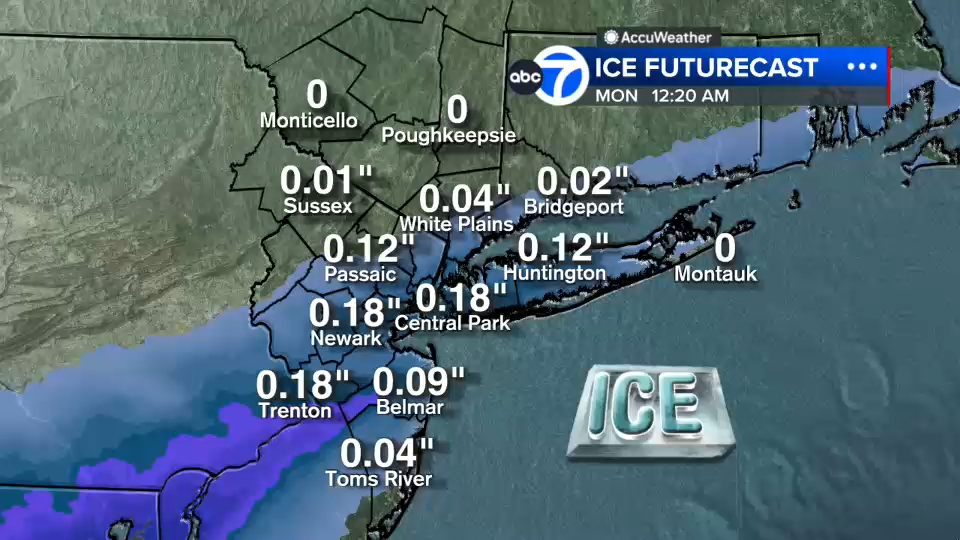
The ice falling atop large drifts of snow willl produce its own special problems, with a glaze that could leave more than a tenth of an inch of ice atop all that snow in Central Park and similar amounts across the region. The ice will even make it as far north as the White Plains area, but the buildup there is expected to be considerably less.
Snow and icing will continue, though at a less furious pace, into the evening and the early hours of Monday before the storm finally pulls away.
But anybody betting on a quick melt from the sun’s return on Monday will be sorely disappointed, as the region will remain in the deep freeze, with temperatures never even approaching the melt threshold of 32 degrees, into the beginning of February.