
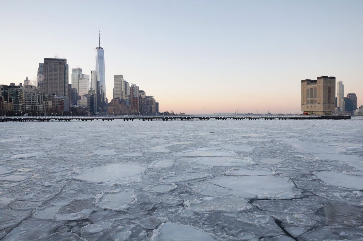
Arctic air has locked in across the New York City area after the weekend snowstorm, and the cold is now freezing important waterways.
Ice has built up on the Hudson River and nearby channels, disrupting ferry and boat traffic and forcing some trips to be canceled.
“NYC Ferry service remains suspended across all routes due to continued ice in the East and Hudson Rivers and across New York Harbor,” NYC Ferry said on its website. “The safety of all crew, passengers, and vessels is of the utmost importance, and NYC Ferry crew continues to monitor evolving waterway conditions and prepare the fleet to ensure service can resume once conditions improve.”
It is unclear when services will return to normal. With additional surges of Arctic air in the forecast, ice may continue to grow before it begins to break up.
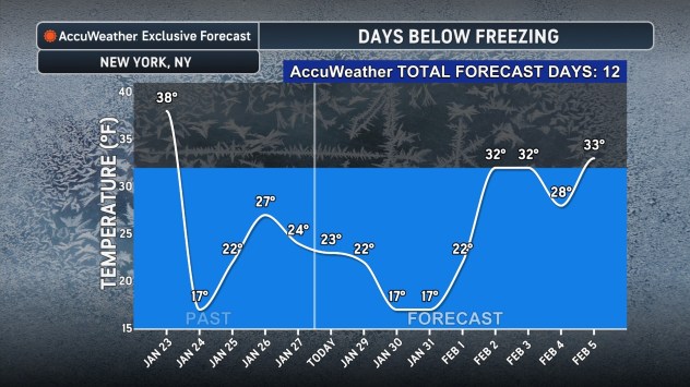
AccuWeather meteorologists say New York City could be in for one of its longest stretches of temperatures at or below freezing in history. The next time highs are forecast to climb above 32 degrees is Thursday, Feb. 5, but even then, temperatures may only edge above freezing before dropping back below 32 overnight.
If the forecast holds, the city could log 12 consecutive days with highs at or below freezing, just shy of the all-time record of 16 days.
The polar vortex could unleash another surge of frigid air across the region around the middle of February, according to AccuWeather long-range expert Paul Pastelok.
Even with spring around the corner, most of the Northeast will face a slow climb out of winter before warmth arrives for good.
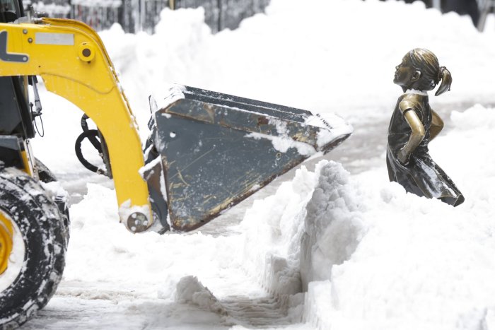
A construction vehicle delicately removes the existing snow that surrounds the Fearless Girl Statue at the entrance to the New York Stock Exchange after Sunday’s major winter snow storm on January 26, 2026. Photo by John Angelillo/UPI | License Photo