
Get set for typical type temperatures for the end of October for the next seven days and nights across all of Central and Upstate New York.
After climbing into the lower to middle 60s for high temperatures on Tuesday, numbers will be lower next.
At the same time, our weather pattern will be favorable for a combination of regular, passing rain showers and localized heavy lake effect rain showers, but only over select spots of Upstate New York.
All of this is part of our next weather makers:
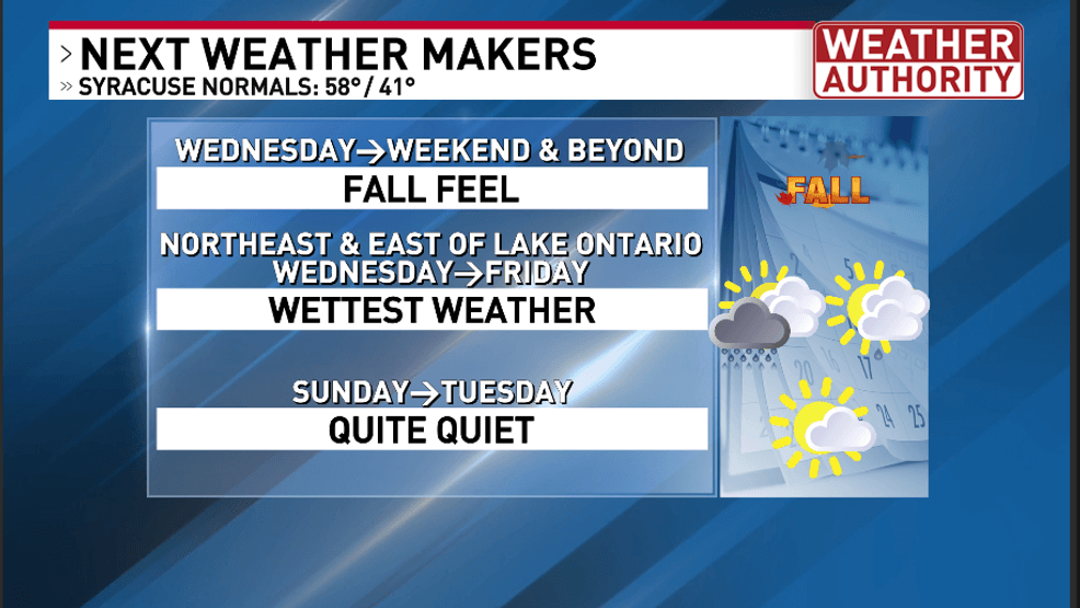
Central New York’s next weather makers
As shown above, it will feel like full on fall for Wednesday and beyond.
Here are my forecast highs for the next 7 days for Syracuse:
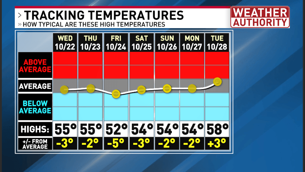
Tracking my forecast high temperatures over the next 7 days & comparing them to normal
You can easily see that my forecast for high temperatures remains only in the 50s for the next several days which allows our highs to be near to slightly below average at times.
One cold front has already passed through our area. There still will be a threat for redeveloping showers this evening especially over eastern section before clearing skies occur overnight.
A second cold front will enter our area around dawn Wednesday with some passing rain showers for all of our area.
Behind this cold front, lake effect clouds and rain will be monitored for its position and intensity.
It appears that the wettest weather from lake effect rain should be mostly northeast and east of Lake Ontario and Lake Erie between Wednesday and Friday.
Closer to home, this would mean that Jefferson, Lewis, Oswego and northern Oneida counties would be the wettest during this period from Lake Ontario. The Lake Erie showers will be heaviest in western NY but could occasionally throw some scattered showers over portions of Central and Southern New York.
While some of the Lake Ontario showers will drop southward to closer to the Route 49 and 31 corridors (and perhaps briefly near Syracuse), most of the time, the heaviest consistent lake rain showers will occur up north.
Many of the rain showers that Syracuse and the immediate CNY area will see will be from instability pop-up showers.
Besides the rain, I would not be surprised if lightning and thunder with graupel occurs in the heaviest lake effect rain bands east of Lake Ontario.
There is also a risk that a regular pop-up heavier shower may also contain graupel and maybe some thunder and lightning.
Here is my preliminary forecast for rain through Friday:
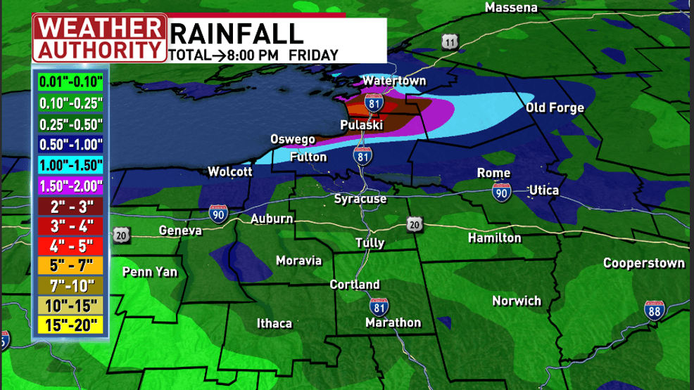
Total rainfall forecast across much of Upstate NY through 8:00 PM Friday
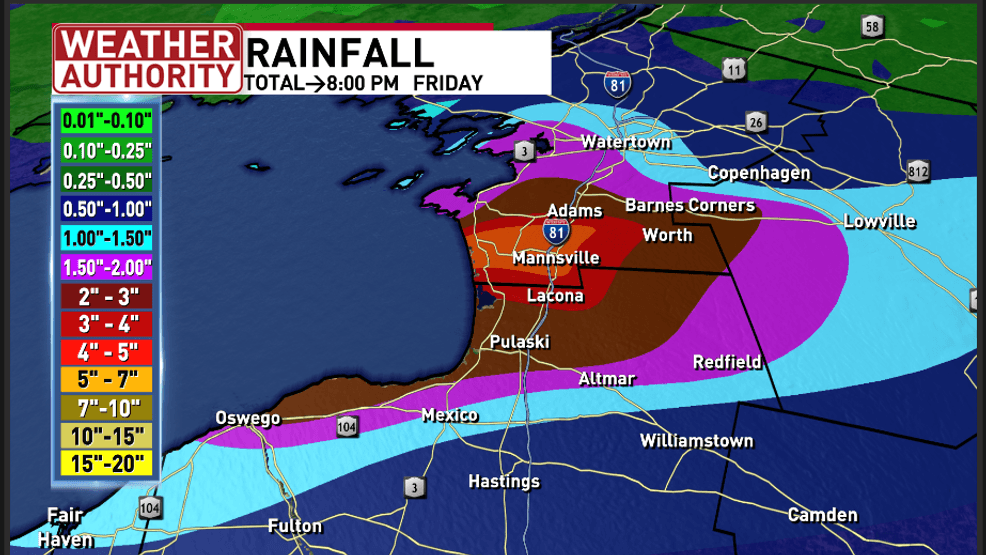
Total rainfall forecast east of Lake Ontario through 8:00 PM Friday