
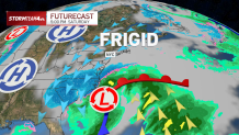
The strong coastal storm expected to intensify off the Carolina coast on Saturday is looking like a miss for most of the northeast.
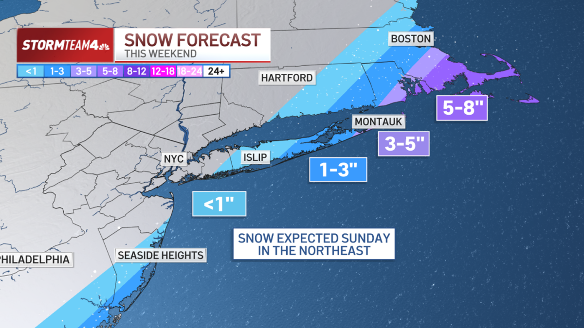
Cape Cod has the best chance for big snow this weekend, with 5-8 inches possible. In the tri-state area, eastern parts of Suffolk County will get the best chance at accumulating snow, with 1-3 inches likely.
The storm will explode just offshore from the Tar Heel State.
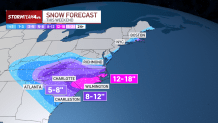
It will likely deliver a foot or more of snow to eastern North Carolina and parts of South Carolina — areas not exactly used to big winter storms. Heavy snow will extend west into the Appalachian Mountains of Tennessee and Virginia, too.
The storm will make its closest pass to the Northeast on Sunday. It looks like the track will be far enough offshore that the shield of snow it produces largely miss the coast, with the exception of southeastern Massachusetts, where 5-8 inches of snow could fall.
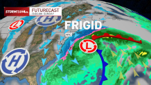
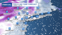
The counterclockwise flow around the low pressure system will draw frigid air into the region. North wind gusts will be 30-40 mph. Highs on Sunday will be in the low 20s, so expect wind chills in the single digits through the afternoon.
The storm will likely churn up the Atlantic waters and create rough surf on Sunday. That, in combination with the full moon on Sunday, increases the risk of minor coastal flooding in low-lying areas at high tide on Sunday.
After this weekend’s storm passes, high temperatures will moderate slightly – into the low 30s from the teens and 20s we’re feeling now – but overall temperatures will remain well below normal for this time of year.
Stay warm and stay safe!