
STATEN ISLAND, N.Y. — Staten Islanders hoping Staten Island Chuck’s prediction for six more weeks of winter is inaccurate will be disappointed, at least for the upcoming week, according to the latest forecast.
AccuWeather senior meteorologist Dan Pydynowski said that while no significant snowfall is expected in the coming week, the existing snow piles won’t be disappearing anytime soon due to persistent cold temperatures.
“It doesn’t look like there’s any big accumulating snow events over the next week for us,” Pydynowski said. “It’s possible we see a few flurries Tuesday night into early Wednesday, but it doesn’t really look like it’s really going to amount to much.”
The forecast calls for two potential low-impact snow systems. The first system will move through the New York City area Tuesday night into early Wednesday morning while the second chance for light snow arrives Friday. Both systems are expected to remain minor, Pydynowski noted.
“There’s also a chance for some snow flurries or showers with a cold front Friday afternoon into the evening,” he said. “Again, I don’t think it would be a huge accumulation, but there might be a chance to get a coating or dusting of snow in some areas.”
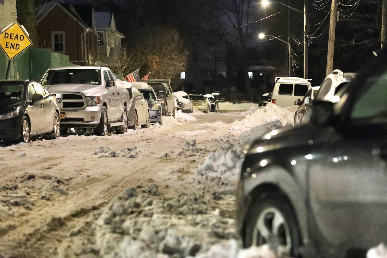
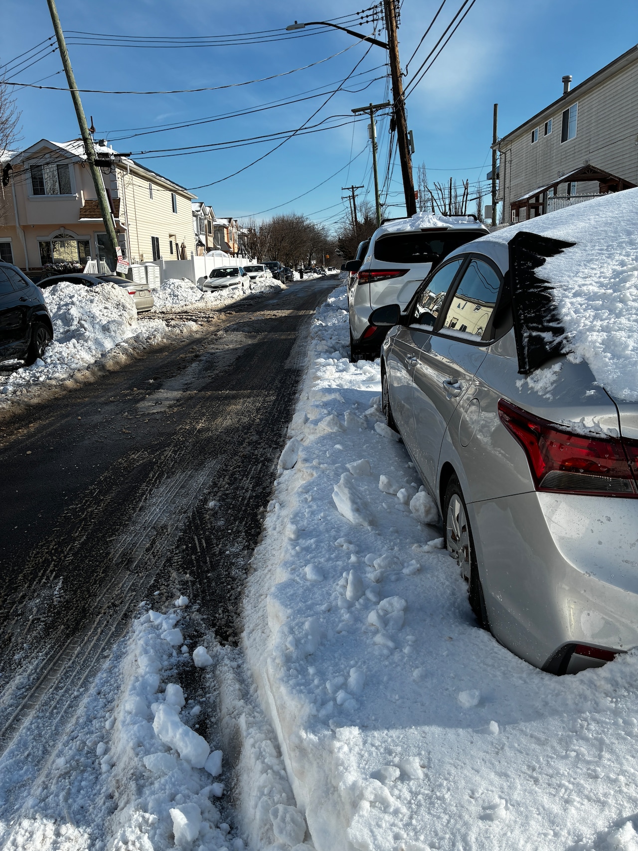 Highs around 32 degrees through Wednesday will allow minimal daytime melting, but nighttime freezes will stall progress on clearing driveways and walkways. Residential streets in Tottenville remain lined with towering snowbanks, making parking nearly impossible as schools and workplaces reopen across the borough on Jan. 27, 2026.Advance/SILive.com | Shaina McLawrenceWhen will this all melt?
For Staten Islanders hoping the existing snow will melt quickly, Pydynowski offered little encouragement. Temperatures through Wednesday are expected to hover around the freezing mark, with highs of about 32 degrees. While these temperatures might allow for a little melting during daylight hours, overnight temperatures will drop well below freezing.
“We’re not going to see any kind of rapid melting or thawing anytime soon. Maybe just a little bit of slow melting each afternoon,” Pydynowski said, highlighting that any small progress made during the day would be stalled by the cold nights.
The week’s temperature trend turns even more unfavorable for melting after Wednesday.
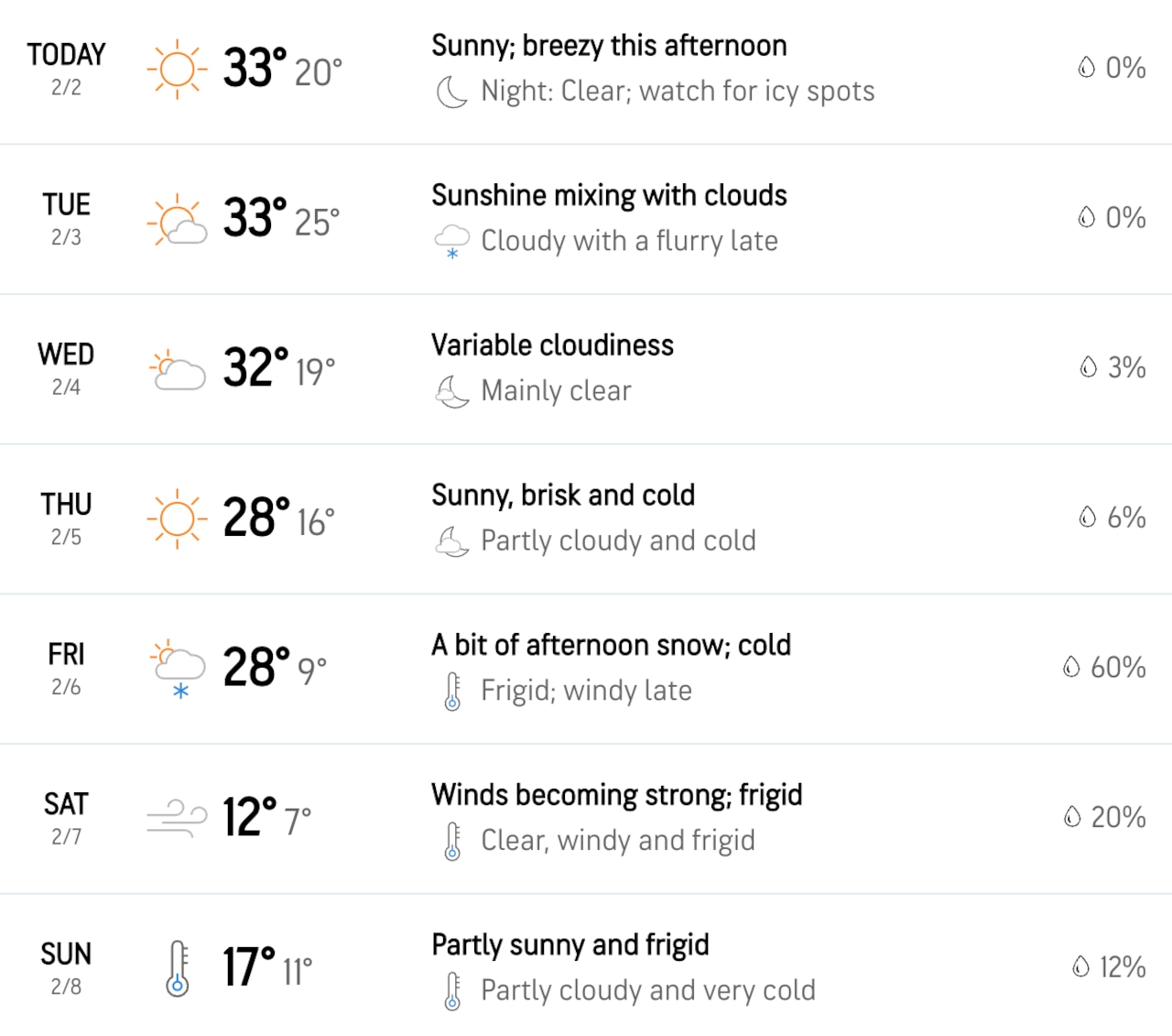 The graphic above depicts the weather forecast from Feb. 2 to 8. According to the forecast 33 degrees is this week’s high.Courtsey of AccuWeather
“Beyond Wednesday, it turns colder again. It looks like highs will be back into the 20s on Thursday,” Pydynowski forecasted. These colder conditions will be flanked by wind, making it feel even colder. “Real feels could range from the lower 20s or upper teens,” he noted.
The science behind the slow melting relates to the consistently cold air temperatures, which counteract the sun’s warming effect. Even during sunny days, the conditions haven’t been conducive to significant snowmelt.
“It’s been so cold that even these days where it’s sunny, it’s been tough to get any kind of substantial melting with these air temperatures being so cold. It’s been a real struggle,” Pydynowski explained.
For residents wondering when relief might arrive, Pydynowski offered little in the way of immediate hope but assured that the snow will eventually melt: “Well, it will one day, but it’s been taking its time.”