
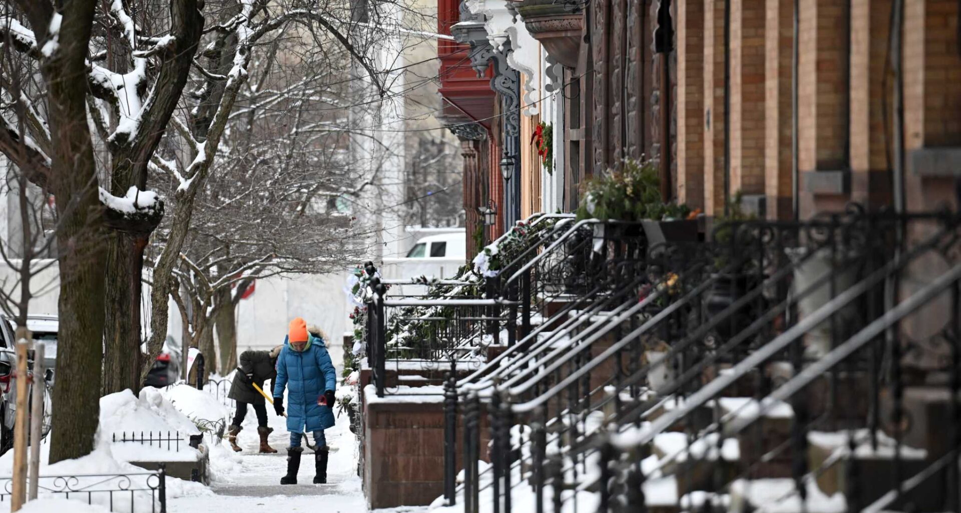
Lancaster Street residents clear snow and ice from their walkways following a winter storm on Feb. 17, 2025, in Albany. AccuWeather forecasters are predicting a near-normal amount of snowfall for much of New York and below-average snowfall for areas closer to the coast.
Will Waldron/Times Union
Parts of the western U.S. are seeing some of the first significant snows of the season this week. Between 1 and 3 feet of snow is expected in the higher peaks of the Sierra Nevada region, while a foot of snow could pile up in the Cascades of Washington.
With these early signs of winter in the West, it seems like a good time to ask one of the country’s largest private weather forecasting companies what they think this winter will look like in the Northeast.
Article continues below this ad
AccuWeather’s winter forecast for the Northeast
Long-range winter forecasting isn’t for the faint of heart. It requires wrestling with the complexity and chaos of our atmosphere and its inherent unpredictability when looking forward for an extended period. Those challenges don’t keep the State College, Pennsylvania-based AccuWeather from sticking its neck out. They have been forecasting the country’s weather for more than six decades.
AccuWeather’s Lead Long-Range Expert, Paul Pastelok, has many things to consider in his winter crystal ball before coming up with a seasonal forecast. The factors that influence his forecast include water temperature anomalies in the Atlantic and Pacific oceans, as well as across the waters of the Gulf. The forecast of a La Niña is also something to consider.
Live map: Real-time weather across New York
Article continues below this ad
How much rain did we get? Regional storm totals
The influence of a La Niña on the winter weather pattern in the Northern Hemisphere.
NOAAClimate.gov
These are examples of teleconnections. Teleconnections describe distant climate relationships, patterns in one part of the world that influence weather far across the globe. We have already discussed how an expansive warm blob of water, stretching from near Japan to the west coast of the U.S, and measuring nearly as big as our country, could help tip the scales in favor of a harsh winter for the East.
AccuWeather’s forecast of snowfall departure for this winter.
AccuWeather
Pastelok and his forecast team at AccuWeather have taken all these things and more into account in their forecast for the winter of 2025-2026.
Article continues below this ad
The bottom line for this winter’s snowfall forecast in the Northeast is below-average snowfall for the coast and near-normal snowfall further inland.
AccuWeather’s winter snowfall forecast for some selected cities.
AccuWeather
“Near average snow, perhaps below average near the coast,” is what Pastelok says he expects for New York.
“November and December temperature above average, just occasional cold shots, but not persistent,” he said when reached via email. “January can feature more ice, some snow, some rain. February can be colder and probably more snow.”
Article continues below this ad
Live New York flood tracker: See river levels, storm alerts, radar
Interactive: New York Power Outage Tracker
AccuWeather is calling for 17-21 inches of snow in New York City this winter. The average snowfall for NYC is 29.8 inches. Buffalo is forecast to receive 90-100 inches of snow this winter, compared to an average of 95.4 inches.
AccuWeather’s temperature departure forecast for this winter.
AccuWeather
AccuWeather expects the biggest departures from average on the cold side will stay west of New York, targeting portions of the northern plains, Upper Midwest, and Great Lakes.
Article continues below this ad
Nearly all of the Northeast and New York is forecast to see near-normal temperatures this winter. The exceptions include along the immediate coast from Boston to Long Island and southward into Philadelphia, where temperatures should be between 1 and 2 degrees above average.
Milder Decembers due to climate change have meant a tendency toward mild winters overall in the Northeast, according to Pastelok.
“Snowfall has been less near the East Coast or (Interstate) 95 corridor in the last 5-10 years,” Pastelok noted. “Snow pack is thinning quickly in the late winter and early spring, leading to drought and a higher fire threat in the spring.”
Here comes the sun
But there aren’t any signs of winter yet in our forecast. The first nor’easter of the season will continue to drift further offshore into the Atlantic today, allowing for cloud cover to finally break a bit. A northwest flow aloft will continue to usher in cool air out of Canada for the next few days.
Article continues below this ad
Temperatures will warm slightly by the weekend before a cold front brings in a reinforcing shot of cooler air for the start of next week.
The National Blend of Models’ daily high and low temperature forecast.
WeatherBELL
That cold front could bring our next good chance for rain after a few morning sprinkles or light showers today. Clouds should break for some peeks of sunshine this afternoon. More abundant October sunshine is expected Wednesday through Friday.
The Capital Region and Hudson Valley’s week ahead
Tuesday
Capital Region: A few showers early, partly to mostly cloudy, high lower 60s
Article continues below this ad
Hudson Valley: Clouds, then partial clearing, breezy, high in the lower to middle 60s
Tuesday night
Capital Region: Mostly cloudy, low in the middle 40s
Hudson Valley: Partly cloudy, low in the middle 40s
Article continues below this ad
Wednesday
Capital Region: Sun and cloud mix, high near 60
Hudson Valley: Partly to mostly sunny, high in the lower 60s
Wednesday night
Capital Region: Mainly clear, low in the middle to upper 30s
Article continues below this ad
Hudson Valley: Mainly clear, low near 40
Thursday
Capital Region: Mostly sunny, high in the middle 50s
Hudson Valley: Plenty of sunshine, high in the upper 50s
Article continues below this ad
Friday
Capital Region: Mostly sunny, highs in the middle to upper 50s
Hudson Valley: Sunny skies, highs near 60
Saturday
Capital Region: Sun and cloud mix, high in the lower 60s
Article continues below this ad
Hudson Valley: Mostly sunny, high in the middle 60s
Sunday
Capital Region: Partly sunny, shower possible late, high near 70
Hudson Valley: Partly to mostly cloudy, shower possible late, high near 70
Article continues below this ad
Monday
Capital Region: Showers possible early, partly to mostly cloudy, high near 60
Hudson Valley: A few morning showers, then partial clearing, high in the lower 60s
Article continues below this ad