
STATEN ISLAND, N.Y. — The approaching weekend will bring the coldest conditions of the winter thus far, according to meteorologists.
But just when will weather conditions be at their worst?
A cold front will approach the city Friday night and move through the area early Saturday morning, according to Brian Ciemnecki, a meteorologist with the National Weather Service.
Initially, this front will bring light snow to the city. As of Friday afternoon, Ciemnecki estimated that snowfall totals will range from half an inch to an inch across the five boroughs.
“I think for the most part, at least Staten Island, it should remain under an inch,” he told the Advance/SILive.com.
That snow could begin to fall Friday evening as early as 8 p.m.; however, snowfall becomes “likely” around midnight and is expected to continue into the overnight hours.
As the front moves through, a lot of cold air and gusty winds will flow in behind it.
“For Saturday, we’re looking at temperatures only in the 20s,” Ciemnecki said. “Now, the thing with this is your temperatures are going to occur very early in the morning because the temperatures will gradually fall through the day, so that 19 to 20 [degrees] is going to occur right around 7 o’clock in the morning and then we just fall through the teens through the day Saturday.”
By 6 or 7 p.m. Saturday, he forecast temperatures around 9 or 10 degrees. Saturday night is expected to hit a low around 5 degrees Fahrenheit.
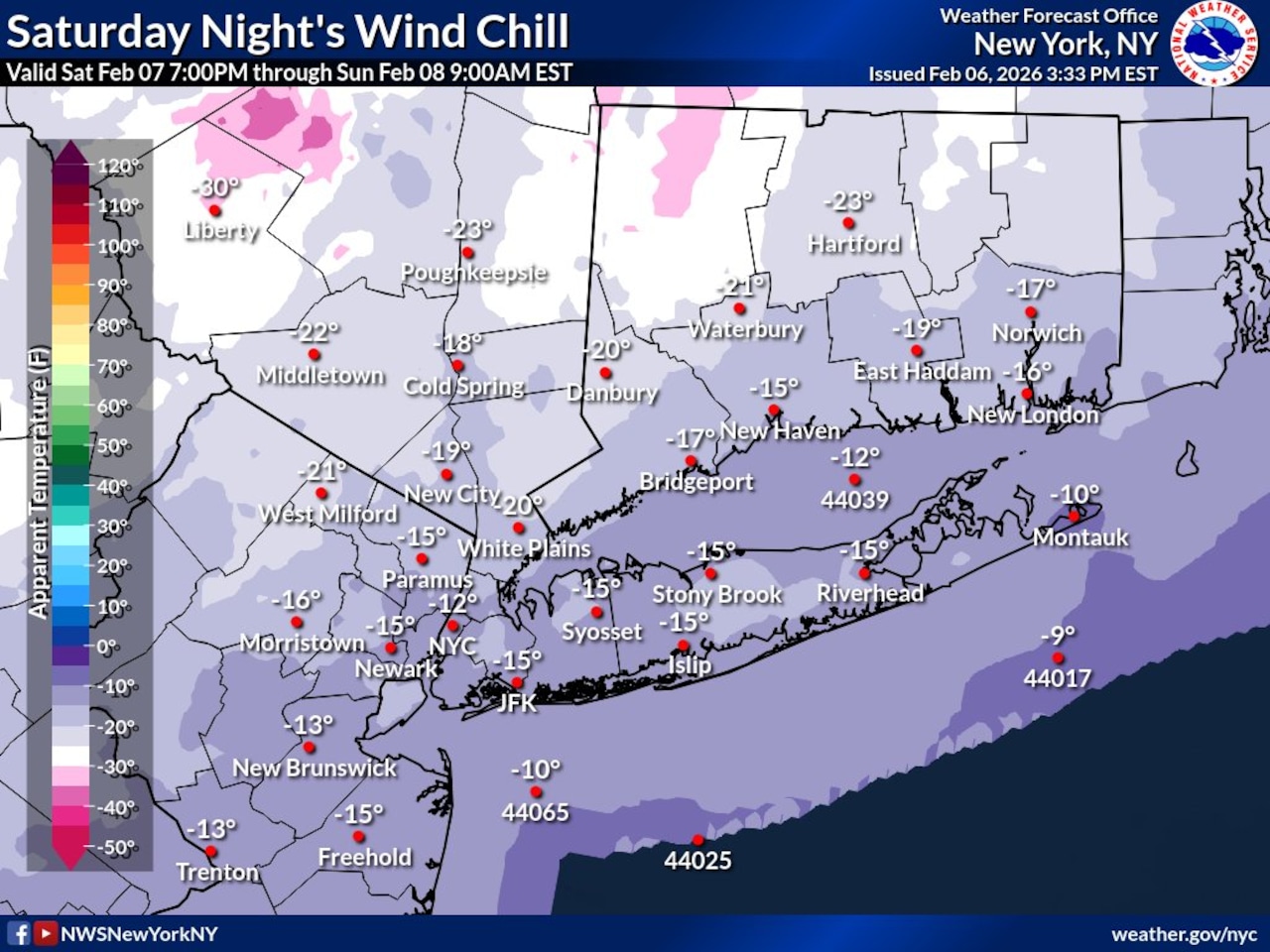
“The combination of these cold temperatures and the wind is going to make it feel very cold,” Ciemnecki explained.
Saturday afternoon could bring wind chills in the single digits, but the night could bring wind chills as low as minus 15 degrees, he said.
“And that’s why we have the extreme cold warning in effect,” Ciemnecki noted.
On Sunday, temperatures will sit around 19 to 20 degrees with an evening low around 7 or 8 degrees. The wind chill will make it feel in the single digits Sunday; Sunday night could feel like minus 5 degrees due to the wind, the meteorologist said.
Should the winds diminish sooner than forecast, it may not get that cold Sunday night.
Conditions will begin to improve on Monday with temperatures in the mid 20s. By Tuesday, the high should reach right around freezing, Ciemnecki added.