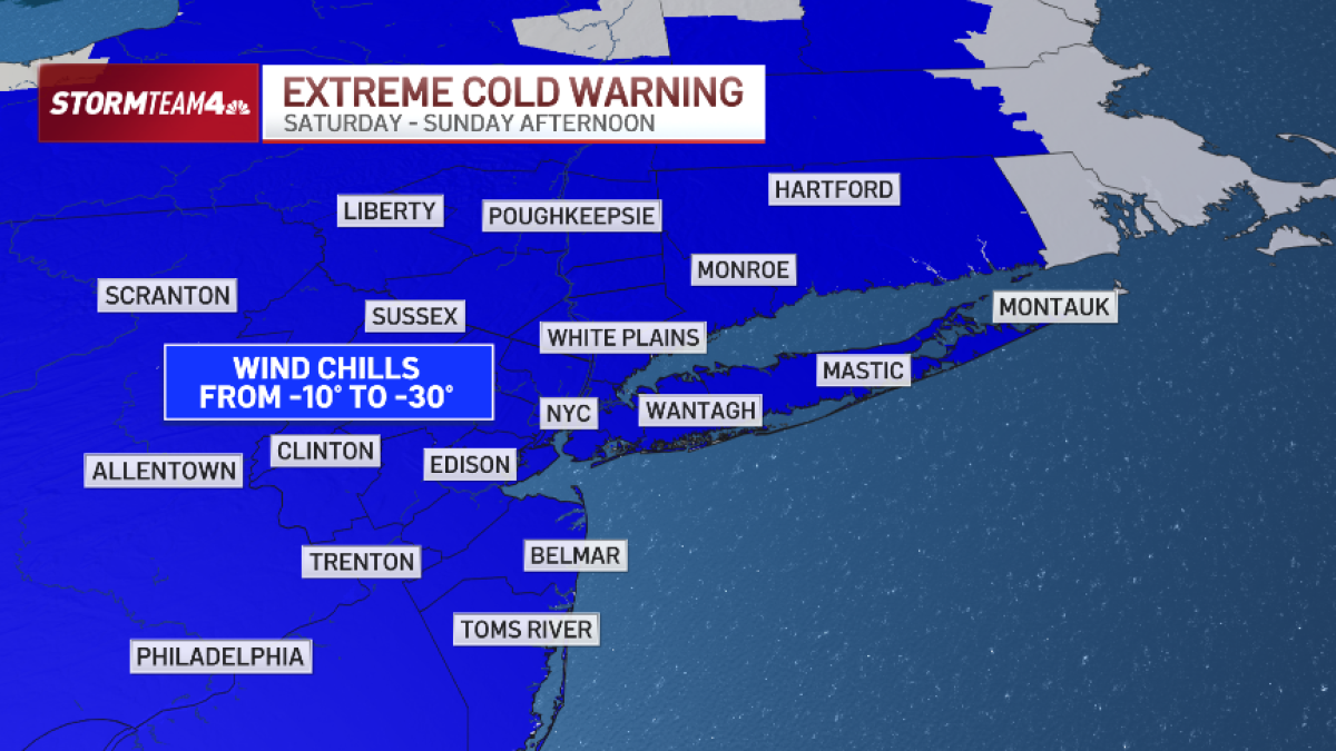
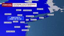
The National Weather Service has issued an extreme cold warning for wind chill temperatures this weekend that will plummet to as low as -15 to -30 degrees Fahrenheit.
The most biting arctic air so far this winter season descends on the Northeast early Saturday morning.
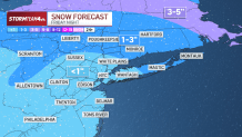
A cold front marking the leading edge of the arctic air generated light snow starting Friday night. It will continue off-and-on into early Saturday.
There’s a chance for an inch or so of fresh snow Saturday morning in Suffolk County on Long Island or in the northern Hudson Valley, but it won’t be any more than a dusting for most, including New York City and New Jersey.
But the snow will play second fiddle to the extremely dangerous wind chills this weekend. The extreme cold warning will likely take effect by 10 a.m. Saturday.
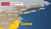
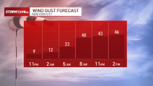
Expect temperatures to plummet throughout the day and the wind pick up – whipping 40-60 mph at times. That has lead to a wind advisory being issued as well.
Wind chills start cold and then get worse. They will be below 0 by the end of the day Saturday. You’ll need to cover as much exposed skin as possible to avoid frost bite, which can set in on bare skin after just 30 minutes.
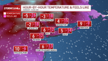
The absolute worst part of the weekend will be Sunday morning, when temperatures are in the single digits and wind chills are anywhere from -15 to -30 across the tri-state.
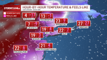
Early in the morning the wind will still be gusty, but as the day progresses the wind will ease even though temperatures will stay bitterly cold. The net effect will be wind chills barely breaking zero by afternoon.
The most optimistic news in our long-range forecast is that this weekend may be the last deep, deep freeze we feel for a while. Monday is still cold, but temperatures should rebound midweek and be close to average (aka above freezing) by next weekend.
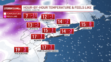
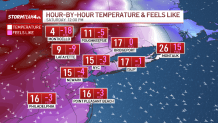
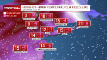
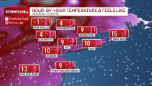
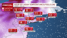
Hour-by-hour temperatures and what it will feel like
Saturday 8 a.m.
Saturday 12 p.m.
Saturday 4 p.m.
Saturday 10 p.m.
Sunday 8 a.m.
Sunday 12 p.m.
Sunday 3 p.m.