

High pressure has helped temperatures rise quickly, with winds weakening as our overnight low hit the lowest it’s been in Rome since 2018 at 21 below zero! The rest of the day today will be quiet and cold, with faded sunshine as we head into the evening.
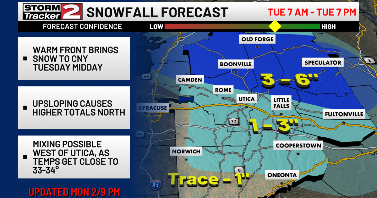
Tuesday brings a warm frontal boundary through Central New York as a clipper system passes to the north. This setup could bring light snow, especially in Oneida County and Central Herkimer County, where a 3-6 inches are possible. The rest of CNY will be in the 1-3″ range.
The warm front could lead to light rain or freezing drizzle Tuesday afternoon and evening. With cold ground temperatures, minor ice accumulation is possible even with temperatures around 33 to 34 degrees.
By late Tuesday evening, colder air returns, bringing back snow showers, particularly from lake-effect off Lake Ontario. Snow ratios could improve, leading to a few more inches of snow with gusty winds possible.
As we move into the latter part of the week, temperatures will drop back into the 10s and 20s behind the clipper. Looking ahead, a system from the South or Ohio Valley may impact the area Sunday, but it’s too early to predict the exact impact.