
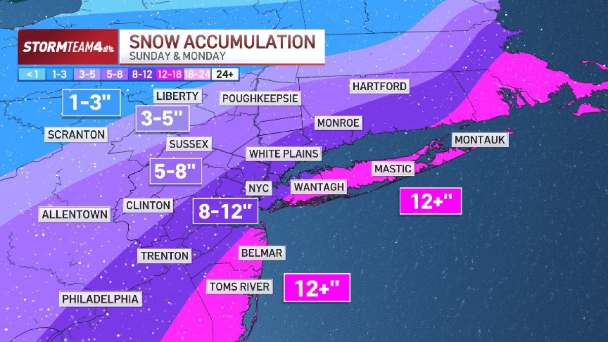
What to KnowA blizzard warning has been issued for all five boroughs of New York City, Long Island and much of NJ as a classic nor’easter threatens to dump heavy snow and strong winds on our areaA blizzard warning is issued when snow accumulations are expected between 13 and 18 inches and winds are expected to gust as high as 55 mph. Whiteout conditions are likelyForecasts now show up to a foot of snow expected for the five boroughs, along with central Jersey and Nassau County on Long Island. Some farther east may get more than a foot of snow. Totals may be a little lower farther north and west.
A blizzard warning has been issued for all five boroughs of New York City, Long Island and much of New Jersey as a classic nor’easter threatens to dump up to a foot of snow in the metro area Sunday into Monday.
And projected snow totals are rising for some of us.
Snowfall rates could hit up to 2 inches an hour at times. A blizzard warning is issued when snow accumulations are expected between 13 and 18 inches and winds are expected to gust as high as 55 mph. This drops visibility below 1/4 mile due to blowing snow, and whiteout conditions are expected.
Travel will be treacherous and potentially life-threatening, the National Weather Service said. Check the latest severe weather alerts for your neighborhood here.
As of Saturday morning, forecasts show up to a foot of snow expected for the five boroughs, along with central Jersey and Nassau County on Long Island. Some farther east on Long Island and down the Jersey Shore could see well more than a foot of snow. Totals may be a little lower farther north and west, with the Hudson Valley, North Jersey and Connecticut in the 5-8 inch range.

Additionally, winds will gust between 30 and 50 mph during the storm, so blowing snow will be a problem, particularly along the coast.
Winter storm warnings have been issued for much of north Jersey and the Hudson Valley. A winter storm watch blankets the rest of the area.

So what changed since Friday morning? Models that previously showed the system farther offshore (like the European model) moved Friday morning, showing it hugging the coastline more. That is closer to the forecast predicted by the American model, which had been very aggressive on snow for the past day or so.

The storm comes as a result of an area of low pressure currently over California that will traverse the country and move off the North Carolina coast Sunday. As it moves into the Atlantic, the low will strengthen and the tri-state area will pick up light to moderate snow and gusty northeast winds beginning Sunday afternoon.
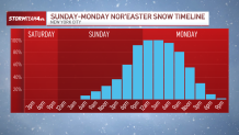
Snow will begin light with slightly above-freezing temperatures, so accumulations through Sunday afternoon will be relatively small. The heaviest snow will happen after sunset Sunday and continue into early Monday morning before it begins to taper off.
Travel Sunday night will be a mess, with heavy snow and gusty wind. The morning commute on Monday will be terrible, too. While the snow will be coming to an end, the winds will lead to blowing snow and reduced visibility, making roads awful to navigate.
The storm system will begin pulling away Monday afternoon, so conditions will begin to improve, with dry skies and sunshine taking over Tuesday.
Stay with Storm Team 4 through the weekend as we fine-tune the forecast for you.