
NBC5 meteorologists are tracking a nearby coastal storm, possibly bringing blizzard conditions to southern New England Sunday night into Monday. The storm will be close enough to produce some impact in Vermont and New York. Storm DetailsA strong area of low pressure likely develops along the Mid-Atlantic coast Sunday night. Recent model guidance has suggested a storm track closer to the coast; a scenario that brings widespread snow and wind to most of the I-95 corridor. The storm’s closest pass If current trends hold, 1 to 2 feet of snow could fall in parts of Massachusetts, Rhode Island, and Connecticut by Monday evening.Wind gusts may approach 60 mph in coastal areas, bringing potential blizzard conditions.Local ImpactOverall, Vermont and northern New York will miss out on significant snow and wind.The storm’s northern fringe comes close enough to bring accumulating snow to southern Vermont and New Hampshire.Over 8 inches of snow are possible near the Massachusetts border! Amounts quickly drop farther north, with only scattered flurries expected in the Champlain Valley.Aside from the snow, a northerly wind will gust between 20 and 40 mph for most of Monday.This forecast is developing and will change. Check back for updates in the next couple days.
NBC5 meteorologists are tracking a nearby coastal storm, possibly bringing blizzard conditions to southern New England Sunday night into Monday. The storm will be close enough to produce some impact in Vermont and New York.
Storm Details
A strong area of low pressure likely develops along the Mid-Atlantic coast Sunday night.

NBC5 News
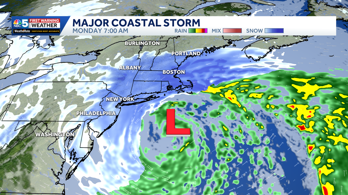
A strong coastal storm may bring blizzard conditions to southern New England Monday.
Recent model guidance has suggested a storm track closer to the coast; a scenario that brings widespread snow and wind to most of the I-95 corridor. The storm’s closest pass
If current trends hold, 1 to 2 feet of snow could fall in parts of Massachusetts, Rhode Island, and Connecticut by Monday evening.

NBC5 News
Gusty winds are expected across the Northeast Monday.
Wind gusts may approach 60 mph in coastal areas, bringing potential blizzard conditions.
Local Impact
Overall, Vermont and northern New York will miss out on significant snow and wind.

NBC5 News
Potential snowfall Sunday night into Monday.
The storm’s northern fringe comes close enough to bring accumulating snow to southern Vermont and New Hampshire.
Over 8 inches of snow are possible near the Massachusetts border! Amounts quickly drop farther north, with only scattered flurries expected in the Champlain Valley.

NBC5 News
Wind gust forecast across Vermont and New York.
Aside from the snow, a northerly wind will gust between 20 and 40 mph for most of Monday.
This forecast is developing and will change. Check back for updates in the next couple days.