
STATEN ISLAND, N.Y. — A major nor’easter packing blizzard-like conditions is expected to blanket New York City with several inches of snow this weekend.
Although subject to change, as of Saturday morning, it’s looking like the five boroughs will receive upward of 15 inches of snow. There is a 10% chance snowfall exceeds 24 inches on Staten Island and a 90% chance the borough gets at least an inch of accumulation, according to the National Weather Service.
In addition to snow, city residents should also prepare for forecast winds of 25-35 mph and gusts of up to 55 mph.
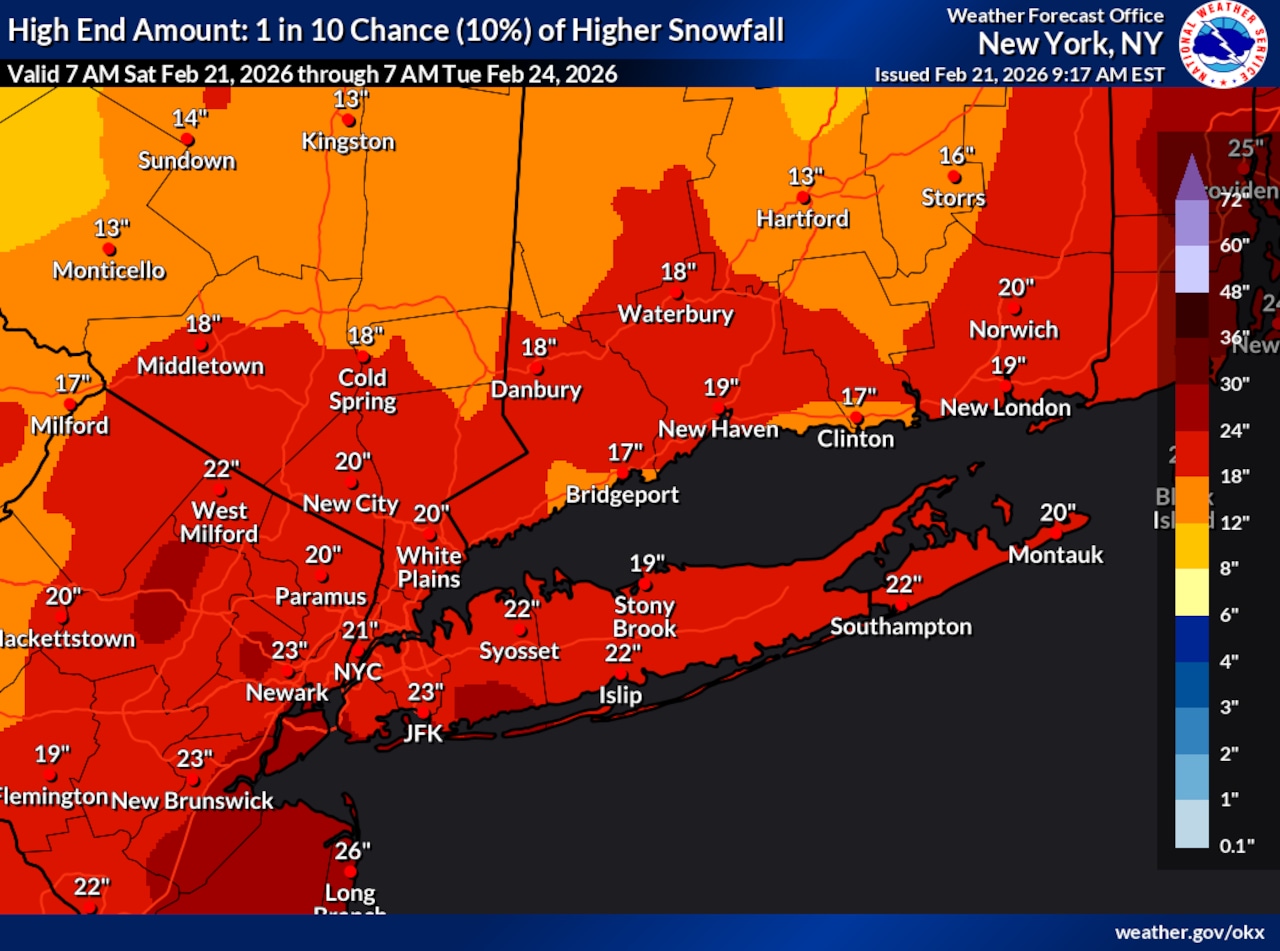 This National Weather Service graphic shows there is a 10% chance Staten Island will receive at least 24 inches of snow with the storm forecast to impact New York City on Sunday, Feb. 22, and Monday, Feb. 23, 2026.(National Weather Service)
Residents should prepare for the worst of the storm late Sunday night, when snowfall rates could exceed 2 inches per hour. The weather service believes the heaviest snow will come down from 7 p.m. Sunday through about 12 p.m. Monday.
The snow is expected to develop Sunday morning and afternoon, possibly mixing with rain at the onset before tapering off late Monday morning into Monday afternoon.
Minor to moderate coastal flooding is a possibility Sunday night into Monday morning with the high tide, the weather service explained.
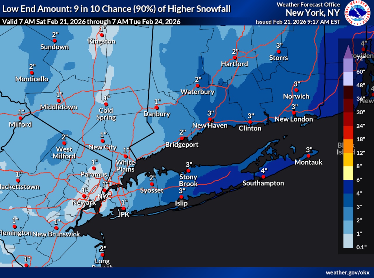 This National Weather Service graphic shows there is a 90% chance Staten Island will receive at least 1 inch of snow with the storm forecast to impact New York City on Sunday, Feb. 22, and Monday, Feb. 23, 2026.(National Weather Service)
In anticipation of these conditions, the weather service has issued a blizzard warning for the first time in nearly a decade. The warning will go into effect at 6 a.m. Sunday and remain in place until about 6 p.m. Monday.
According to the weather service, a blizzard warning is issued when two particular conditions are occurring or expected within the following 12 to 18 hours. A warning is issued when snow or blowing snow reduces visibility to a quarter of a mile or less for three hours or more and sustained winds or frequent gusts are 35 mph or greater.
There is no temperature requirement that must be met to achieve blizzard conditions.
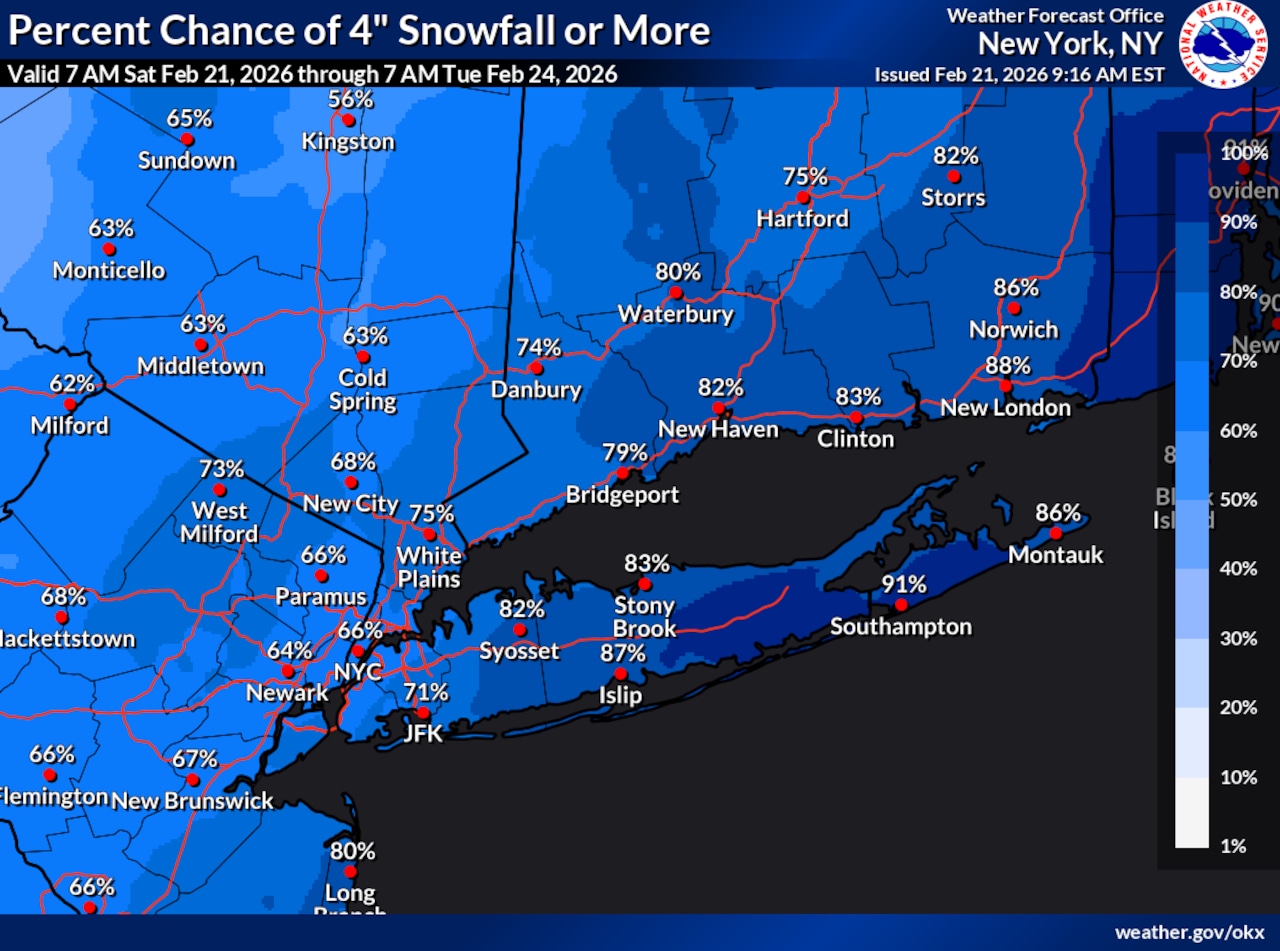 This National Weather Service graphic shows there is at least a 70% chance Staten Island will receive at least 4 inches of snow with the storm forecast to impact New York City on Sunday, Feb. 22, and Monday, Feb. 23, 2026.(National Weather Service)
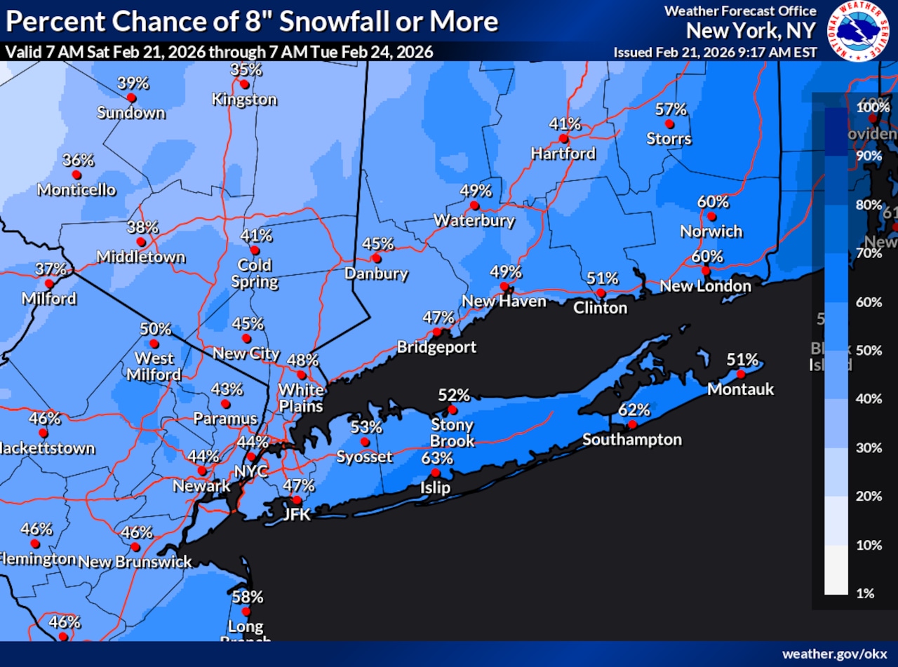 This National Weather Service graphic shows there is at least a 40% chance Staten Island will receive at least 8 inches of snow with the storm forecast to impact New York City on Sunday, Feb. 22, and Monday, Feb. 23, 2026.(National Weather Service)
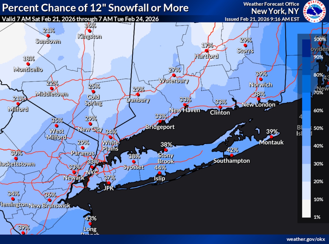 This National Weather Service graphic shows there is at least a 30% chance Staten Island will receive at least 12 inches of snow with the storm forecast to impact New York City on Sunday, Feb. 22, and Monday, Feb. 23, 2026.(National Weather Service)
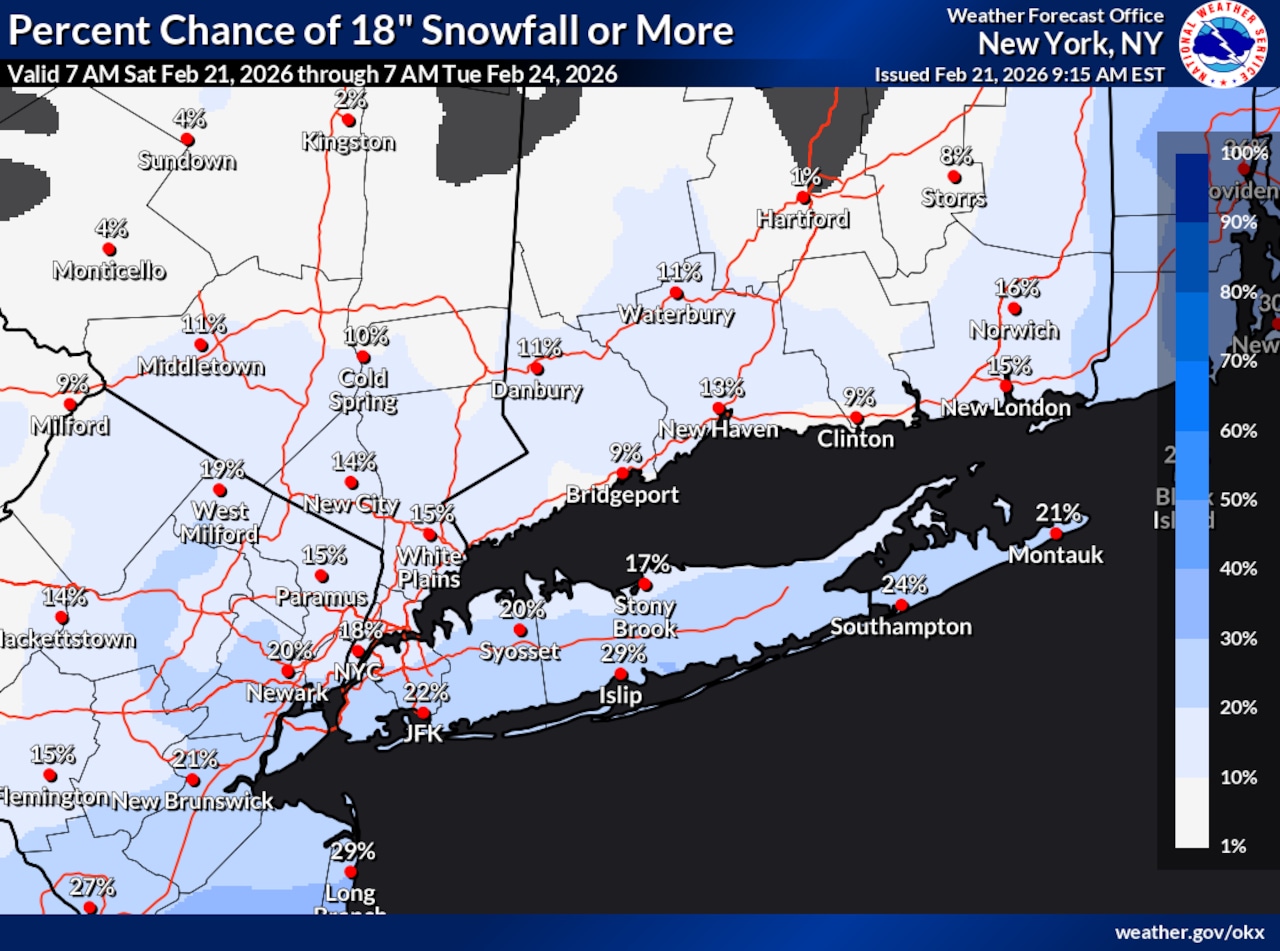 This National Weather Service graphic shows there is a 20% chance Staten Island will receive at least 18 inches of snow with the storm forecast to impact New York City on Sunday, Feb. 22, and Monday, Feb. 23, 2026.(National Weather Service)
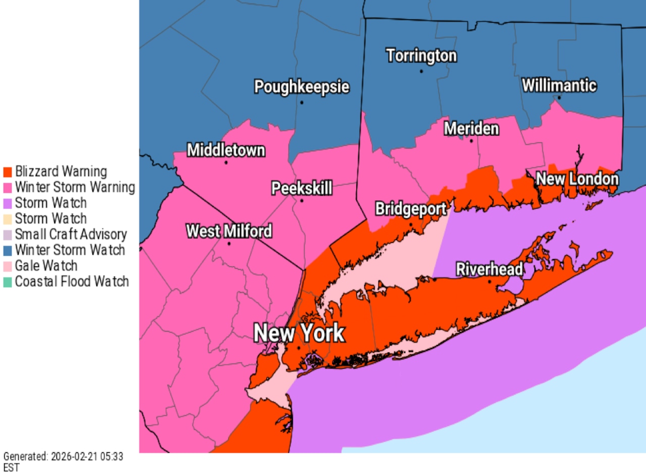 A National Weather Service graphic shows that New York City has been issued a blizzard warning from Sunday, Feb. 22, through Monday, Feb. 23, 2026.(National Weather Service)