
STATEN ISLAND, N.Y. — A major nor’easter is forecast to deliver a significant amount of snowfall to New York City this weekend.
Snow could begin falling in the city as early as “lunchtime” Sunday, according to Tom Kines, a senior meteorologist with AccuWeather.
“Having said that, I don’t think there’s many problems tomorrow afternoon from the snow,” Kines told the Advance/SILive.com. “I think temperatures are going to be a little bit above freezing, so while it is going to be snowing — at least on the roads, it’s going to have a real tough time accumulating.”
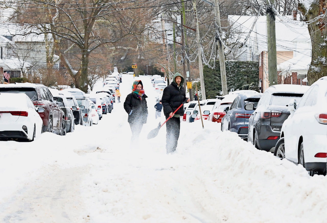 People shovel their cars out of the snow on Oakwood Avenue near Forest Avenue in West Brighton in January.(Advance/SILive.com | Jan Somma-Hammel)
It’s around 5 p.m. that Kines said residents will need to worry about snow accumulation on the roads.
“And also as we get into the overnight hours the precipitation intensity is going to pick up,” he added. “There’s going to be a time tomorrow night when it’s snowing pretty hard out there.”
The National Weather Service foresees the heaviest snow coming down between 7 p.m. Sunday and noon on Monday. Snowfall rates late Sunday into Monday morning could even exceed 2 inches per hour.
Snow will taper off Monday morning, but Kines believes the Monday morning commute will be “horrendous” due to the wind and snow.
“Not a good recipe for a pleasant morning commute,” he noted.
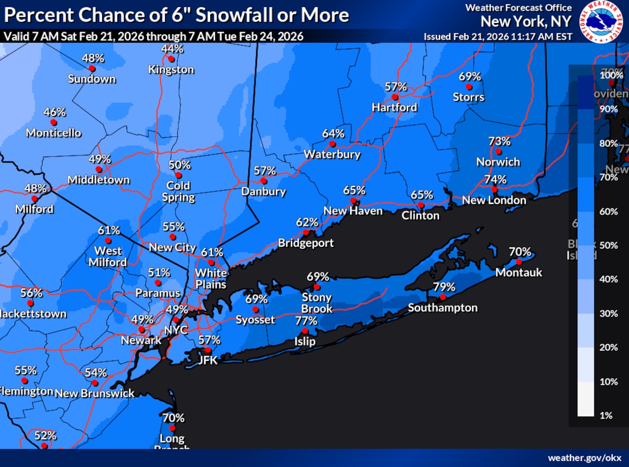 This National Weather Service graphic shows there is at least a 50% chance that New York City will receive 6 or more inches of snow between Saturday, Feb. 21, through Tuesday, Feb. 24, 2026.(National Weather Service)The snowfall forecast
As of Saturday morning, Kines explained that the snowfall forecast for the city is a general 6-12 inches. While there is confidence there will be at least 6 inches, he said there is “certainly potential” for the five boroughs to receive over a foot of accumulation.
“A lot of times with these rapidly intensifying storms — which this one will be — you do get bands of very heavy snow,” Kines explained. “If you’re underneath one of those bands of heavy snow for three or four hours and the snow is coming down at an inch or 2 an hour, right there you can see how you could pick up 6-8 inches in a rather short period of time.”
“Whether there’s 10 inches or 15 inches, the impact is the same, okay? It’s terrible,” he added.
As of Saturday morning, the National Weather Service forecasts that the city will receive upwards of 15 inches of snow. There is a 10% chance snowfall exceeds 24 inches on Staten Island and a 90% chance the borough gets at least an inch of accumulation, according to the National Weather Service.
“I think a lot of people would be surprised in the weather world if this storm all of a sudden, you know, shifted far enough off the coast that we didn’t get much snow,” Kines told the Advance/SILive.com.
In addition to snow, Kines foresees wind gusts of up to 50 mph Sunday night. The weather service forecasts sustained winds of 25-35 mph with gusts of 45-55 mph Sunday night.
“It’s not out of the question that there’s some power outages that take place,” said Kines.
Minor to moderate coastal flooding is also possible Sunday night into Monday morning with the high tide, the weather service explained.
Given these anticipated conditions, the National Weather Service has issued a blizzard warning for the city. The warning will go into effect at 6 a.m. Sunday and remain in place until about 6 p.m. Monday.