
Light snow and a wintry mix had begun to fall in New York City and parts of North Jersey by 8:30 a.m., while the heaviest snow is expected to start Sunday afternoon and into Monday.
New Jersey remains under a blizzard warning and a state of emergency beginning at noon on Sunday, Feb. 22.
Gov. Kathy Hochul also declared a state of emergency for 20 New York counties and activated the National Guard as blizzard conditions are predicted to hit New York City as well as Long Island and the Hudson Valley.
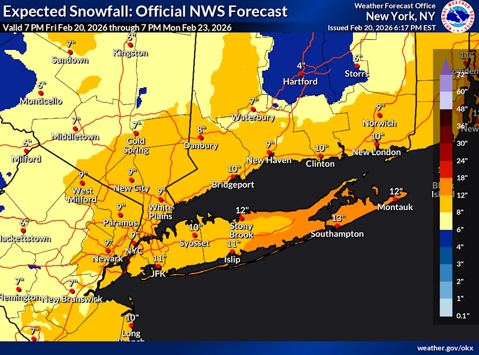
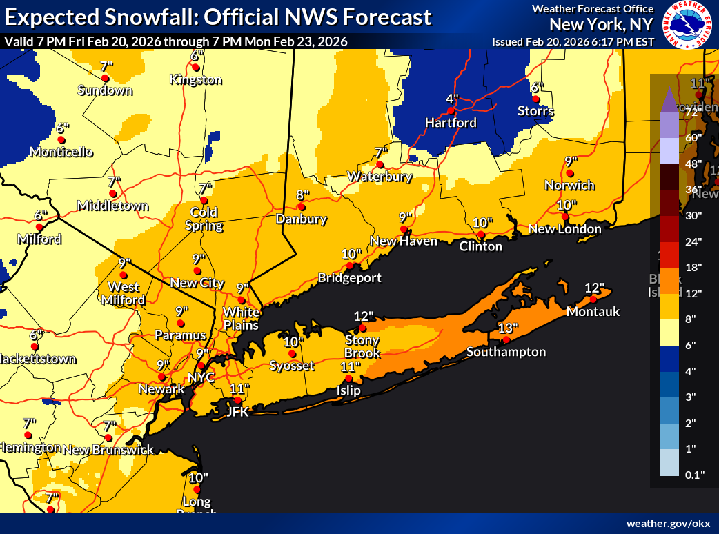
The National Weather Service forecast for the New York City area, as of Friday, Feb. 20.
The National Weather Service issued a blizzard warning that was expanded on Sunday morning to include all of New Jersey, the Philadelphia Metro and Suburbs, all of Delaware, and Carbon and Monroe Counties in Pennsylvania. In New York City, as of Sunday morning, the blizzard warning expanded to include Orange and Putnam counties in the lower Hudson Valley.
This storm is expected to produce snowfall totals ranging from 12 to 20 inches for much of the Tri-State area and strong winds with gusts up to 50 miles per hour.
A light snow and rain mix started on Sunday morning in the Northeast of New Jersey and New York City, which is out ahead of the system, National Weather Service Meteorologist James Tomasini said.
“The heavy and steadier snow will start later this afternoon and gradually increase around 2 or 3 p.m.,” he said. “The worst and heaviest snow is expected overnight into early Monday morning.”
New York City can expect around 20 inches of snow and a little more, up to 22 inches in the southern parts of the city, Tomasini said.
This article originally appeared on NorthJersey.com: When will blizzard hit New York City? Here’s what we know