
STATEN ISLAND, N.Y. — The blizzard’s fierce snowfall that began blanketing Staten Island on Sunday is predicted to intensify overnight, AccuWeather Meteorologist Melissa Constanzer said.
Multiple bands of heavy snow and strong wind gusts are expected to fall through Monday, with a particularly intense period between 1 and 3 a.m.
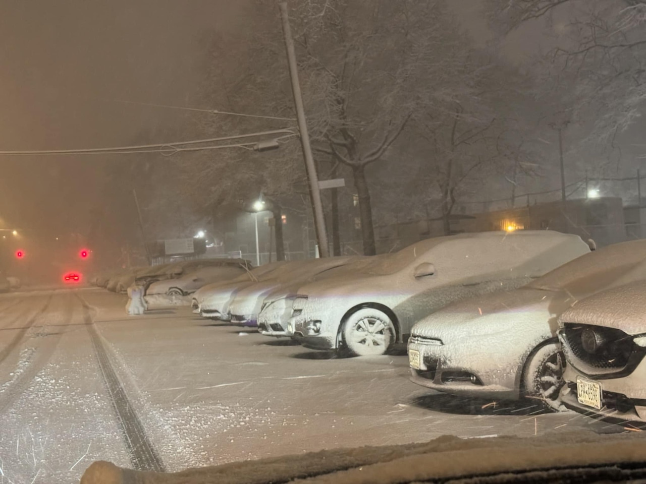
1/19
A blizzard featuring more than a foot of snow and strong wind gusts has been forecasted to hit parts of the Northeast, including Staten Island and the rest of New York City. Here’s how the storm unfolded, from late Sunday afternoon through Monday.
Constanzer predicts about 14 inches of total snowfall for this potent winter system. According to the forecaster, high winds of 50 to 60 mph are a major threat across New York City.
The National Weather Service issued a blizzard warning through Monday at 6 p.m., predicting 12-to-18 inches of snow for Staten Island and neighboring areas on Sunday night — with up to seven more inches of snow on Monday.
Other parts near New York City, such as the Jersey Shore and much of southern and eastern Long Island, are in a zone predicted to receive 18 to 24 inches of snow, said Constanzer.
 A look at Mansion Avenue, Great Kills, at the start of heavy snowfall, around 4 p.m. on Sunday, Feb. 22, 2026.Steve White for the Advance/SILive.com
The combination of wet, heavy, “cakey” snow and high winds bring an increased risk of widespread power outages across New York, she said, as the elements could lead to immense stress on tree branches and power lines,
“It becomes very easy for power outages to occur in this area. So we are expecting some regionalized power outages across the area,” Constanzer explained. “It could even be more widespread as you work your way through parts of Long Island, for example, especially east towards Montauk.”
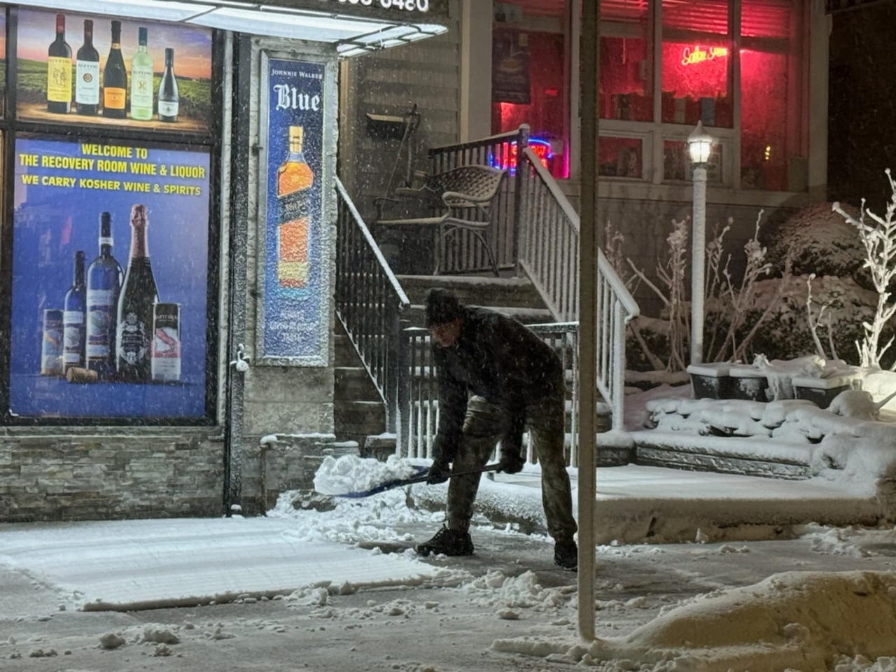 A man shovels early snow on Manor Road, at 7 p.m. on Sunday, Feb. 22, 2026.Steve White for the Advance/SILive.com
“You have this wet, heavy snow falling down. That means the snow will kind of plaster to the sides of road signs,” Constanzer said. “It’s a really sticky, cakey kind of snow. It probably will not drift that much. ”
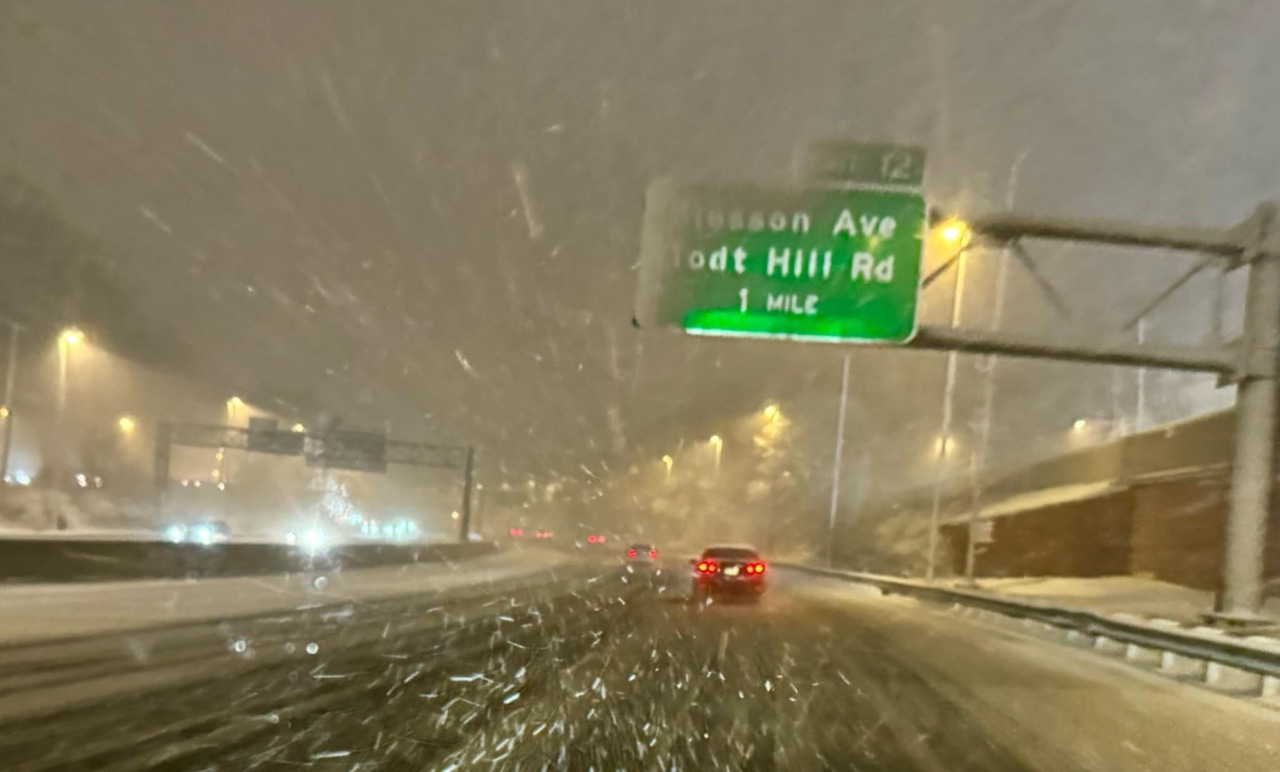 A look at the Staten Island Expressway, eastbound, near the Slosson Avenue and Todt Hill Road exit, on Sunday, Feb. 22, 2026.Steve White for the Advance/SILive.com
The blizzard prompted New York officials to declare a state of emergency and shut down public schools on Monday.
Schedules for the Staten Island Ferry and other public transportation systems were also modified.
Con Edison prepared additional workers for the storm, and said responders were ready to handle outages.
The storm’s timing ensures a dangerous commute on Monday morning. Constanzer predicted that heavy snow was still expected to be falling around 6 and 7 a.m. The roads will also be covered with significant accumulation from the overnight snowfall, making any travel extremely difficult.
“It’s probably easiest just to try to work from home if you can, in the morning,” Constanzer said.
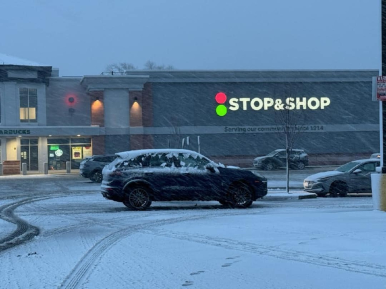 A look at the Stop & Shop parking lot in New Dorp, as the snow falls on Sunday, Feb. 22, 2026.Steve White for the Advance/SILive.com
The storm is forecast to begin moving away from the New York City area on Monday. The system’s center will be well off to the east over the Atlantic Ocean by noon. As a result, the precipitation will begin to taper off significantly.
After the midday timeframe, the steady snow is expected to transition to just flurries during the afternoon before ending shortly after lunchtime on Monday.
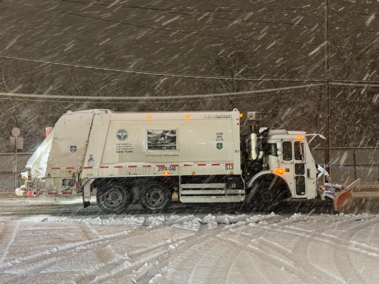
A Department of Sanitation snow plow vehicle is seen on Sunday, Feb. 22, 2026.Steve White for the Advance/SILive.com
“The winds will still be blowing throughout the day Monday, so that’s going to be a bit of a challenge. They will be quite strong. Like I said, not expecting a ton of drifting out there,” Constanzer noted.
There will still be a threat of coastal flooding in vulnerable areas along the coast during high tide cycles.
When will the snow melt?
After the storm departs, a warming trend will aid in the melting process, Constanzer said.
Monday’s high is forecast to be 37 degrees, just above freezing. While Tuesday will be colder with a high of 32 degrees, temperatures will rebound quickly, reaching near 40 degrees on Wednesday and remaining in the 40s by Friday.
 A look at Giffords Lane in Great Kills, around 7 p.m. on Sunday, Feb. 22, 2026.Steve White for the Advance/SILive.com
The snow from this storm is not expected to linger as long as the snow from previous storms in January and early February.
This is due to two key factors, the forecaster said: warmer post-storm temperatures and the stronger sun angle of late February.
 A look at the Verrazzano-Narrows Bridge as snow comes down on Sunday, Feb. 22, 2026.Steve White for the Advance/SILive.com
She explained that the stronger sun, even on a day with a high of 32 degrees, has a much greater melting power than it did during January’s storm, helping to speed up the melting process.
Although the melting conditions will be more favorable, Islanders should not expect the snow to disappear overnight due to the sheer quantity of snow, Constanzer admitted.
“Even though it’s only 32 degrees this time of year, the late February sun makes a huge difference,” she said. “You’ve probably already noticed it as you’ve gotten in your car the past couple of days, it’s a lot warmer inside when the sun’s out than it was say two, three weeks ago. So that sun does make a difference for us.”
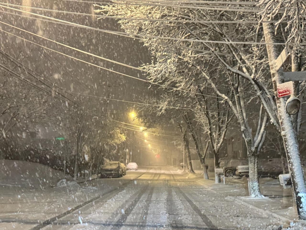
 Snow accumulates at 6:30 p.m. on LaGuardia Avenue in Emerson Hill on Sunday, Feb. 22, 2026.Steve White for the Advance/SILive.comA state of emergency
New York City Mayor Zohran Mamdani announced Sunday afternoon that the five boroughs are under a local state of emergency as a massive blizzard pumbles the city.
“The safety of New Yorkers is my top priority. As this blizzard moves in, our administration is mobilizing every tool at our disposal, around the clock, to keep our neighbors safe. This emergency declaration allows us to cut through red tape so emergency vehicles, sanitation crews, and essential workers can move quickly and do their jobs without delay,” Mamdani explained in a written statement.
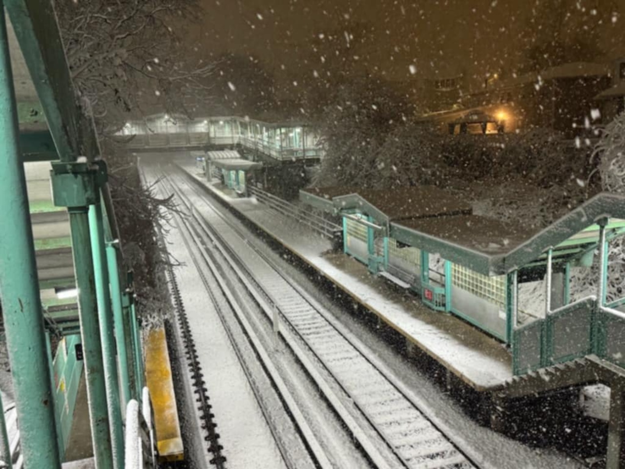
A look at a snowy Great Kills train station a little past 7 p.m. on Sunday, Feb. 22, 2026.Steve White for the Advance/SILive.com
As a result, all streets in New York City will shutter to any automobiles other than the essential vehicles from Sunday at 9 p.m. to Monday at noon.
City plows can be tracked through the department’s PlowNYC map, which can be found at plownyc.cityofnewyork.us/plownyc/.
New York City Public Schools are closed monday due to the blizzard, the mayor announced.
NYC, we’ve declared a local state of emergency ahead of this blizzard.
Here’s what that means for you:
Roads closed at 9pm — streets, highways, and bridges closed to all vehicles (cars, trucks, scooters, e-bikes) through 12pm Monday. Essential and emergency trips only.
No…
— Mayor Zohran Kwame Mamdani (@NYCMayor) February 22, 2026