

NEW YORK CITY – Snow continues to blanket the Tri-State area Monday as a blizzard warning remained in effect through 7 p.m., with hazardous travel, strong winds and coastal flooding concerns persisting across the region.
Stay connected with FOX LOCAL. For 24/7 winter storm coverage—Download now.
What we know:
The National Weather Service (NWS) says blizzard warnings remain in effect until 6 p.m. Monday for portions of northeast New Jersey, where an additional 7 to 10 inches of snow and wind gusts up to 50 mph are expected.
Forecasters warn of whiteout conditions, near-zero visibility and dangerous travel, with blowing snow and strong winds potentially downing trees and power lines.
FOX Weather live updates
Here’s the latest on when the snow will finally stop — and what to expect next:
When will the snow stop in NYC?
Timeline:
Intense snow is expected across the region through mid-morning Monday.
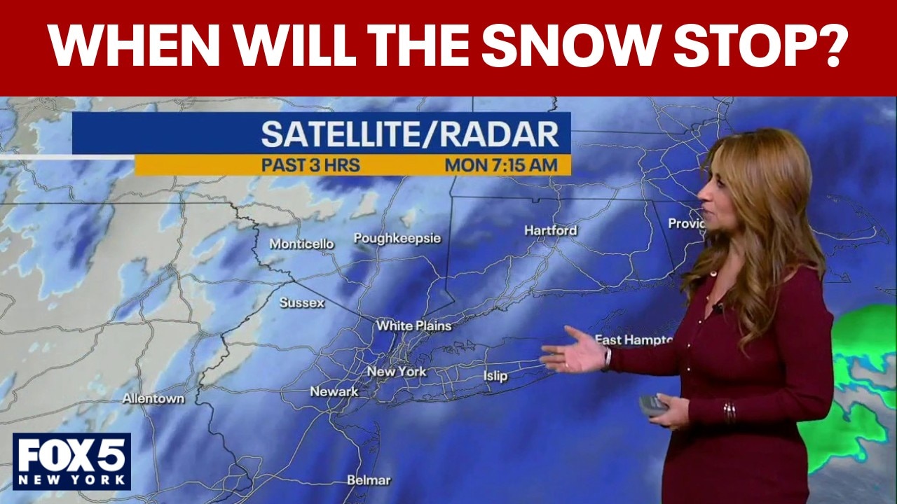
FOX 5 NY meteorologist Audrey Puente said snowfall will continue through at least midday, though conditions are expected to gradually improve over the next several hours.
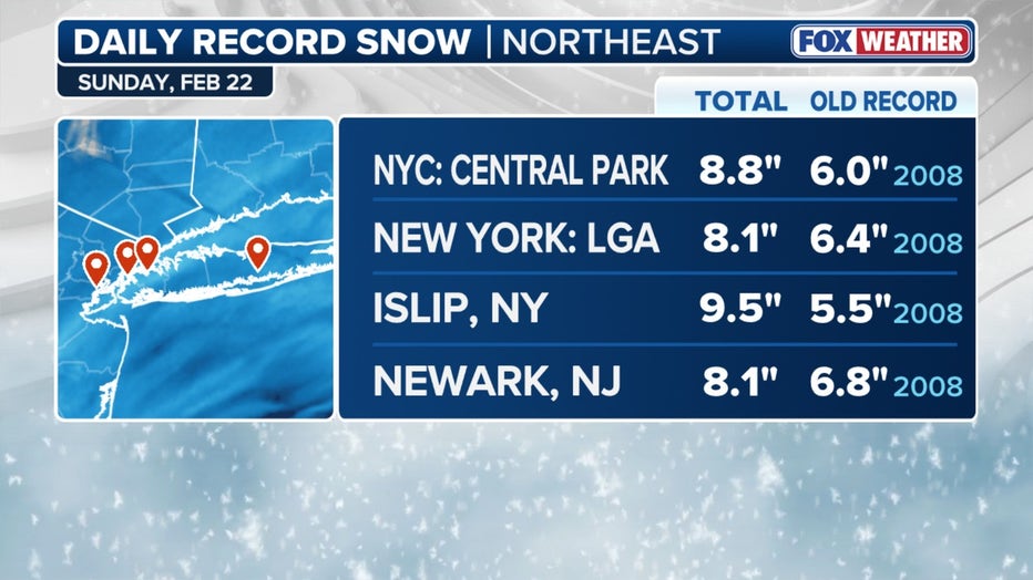
Daily snowfall records (FOX Weather)
“We’re anticipating snowfall rates of up to 3 inches per hour,” Puente said, noting Long Island experienced those intense bands earlier in the morning.
Timeline:
Blizzard conditions are expected through midday. After that, steady snow should taper to snow showers during the afternoon, especially west of New York City. The heaviest snow is now shifting toward Rhode Island and Massachusetts as the coastal low slowly moves east.
As of 8 a.m. Puente said conditions were improving and that most areas are expected to see improving conditions later this afternoon.
NYC latest forecast
Temperatures are holding near the freezing mark, allowing snow to continue accumulating on roads and sidewalks. Highs on Tuesday will be near 30 degrees, meaning little melting is expected in the short term.
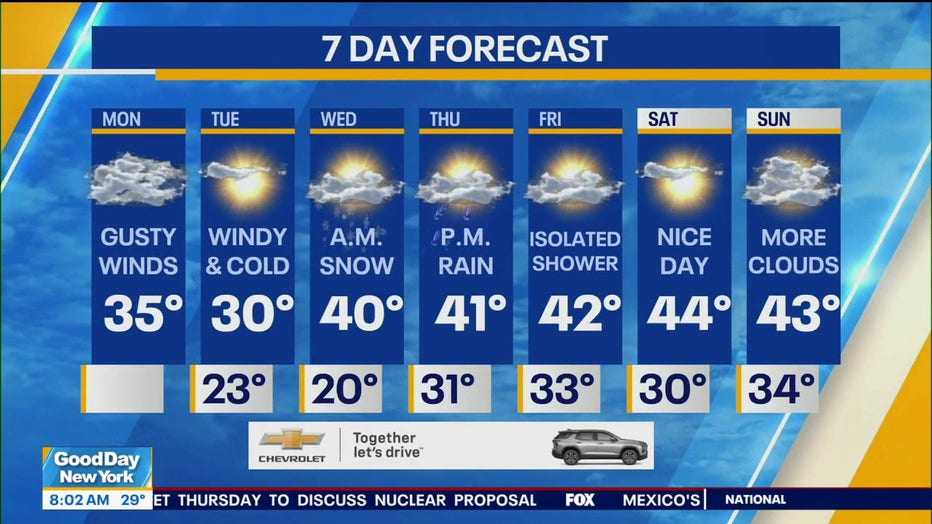
A warming trend begins Wednesday, with highs climbing into the 40s through the second half of the week, which should help melt accumulated snow.
Dangerous weather conditions
Local perspective:
Dangerous travel conditions continue across the Tri-State area. Strong to damaging wind gusts have led to reports of downed trees and power lines. Earlier heavy snow bands producing up to 3 inches per hour have begun to diminish in intensity across parts of New Jersey and the Hudson Valley, though light to moderate snow is still falling.
A coastal flood advisory remains in effect for parts of Long Island and the Jersey Shore, where minor to moderate flooding is possible during high tide. City officials have urged residents to stay off the roads as crews continue snow removal operations.
While the snow is still coming down, forecasters say gradual improvement is underway — with the steadiest snowfall expected to wind down by this afternoon.
Stay ahead of the snow with FOX 5’s expert meteorologists, streaming LIVE on FOX LOCAL. We’re streaming nonstop coverage with the newest forecasts, snow potential, and preparation tips. Download FOX LOCAL for 24/7 weather coverage on your smart TV and mobile devices.
The Source: This report is based on information from the National Weather Service and FOX 5 NY’s Audrey Puente.