
New York City was put under a local State of Emergency, enforcing a temporary travel ban on February 22 as the storm intensified across the northeastern United States. The order restricts private vehicle movement on streets, bridges, and tunnels to allow uninterrupted snow removal and emergency response operations.
All non-essential travel will remain restricted from 21:00 local time (LT) on February 22 through midday February 23. All public schools in the city will also be closed on February 23, with the exception of those that serve as warming centers.
The city’s decision to suspend remote learning reintroduced the traditional “snow day” for the first time since 2019. While many U.S. districts have shifted to online instruction during weather closures, the mayor’s order explicitly paused both in-person and virtual classes.
“There will be a traditional ‘snow day.’ No remote instruction will take place, and all after-school activities are cancelled,” Mayor Mamdani said.
“The safety of New Yorkers is my top priority. As this blizzard moves in, our administration is mobilizing every tool at our disposal, around the clock, to keep our neighbors safe. This emergency declaration allows us to cut through red tape so emergency vehicles, sanitation crews, and essential workers can move quickly and do their jobs without delay.”
All classes have been cancelled for Schools in New York and Boston, while online classes will be conducted in Philadelphia on February 23.
While classes getting cancelled due to snowfall isn’t new, most schools have shifted to online classes during such situations. However, the Mayor’s declaration applies to both online and offline classes, giving a complete day off to staff and students alike.
“It is the first old-school snow day since 2019,” Mamdani said.
The National Weather Service (NWS) issued blizzard warnings covering all five boroughs. Verified storm total snowfall measurements as of 02:27 EST on February 23 show significant variation across the metropolitan area. Central Park recorded 23.6 cm (9.3 inches), while LaGuardia Airport measured 23.1 cm (9.1 inches) and John F. Kennedy International Airport reported 19.8 cm (7.8 inches).
Higher totals were reported in parts of Manhattan and the outer boroughs, including 28.2 cm (11.1 inches) in Washington Heights, 29.7 cm (11.7 inches) in Flatbush, 30.5 cm (12 inches) in Mott Haven, and 35.6 cm (14 inches) in Dongan Hills on Staten Island.
Meanwhile, heavy snow was also recorded across Long Island and northern New Jersey. Nesconset in Suffolk County measured 36.1 cm (14.2 inches), Leonia in Bergen County, New Jersey, reported 33 cm (13.0 inches), and Newark Airport recorded 28.2 cm (11.1 inches).
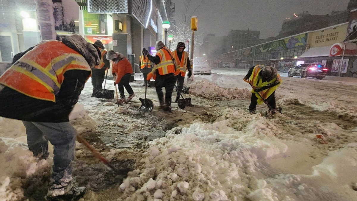
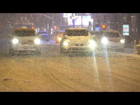
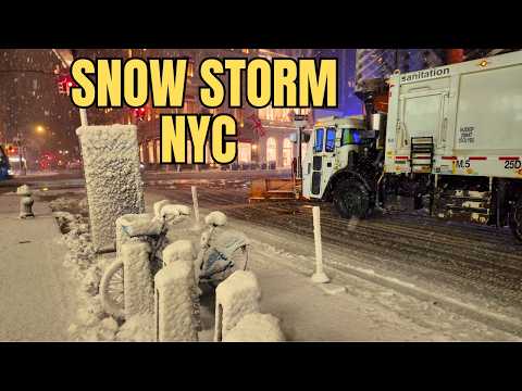
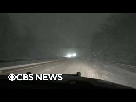
Streets remained largely empty during the storm’s peak as residents complied with the travel ban and business activity slowed. Sanitation and emergency crews maintained continuous plow rotations to keep priority routes open. Officials urged citizens to avoid non-essential travel until conditions improved and restrictions were lifted around midday February 23.
Over 3 000 flights were cancelled across the Northeast during the height of the storm, affecting operations at John F. Kennedy International Airport, LaGuardia Airport, and Newark Liberty International Airport. Runway clearing operations and aircraft de-icing procedures were repeatedly impacted by persistent snowfall and wind-driven drifting.
The Metropolitan Transportation Authority (MTA) modified subway schedules, while portions of the Long Island Rail Road and Metro-North Railroad suspended or reduced above-ground service due to snow accumulation and drifting. Bus operations were limited in areas experiencing deeper snowfall.
Streets across Manhattan, Brooklyn, Queens, the Bronx, and Staten Island remained largely empty during the height of the storm, as commercial activity slowed and delivery services temporarily suspended operations.
Snow removal crews were deployed across primary corridors and emergency routes, repeating plow cycles as high winds redistributed snow across cleared surfaces. Officials urged residents to remain indoors and avoid non-essential travel until restrictions were lifted.
The latest satellite imagery this morning shows a major nor’easter taking on a classic comma-head structure as it rapidly intensifies off the Delaware–New Jersey coastline, NWS forecaster Asherman noted at 03:22 EST on February 23.
Overall, the forecast remains consistent with expected impacts from this powerful system. Very heavy snowfall rates of 50–75 mm (2–3 inches) per hour and gusty winds of 65–110 km/h (40–70 mph) will continue to affect the Northeast today, extending into New England this morning as the storm begins to accelerate.
By tomorrow morning, some coastal areas could record storm-total snowfall amounts of 30–60 cm (1–2 feet) as the low moves into the Canadian Maritimes. For today, however, the combination of very high snowfall rates and potentially damaging wind gusts will make travel nearly impossible from the Delmarva Peninsula through southeastern New England.
Beyond tomorrow, a progressive clipper system moving out of the Upper Great Lakes could produce additional snowfall across parts of the Northeast, including areas currently experiencing heavy snow.
References:
1 Mayor Mamdani Declares Local State of Emergency, Snow Day for NYC Public Schools to Keep New Yorkers Safe – New York City Government – February 22, 2026
2 Public Information Statement – NWS – February 23, 2026
3 Short Range Forecast Discussion – NWS/WPC – Issued at 03:22 EST on February 23, 2026