
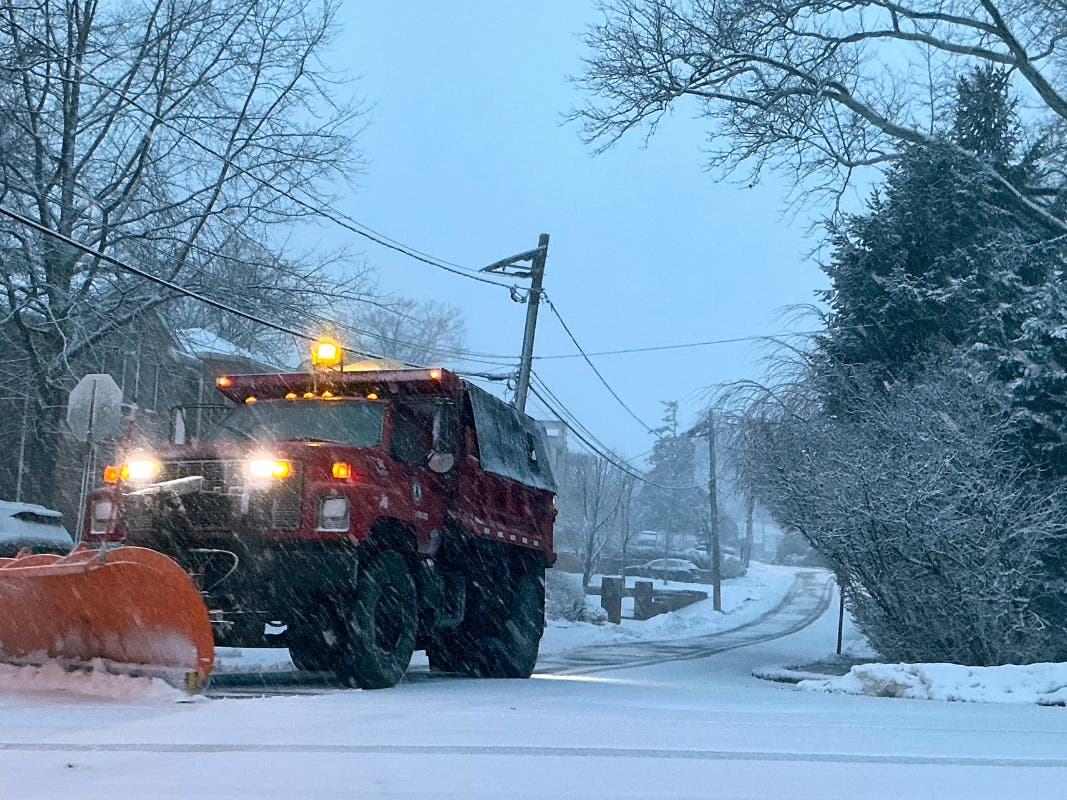
After a blizzard dumped more than two feet of snow on the Garden State on Monday, mass transit lines are set to resume gradually, officials said.
Gov. Mikie Sherrill said the Newark Light Rail and River Line would resume service around 4 p.m. Monday, operating on Sunday schedules. The Hudson-Bergen Light Rail (HBLR) resumed service around 6 p.m., operating on a weekend schedule.
Other train and bus lines were set to resume Tuesday. READ MORE: NJ Trains, Buses To Run Tuesday After Shutdown
The emergency 35 MPH speed limit for major highways was to be lifted at 5 p.m., Sherrill said.
“I want to thank NJ Transit and the New Jersey Turnpike Authority crews who are working tirelessly around the clock to restore our transportation systems for the millions of New Jerseyans who rely on them,” Sherrill said. “We are pleased that light rail services are set to return later today.”
“Thanks to the dedicated efforts of our teams over the past 24 hours, I’m pleased to announce the gradual resumption of transit service, beginning with our three light rail lines later today,” said NJ Transit CEO Kris Kolluri.
Earlier on Monday, roads were snarled, mass transit was suspended, and power was out in some areas.
Monmouth County received as much as 24.2 inches of snow, and many other areas received more than 18 inches, according to National Weather Service spotters who logged totals by 8 a.m.
A statewide travel ban expired at noon on Monday.
While expected snow totals were downgraded, some areas reported amounts that were higher than predicted.

“More than 500,000 customers are waking up without power, some with feet of snow at their doorsteps, after a massive nor’easter delivered blizzard conditions to millions,” Accuweather said Monday morning.
“After a night of heavy snow and winds up to 60 mph, snow is forecast to continue through Monday after the storm strengthened into a strong bomb cyclone. Snow totals in parts of New Jersey have surpassed a foot and are continuing to climb.”
Much of the Jersey Shore remains under a coastal flood advisory.

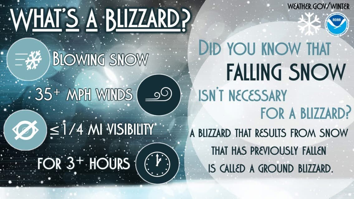
The blizzard warning continues until 6 p.m. Monday.
“Areas of blowing snow could significantly reduce visibility,” says the National Weather Service. “The hazardous conditions will impact the Monday morning and evening commutes. Gusty winds could bring down tree branches.”
State Of Emergency
Gov. Mikie Sherrill issued a State of Emergency starting at noon on Sunday.
Later in the day, she announced a mandatory travel restriction from 9 p.m. Sunday to 7 a.m. Monday, which was extended until noon. “This is a very serious storm and I urge all residents to stay inside and stay safe,” she said in a social media post.
A storm like this hasn’t been seen in years, officials said.
“This will be the first blizzard for much of the mid-Atlantic and southern New England coasts in bout four years,” said AccuWeather Senior Meteorologist Tyler Roys.

.
The last time the Jersey Shore was under a blizzard warning was in 2022, when a nor’easter dumped 22 inches on parts of the state.