
We told you snow. And we’re not just talking about Thursday night, though that could be wintry, too.
Our chances for meaningful snow on Thursday have actually decreased since earlier in the week — so less to be concerned about afternoon and evening commutes today.
Most models now keep precipitation south just of the region or show very light snow brushing the southern edge. Even if snow reached farther north, daytime temperatures above freezing would limit accumulation and potential impacts. That’s Thursday night.
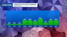
Then we’re looking at a couple more chances for snow and wintry weather, with one system of particular interest, into early next week. A fast-moving cold front arrives Sunday, bringing likely snow showers. There’s a slight chance of brief snow squalls in the area, though the best chance for that stays farther north.
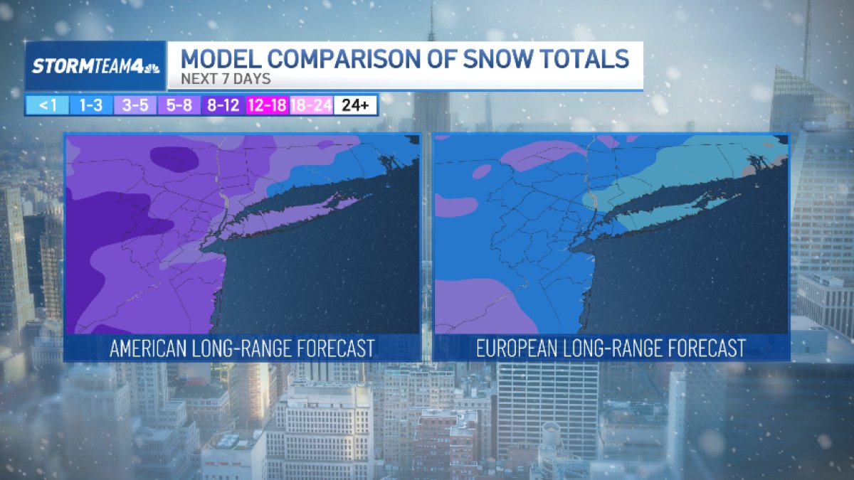
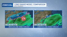
Another quick-moving system approaches Monday into Tuesday. Models vary, but most place the region on the northern edge of the storm, which favors an all-snow event. It’s way too early, though, to talk totals or timing.
We’ll know closer to the weekend. Either way, New York City might need those emergency snow shovelers again.

Another system could follow Tuesday night into Wednesday, but that one is even more uncertain and may start as snow before mixing with or changing to rain if it tracks farther north. Bottom line: there are multiple chances for snow next week, but confidence on timing and amounts is still low, and details will continue to evolve.
By midweek, we can look forward to a string of mild days and chances for rain instead of snow.
PHOTOS: Snowmen arise across the NYC area thanks to the blizzard