We’re still on track for a warm-up that begins Saturday (temperatures in the low 50s) and culminates mid-next week (reaching the low 70s!). In the meantime, we’ve got a cold, wet day Thursday that will extend into Friday morning.
Grab your umbrella and a warm, waterproof coat on your way out the door. Rain moves in around sunrise and continues through Thursday night, finally tapering off around dawn Friday.
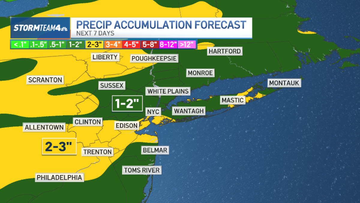
We may get a brief respite early Thursday afternoon, but plan for an overall wet day. We anticipate about an inch to an inch and a half of rain, which would be a good soaking. Rain will be light enough at any given time to preclude flooding.
A dense fog advisory will be in place Thursday morning for Monmouth and Ocean County in New Jersey. Visibility could drop below a mile in some areas during the morning commute.
While the rain exits early Friday, the chilly air stays put. Highs will only be around 40 degrees. For comparison, our current normal high temperature is 46 degrees.
Thursday brings the best chance for rain over the next 10 days, but we have other opportunities for lesser amounts come Saturday night, next Wednesday or Thursday, and possibly again next Friday night.
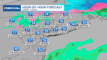
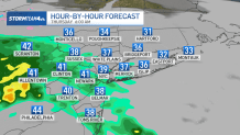
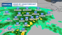
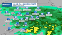
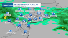
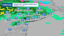
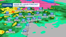
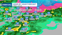
See hourly radar breakdown below for what’s in store for Thursday and into Friday morning:
Thursday 6 a.m.
Thursday 9 a.m.
Thursday 12 p.m.
Thursday 3 p.m.
Thursday 6 p.m.
Thursday 9 p.m.
Friday 12 a.m.
Friday 3 a.m.
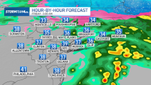
Friday 7 a.m.