
We’re all going to be singing the same song for the next few days.
Don’t expect to see the sun before Sunday. On the plus side, it will be a glorious day — a reward for the dreariness we’re slugging through now.
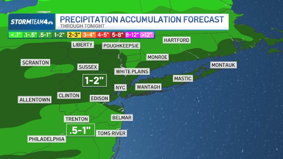
It was a wet start to Thursday, with rain developing after sunrise and continuing through the afternoon and evening. At times, it’ll be steady enough to cause ponding in poor drainage areas.
Temperatures rise above freezing for most, but a few interior spots could briefly flirt with freezing rain, especially later Thursday night as colder air sneaks in.
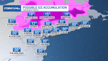
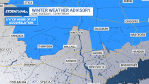
Any impacts look limited and unlikely, although there is a winter weather advisory up for Sullivan, Ulster and parts of Dutchess counties through Friday morning.
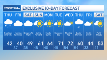
Rain tapers off late Thursday into early Friday, leaving behind clouds and a chilly, mostly dry, albeit cloudy Friday.
Looking ahead, temperatures begin to moderate this weekend with a noticeable warm-up Sunday into early next week. A few scattered showers are possible Saturday night, but overall, the trend is toward milder air, with springlike warmth building by midweek, especially away from the coast, with 70-degree temperatures possible.
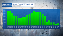
See hourly radar breakdown below for what’s in store for Thursday into Friday morning.
Track any approaching rain using our interactive radar below.