
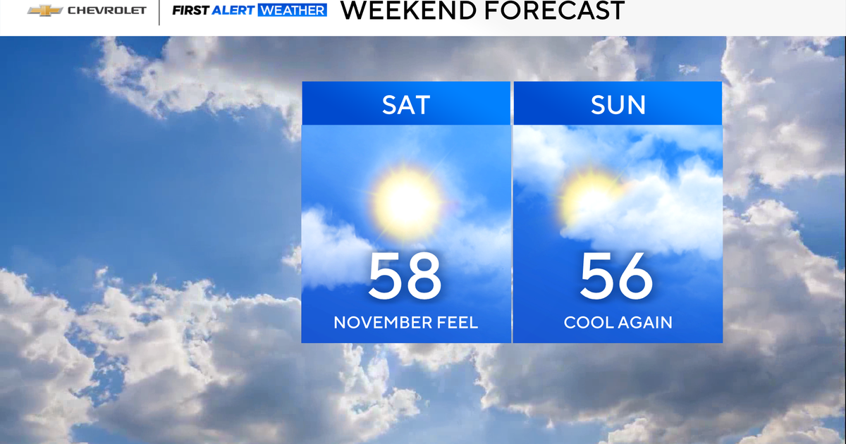
The weekend is shaping up to be pretty decent, albeit on the cool side. Highs both days will range in the mid to upper 50s, with a mix of sun and clouds.
Fall foliage is really starting to peak for portions of the Tri-State Area, and it will be a great weekend to view it.

CBS News New York
Frost advisories in place overnight
Yet another cool night lies in store, as temperatures are anticipated to fall into the 30s and 40s across the region. Frost is possible once again, especially in the Hudson Valley and central New Jersey.
Frost Advisories are in place from 11 p.m. Friday through 9 a.m. Saturday for Middlesex, Monmouth, Ocean, Fairfield, Putnam and Orange Counties.

CBS News New York
First Alert Weather Day issued for Thursday
A dry and cool pattern will be in place through Tuesday.
By later in the day on Wednesday, a storm may begin to affect the region. Right now, our two most reliable forecast models are in disagreement that there will even be a storm, though. For example, the European solution depicts a storm that could bring significant rain and wind from Wednesday into Thursday.

CBS News New York
Meanwhile, the GFS solution has that same storm staying offshore and not being very impactful.

CBS News New York
Nonetheless, the First Alert Weather Team has sided with the European model, as it has been the most consistent in recent years.
That is why we have issued a First Alert Weather Day for Thursday. If the Euro follows suit with the GFS, we will then discontinue the First Alert Weather Day.

CBS News New York
Regardless if we get a storm or not, both models do agree that Halloween will be mostly dry. It also looks to be much cooler than last year, when the high was 81 degrees, which tied the daily record for warmest Halloween ever.