
NBC5 meteorologists expect showers with embedded thunderstorms Tuesday afternoon in Vermont and northern New York. TimingScattered showers and storms develop through the afternoon and evening. The most widespread storm coverage is expected between 2 PM and 8 PM. Storm coverage will decrease after sunset, leading to a quieter overnight period.HazardsThe best thunderstorm ingredients (lift, moisture, instability) exist in southern Vermont, where the potential for severe thunderstorms is highest through the afternoon.Farther north, the risk is lower, but not zero.Any storms that develop will be capable of producing wind gusts near 60 mph or small hail. Rain may be locally heavy, but the threat for flash flooding remains low.Extended ForecastThunderstorms are again possible Wednesday, but the overall risk for severe weather is lower and coverage is more isolated.Lingering shower chances persist through the remainder of the week. Temperatures stay in the 60s and 70s.A cooling trend is expected early next week with highs back in the 40s and 50s… a few snowflakes can’t be ruled out Monday or Tuesday.
BURLINGTON, Vt. —
NBC5 meteorologists expect showers with embedded thunderstorms Tuesday afternoon in Vermont and northern New York.
Timing

NBC5 News
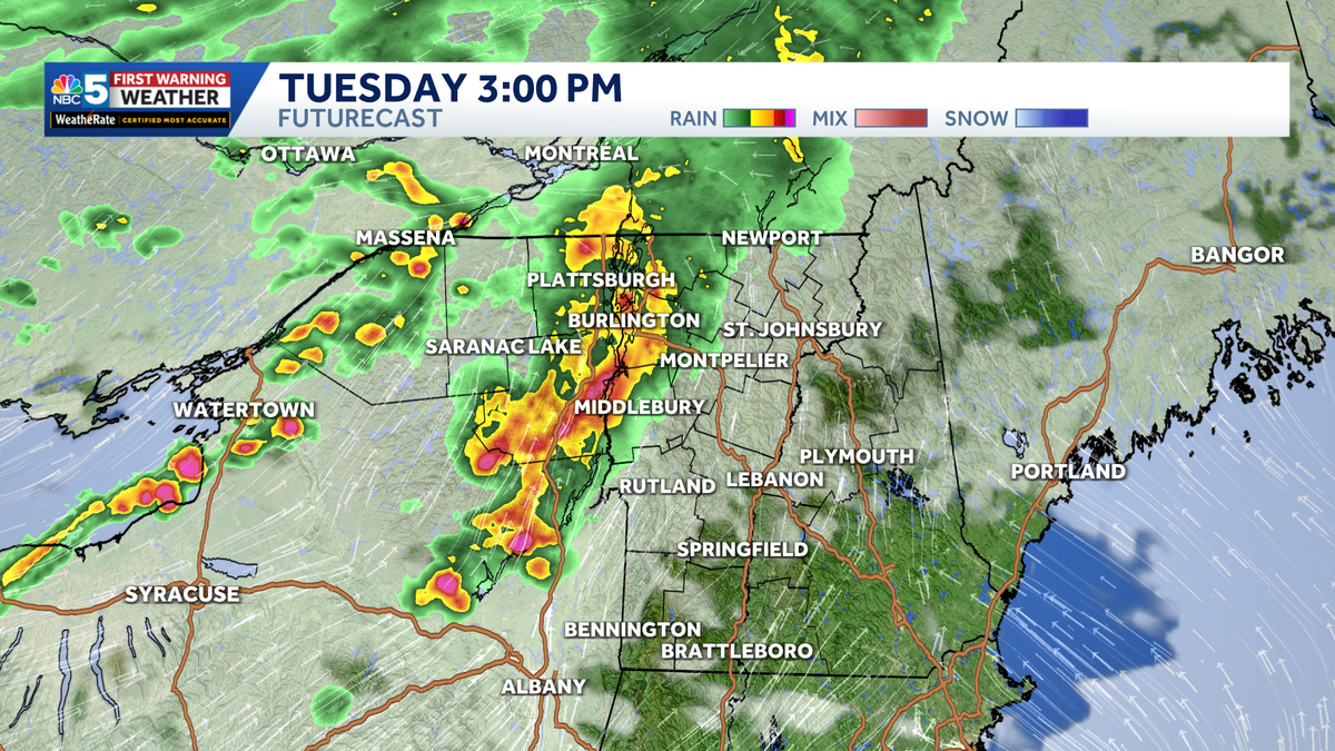
FutureCast at 3 PM Tuesday.
Scattered showers and storms develop through the afternoon and evening. The most widespread storm coverage is expected between 2 PM and 8 PM.
Storm coverage will decrease after sunset, leading to a quieter overnight period.
Hazards

NBC5 News
Severe thunderstorm risk levels for Tuesday in Vermont and northern New York.
The best thunderstorm ingredients (lift, moisture, instability) exist in southern Vermont, where the potential for severe thunderstorms is highest through the afternoon.
Farther north, the risk is lower, but not zero.

NBC5 News
Storm hazards for Tuesday.
Any storms that develop will be capable of producing wind gusts near 60 mph or small hail. Rain may be locally heavy, but the threat for flash flooding remains low.
Extended Forecast

Hearst Owned
Our latest extended forecast.
Thunderstorms are again possible Wednesday, but the overall risk for severe weather is lower and coverage is more isolated.
Lingering shower chances persist through the remainder of the week. Temperatures stay in the 60s and 70s.
A cooling trend is expected early next week with highs back in the 40s and 50s… a few snowflakes can’t be ruled out Monday or Tuesday.