
ALBANY — Meteorologists are warning that rolling across the Capital Region on Thursday afternoon could bring damaging winds, hail and possibly even a tornado.
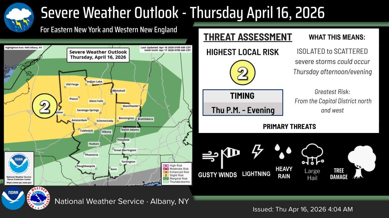
The National Weather Center’s Storm Prediction Center issued a warning for a slight risk of severe thunderstorms in upstate New York. The alert said the storm system’s primary threats for the region are damaging gusts and the potential for a tornado to develop. An alert from the National Weather Service in Albany noted the greatest risk would be later in the day.
“We certainly are looking at the possibility for those storms to be on the stronger side,” said Michael Main, a meteorologist with the National Weather Service in Albany.
The main concern is gusty, damaging winds that could reach 60 to 65 miles per hour, Main said. Hail of at least 1 inch in diameter is possible in some isolated areas. A tornado can’t be ruled out, but Main said there is a very low chance of it forming in isolated areas.
The fast-moving, heavy rain showers and thunderstorms will come from a cold front moving in from the west, colliding with a warm air mass that has given the Capital Region its unusually warm temperatures, Main said.
The storms are expected to be stronger further west and north, such as in the Mohawk Valley and Adirondacks, where they could start as early as 4 p.m. The immediate Albany area is not expected to see severe weather until just after sunset; the storms are expected even further into the evening in the Hudson Valley.
Main said flooding is not expected to be a risk, but lightning could be. He advised anyone who hears thunder to head inside.