
When most people think of archaeology, they might picture researchers digging in the dirt or trekking through a remote landscape searching for artifacts.
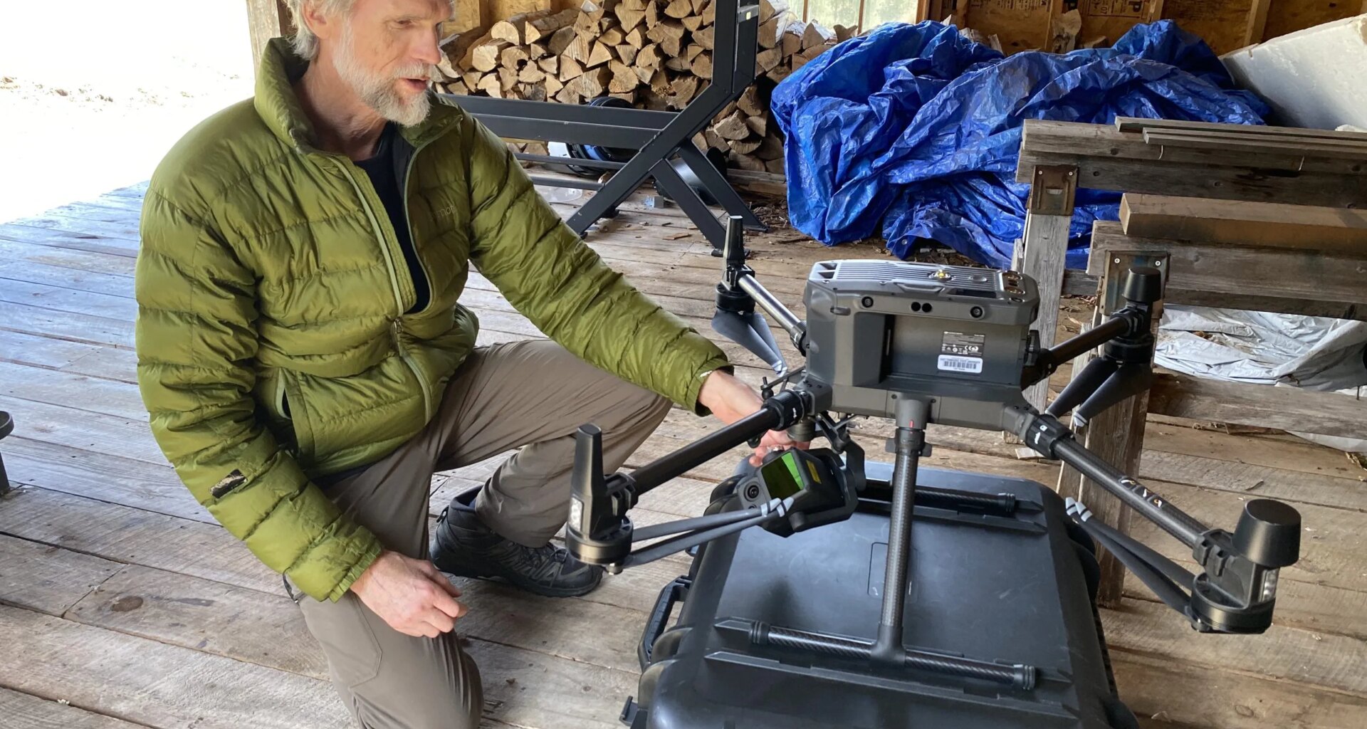
On a recent morning outside of Lake Placid, a team of researchers traded shovels for handheld tablets as they watched a drone lift off from a bright orange landing pad, tilting forward and beginning its programmed flight over a dense stretch of Adirondack forest.
On the ground, Eileen Ernenwein and Steven Jones, geosciences professors from East Tennessee State University, monitored the drone’s flight path. The aircraft, equipped with light detection and ranging, or LiDAR technology, soared about 325 feet overhead.
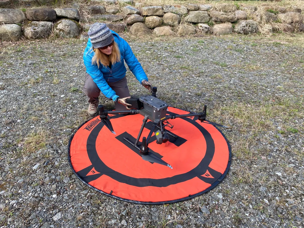 East Tennessee State University professor Eileen Ernenwein sets up a LiDAR drone to survey a plot of land once though to be home to Timbuctoo land grantees. Photo by David Escobar
The aircraft covered about 200 acres of woodland once believed to be part of Timbuctoo, a 19th-century Black settlement founded near Lake Placid by white abolitionist Gerrit Smith. In the mid-1800s, Smith granted parcels of his vast Adirondack property to Black families, hoping land ownership would offer economic independence and, at the time, the right to vote.
But over time, the forest reclaimed much of that landscape. Homes, roads and farm fields faded from history, leaving only fragments in historical maps and in scattered archaeological evidence.
Now, researchers are turning to remote sensing technology to survey land once believed to be home to several Timbuctoo land grantees, hoping to find traces of human activity carved into the landscape nearly 200 years ago.
To do that, Ernenwein is using millions of data points collected by the LiDAR drone to build a detailed three-dimensional map of the forest floor.
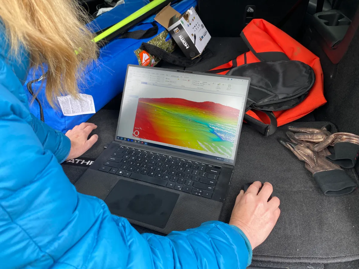 East Tennessee State University professor Eileen Ernenwein examines a 3D model created by LiDAR data, part of a land survey of an area that was once home to Timbuctoo land grantees. Photo by David Escobar
The drone’s LiDAR sensor fires roughly 160,000 pulses of light every second. Those pulses bounce off the ground and return to the aircraft, where timing differences are calculated into elevation data. Ernenwein said even when dense trees shroud the ground, LiDAR can still get an accurate read of a landscape’s subtle contours.
“Imagine you’re walking in the forest on a sunny day, and there’s trees overhead. You’re in the shade, but there’s little spots of sunlight getting filtered through,” Ernenwein said. “That’s the same way the LiDAR is getting in there. It’s getting in between branches and leaves.”
The result is a digital version of the forest floor stripped of vegetation, revealing contours that are otherwise impossible to see.
“It’s a real needle in the haystack,” she said. “Because if you just look in those woods, you see how rough the ground is. The ground is not flat.”
New leads on Timbuctoo
The survey is part of a long-running effort led by Hadley Kruczek-Aaron, an anthropology and archaeology professor at SUNY Potsdam, who has studied Timbuctoo for more than 15 years. This latest research method is a collaboration between Kruczek-Aaron, East Tennessee State University and historians from Adirondack Experience, the Museum on Blue Mountain Lake.
Before LiDAR, Kruczek-Aaron surveyed the remote hillside with metal detectors, small excavations and days of hiking through uneven terrain in search of subtle clues. The drone, by comparison, mapped the entire 200-acre hillside in about 90 minutes.
“It’s an incredible amount of land that they can cover in a short amount of time,” said Kruczek-Aaron.
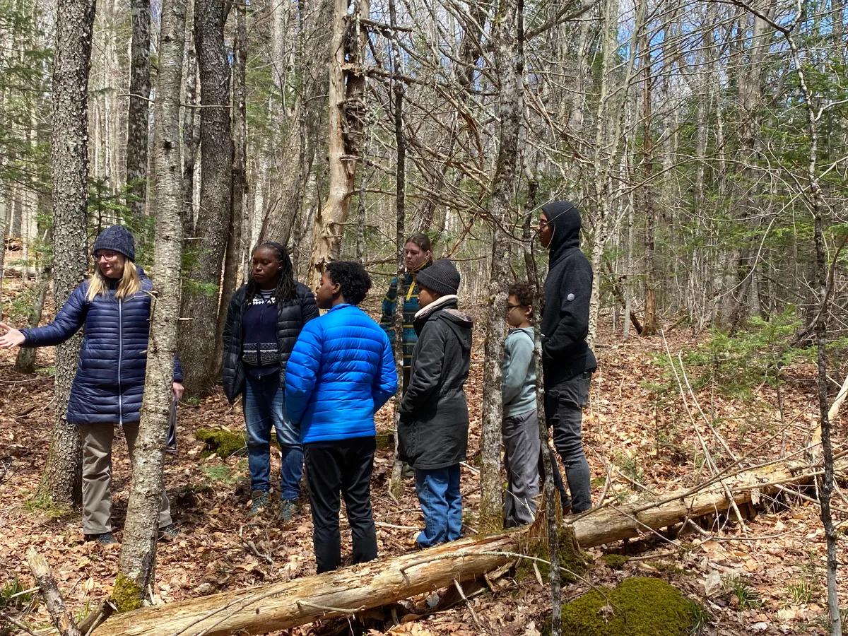 SUNY Potsdam professor Hadley Kruczek-Aaron (left) explains research findings to descendants of Timbuctoo land grantees in a wooded area near Lake Placid. Photo by David Escobar
She said the early results are already pointing to subtle anomalies in the landscape—shapes and contours that could signal past human activity.
“One of the things that we could potentially see are features that would be evidence of field clearing,” she said. “When [settlers] were dealing with the rocky Adirondack soils, they’re going to be taking out as much stone as possible and piling it up.”
Those piles of stone can sometimes appear in LiDAR imagery as faint lines or mounds, an indication that the land could have once been farmed.
“Those are the kinds of things that might show up on those LiDAR results and help us hone in on an area,” Kruczek-Aaron said.
One of the central goals of this surveying project is to pinpoint locations where Timbuctoo families actually lived and farmed.
When Timbuctoo land grantees originally settled on their parcels, New York State law required them to work the land and produce $250 to gain enfranchisement. The rugged mountain landscape and harsh weather forced some families to leave, making their stories more difficult to trace.
Kruczek-Aaron has focused much of her work on a few remaining historical threads. One of the best-documented is Lyman and Anna Epps’ family, who moved from Troy with their two children and settled on the hillside around 1849.
“They developed a very viable farm,” Kruczek-Aaron said. “We know that they are in this vicinity, and it’s just about where exactly they are.”
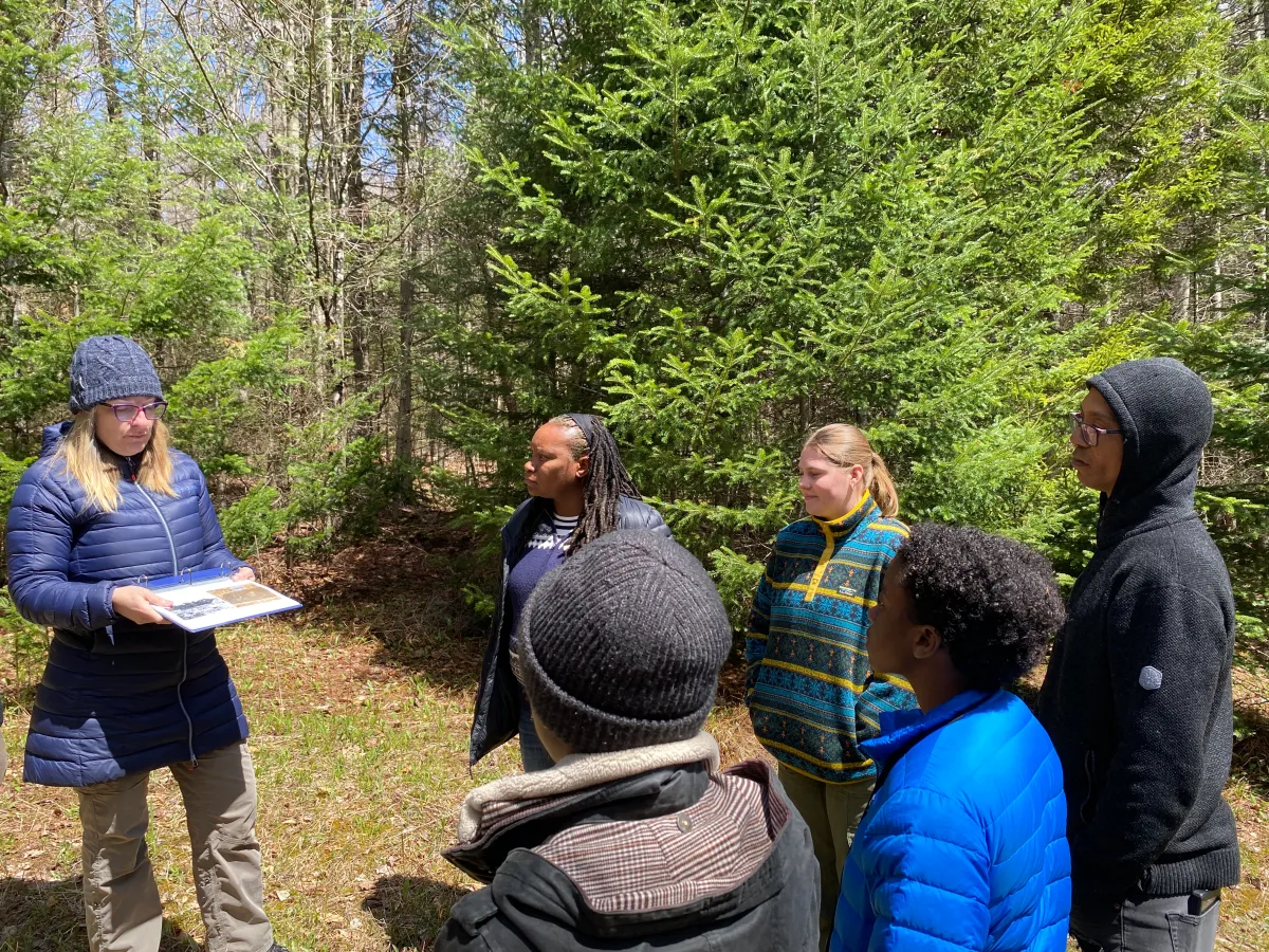 SUNY Potsdam professor Hadley Kruczek-Aaron (left) explains research findings to descendants of Timbuctoo land grantees in a wooded area near Lake Placid. Photo by David Escobar
Living history
During the weeklong survey, Kruczek-Aaron walked the site with descendants of Timbuctoo settlers, pointing out areas where LiDAR data suggested further investigation.
Tanya Jones, who descends from Timbuctoo pioneers Phoebe and Edward Weeks, traveled from Massachusetts to see the work firsthand.
“I think being here really kind of shows the challenge that they faced,” she said. “Just imagining people coming up here with an ox and a cart and maybe some axes to try to tame this space and make it a productive place to farm.”
The history was already familiar to Jones. Her mother, Katherine Butler-Jones, conducted foundational research that helped shape “Dreaming of Timbuctoo,” a permanent exhibition at John Brown Farm exploring Black settlement in the Adirondacks.
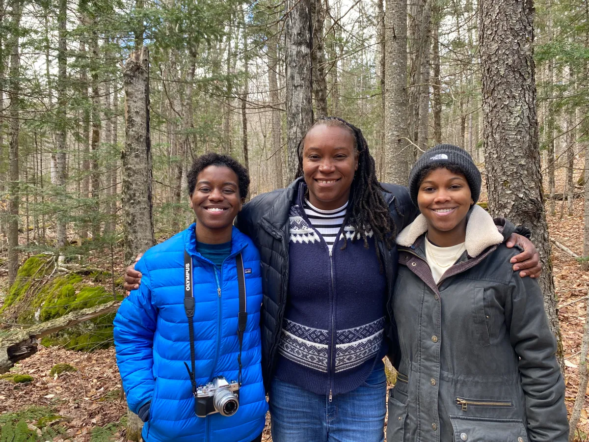 From left to right: Julia Chaffers, Tanya Jones and Shannon Chaffers. All three are descendants of Phoebe and Edward Weeks, early Black Adirondack pioneers that received land through the Timbuctoo land experiment. Photo by David Escobar.
Standing on the hillside where those settlers once lived, Jones said the visit added a dimension in understanding her family’s history in a way that maps and research cannot fully capture.
“It just deepens my respect for all of the pioneers in the Adirondacks,” she said, “particularly the ones that came from urban New York with few means, most likely, to make a life.”
So far, researchers say the LiDAR maps have identified around five small areas that may contain remnants of field systems, stone piles or building foundations. Those locations will guide future ground surveys and excavations as archaeologists continue working to match the digital landscape to what once stood on it.
David Escobar is a Report For America Corps Member. He reports on diversity issues in the Adirondacks through a partnership between North Country Public Radio and Adirondack Explorer.