Here’s what you need to know:
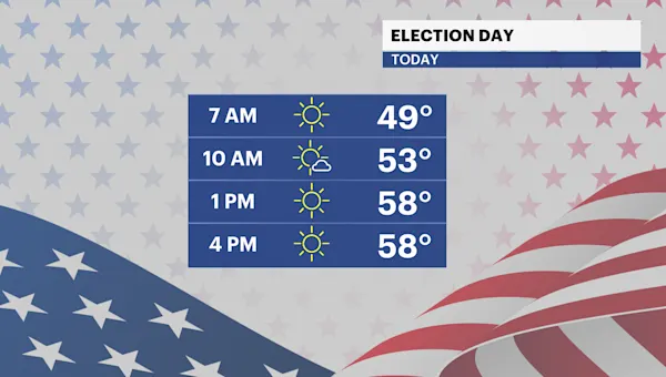
It’s a bright, brisk and breezy start to the day with wake-up temperatures in the mid to upper 40s.
Today will be another seasonable day with beautiful sunshine and windy conditions. Gusts will reach up to 35 mph.
A series of frontal systems will move through our area this week bringing gusty winds and little to no rainfall. It stays mainly dry and cool through Friday. There’s a slight chance for a passing shower Wednesday night. Rain chances increase late Friday night into Saturday morning. Another storm system brings a chance of rain on Sunday into early Monday. Stay tuned for updates.
The latest drought monitor comes out on Thursday. We’ll likely see some improvements to drought conditions thanks to last week’s soaker.
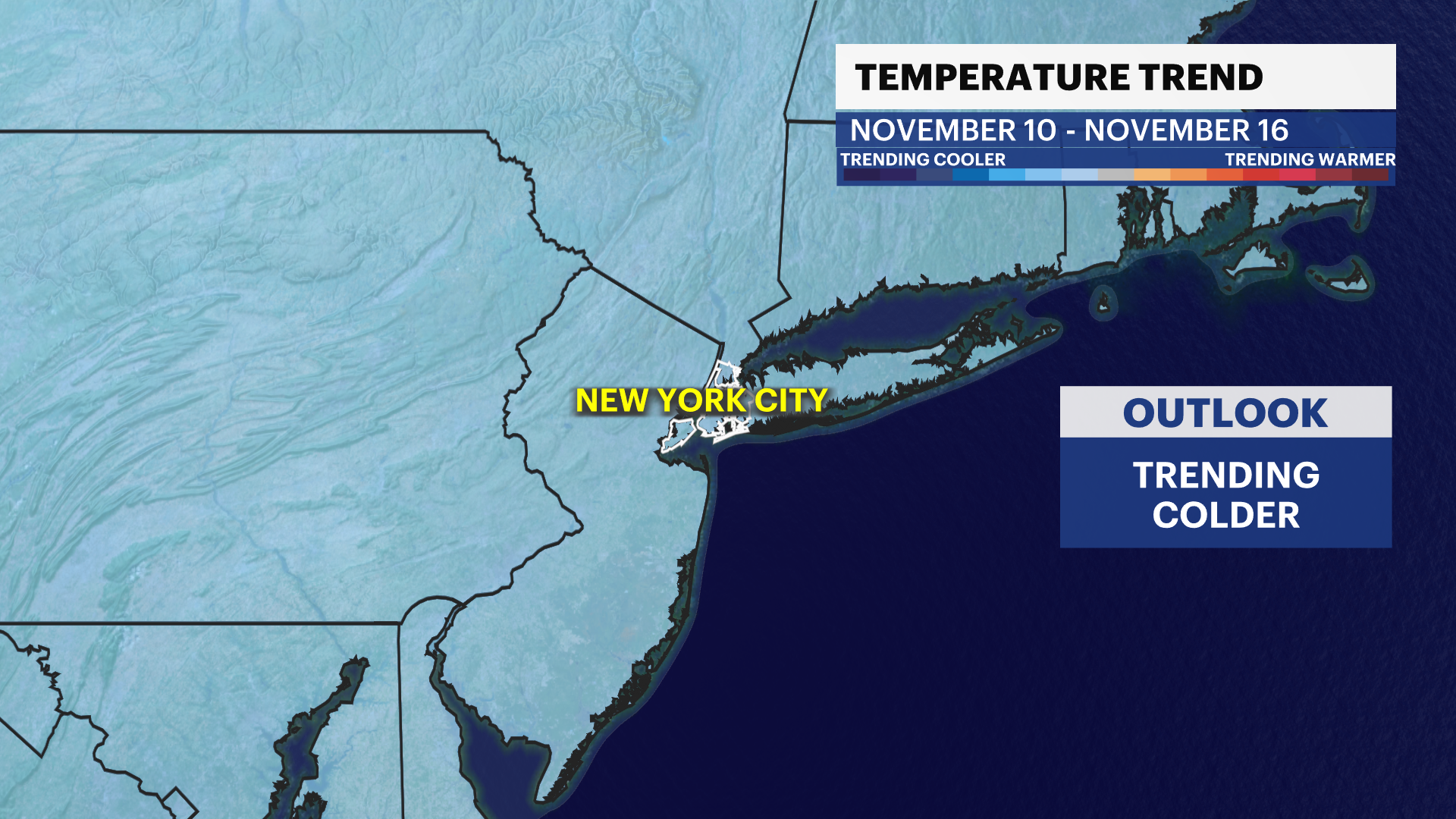
There’s a signal for a little taste of Winter next week. A very cold shot of air arrives with highs stuck in the 40s. Stay tuned for updates!
TRACKING THE TROPICS: There are currently no tropical disturbances in the Atlantic over the next 7 days. Hurricane season doesn’t officially end until Nov. 30. Stay tuned for updates!
Today: Bright, brisk and breezy. Highs near 60.

Tonight: Mostly clear, chilly and less breezy. Lows near 44.
Wednesday: Sun to clouds and cool. Turning windy late in the day. Chance of overnight rain. Highs near 63. Lows near 47.
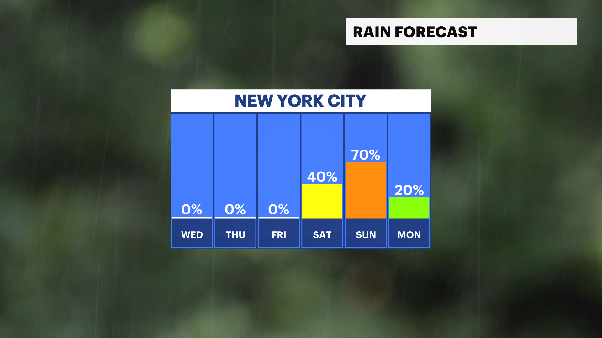
Thursday: Brighter, much cooler and breezy. Highs near 53. Lows near 41.
Friday: Cool and partly sunny. Chance of afternoon showers. Highs near 59. Lows near 51.
Saturday: Sun and clouds, cool and breezy. Chance of rain. Highs near 60. Lows near 46.
Sunday: Mostly cloudy and cool. Chance of rain. Highs near 56. Lows near 44.
Monday: Chance of early rain. Chilly, partly sunny and breezy. Highs near 47. Lows near 36.