
Storm chances rise Tuesday as heat, humidity builds in Vermont, New York
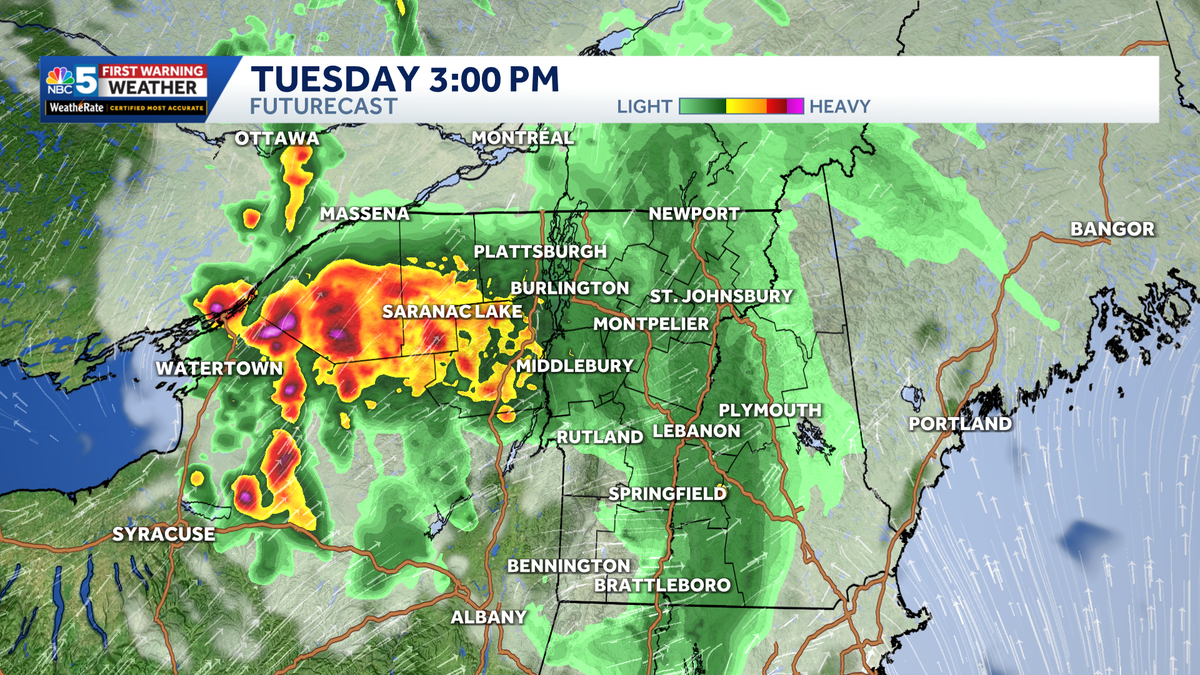
Strong to severe thunderstorms are possible Tuesday afternoon, evening, and overnight
heat event that peaks Wednesday and Thursday, with dangerous humidity and very limited overnight relief. Storm chances are around each day, but they are conditional and uneven – the heat is the more certain, region-wide concern.The main story is a multi-day heat event that peaks Wednesday and Thursday, with dangerous humidity and very limited overnight relief. Storm chances are around each day, but they are conditional and uneven – the heat is the more certain, region-wide concern.The main story is a multi-day heat event that peaks Wednesday and Thursday, with dangerous humidity and very limited overnight relief. Storm chances are around each day, but they are conditional and uneven – the heat is the more certain, region-wide concern.The main story is a multi-day heat event that peaks Wednesday and Thursday, with dangerous humidity and very limited overnight relief. Storm chances are around each day, but they are conditional and uneven – the heat is the more certain, region-wide concern.The main story is a multi-day heat event that peaks Wednesday and Thursday, with dangerous humidity and very limited overnight relief. Storm chances are around each day, but they are conditional and uneven – the heat is the more certain, region-wide concern.The main story is a multi-day heat event that peaks Wednesday and Thursday, with dangerous humidity and very limited overnight relief. Storm chances are around each day, but they are conditional and uneven – the heat is the more certain, region-wide concern.The main story is a multi-day heat event that peaks Wednesday and Thursday, with dangerous humidity and very limited overnight relief. Storm chances are around each day, but they are conditional and uneven – the heat is the more certain, region-wide concern.The main story is a multi-day heat event that peaks Wednesday and Thursday, with dangerous humidity and very limited overnight relief. Storm chances are around each day, but they are conditional and uneven – the heat is the more certain, region-wide concer
NBC5 First Warning Meteorologist
Showers and thunderstorms are possible across the region today, but the setup is not an all-day washout for everyone.The main storm system to watch early today is moving southeast out of the Great Lakes.Recent forecast trends keep the strongest part of that storm complex mainly to our west and south, which would limit the severe weather risk for much of Vermont and northern New York. That said, parts of northern New York — especially St. Lawrence County — have the best chance to see a stronger storm today.Any stronger storms that do develop could produce damaging wind gusts, along with brief heavy rain and lightning.The risk is more isolated than widespread, so some towns may see a storm while others stay mainly dry or just see passing clouds.As the week continues, near-record heat and high humidity will build Wednesday through Friday. Heat index values may exceed 105 degrees in the wide valleys.
Showers and thunderstorms are possible across the region today, but the setup is not an all-day washout for everyone.
NBC5 News
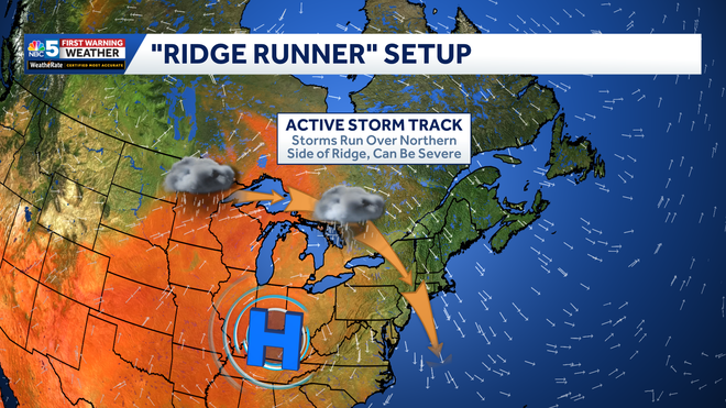
“Ridge Runner” setup, aiming an active storm track at the Northeast.
The main storm system to watch early today is moving southeast out of the Great Lakes.
NBC5 News
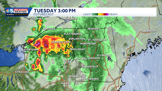
FutureCast at 3 PM Tuesday afternoon.
Recent forecast trends keep the strongest part of that storm complex mainly to our west and south, which would limit the severe weather risk for much of Vermont and northern New York.
That said, parts of northern New York — especially St. Lawrence County — have the best chance to see a stronger storm today.
NBC5 News
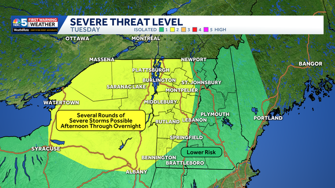
The risk for severe thunderstorms is highest in northern New York and western Vermont Tuesday afternoon through Wednesday morning.
Any stronger storms that do develop could produce damaging wind gusts, along with brief heavy rain and lightning.
The risk is more isolated than widespread, so some towns may see a storm while others stay mainly dry or just see passing clouds.
NBC5 News
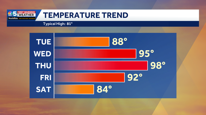
Temperature trend over the next five days.
As the week continues, near-record heat and high humidity will build Wednesday through Friday. Heat index values may exceed 105 degrees in the wide valleys.