
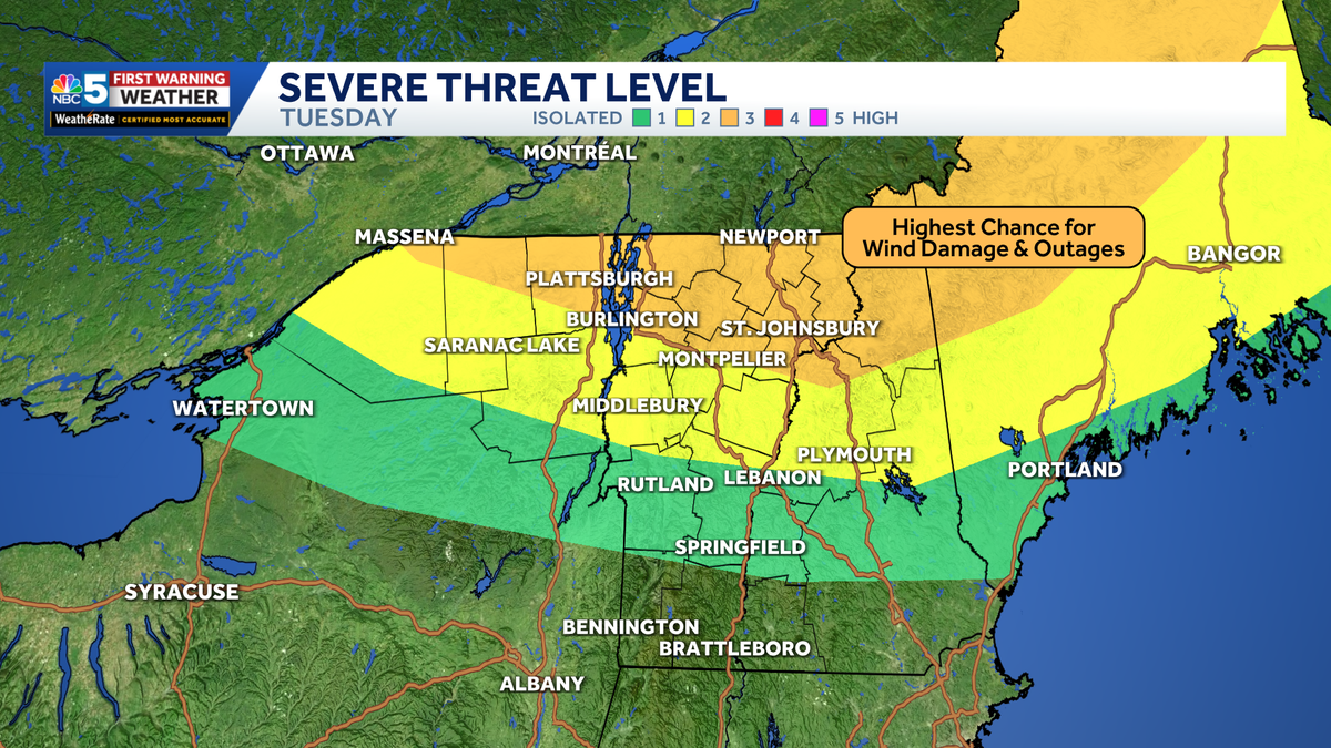
NBC5 meteorologists are tracking a combination of oppressive heat Tuesday, followed by the potential for damaging severe thunderstorms Tuesday evening and overnight across Vermont and northern New York.High Heat, Humidity Tuesday will start off warm and become increasingly hot through midday. A Heat Advisory is in effect for much of the region from 11 a.m. to 8 p.m.Afternoon temperatures will climb into the 90s, while high humidity will make it feel between 95 and 105 degrees. The hottest conditions are expected in the Champlain, Connecticut, and St. Lawrence valleys. Storm Threat Tuesday evening, the threat shifts from heat to the potential for severe thunderstorms. The line of storms is expected to move across the region between 8 p.m. Tuesday and 2 a.m. Wednesday.The Storm Prediction Center has placed parts of northern New York and northern Vermont, especially near the international border, under a rare Enhanced Risk (Level 3 of 5) for severe thunderstorms Tuesday evening into Tuesday night.The primary threat is damaging wind gusts, with the strongest storms capable of producing 70+ mph winds. Large hail, frequent lightning, torrential rainfall, and isolated tornadoes are also possible. The highest risk for the strongest storms is across northern Vermont and communities along the international border, where the potential for significant wind damage is greatest.While widespread flooding is not expected, localized flash flooding is possible where the heaviest rain falls, especially across parts of Vermont’s Northeast Kingdom.Looking AheadConditions will likely turn drier by sunrise Wednesday. It will still be warm, but lower humidity should make conditions feel much more comfortable.
NBC5 meteorologists are tracking a combination of oppressive heat Tuesday, followed by the potential for damaging severe thunderstorms Tuesday evening and overnight across Vermont and northern New York.
High Heat, Humidity
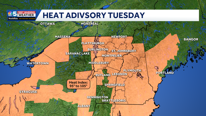
Tuesday will start off warm and become increasingly hot through midday. A Heat Advisory is in effect for much of the region from 11 a.m. to 8 p.m.
NBC5 News
Heat advisory in effect through Tuesday evening.
Afternoon temperatures will climb into the 90s, while high humidity will make it feel between 95 and 105 degrees. The hottest conditions are expected in the Champlain, Connecticut, and St. Lawrence valleys.
Storm Threat
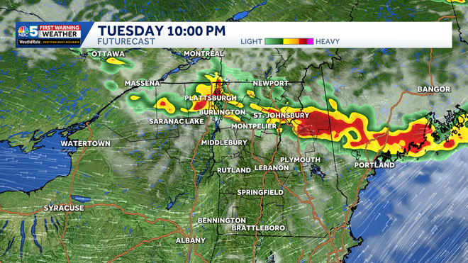
Tuesday evening, the threat shifts from heat to the potential for severe thunderstorms. The line of storms is expected to move across the region between 8 p.m. Tuesday and 2 a.m. Wednesday.
NBC5 News
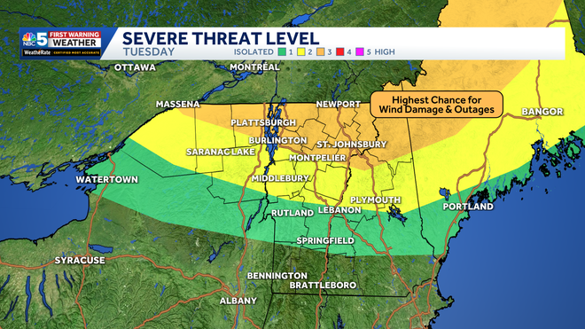
Storm Prediction Center outlook Tuesday. Most activity is expected in the evening and overnight.
The Storm Prediction Center has placed parts of northern New York and northern Vermont, especially near the international border, under a rare Enhanced Risk (Level 3 of 5) for severe thunderstorms Tuesday evening into Tuesday night.
The primary threat is damaging wind gusts, with the strongest storms capable of producing 70+ mph winds. Large hail, frequent lightning, torrential rainfall, and isolated tornadoes are also possible.
NBC5 News
FutureCast at 9 PM Tuesday.
The highest risk for the strongest storms is across northern Vermont and communities along the international border, where the potential for significant wind damage is greatest.
While widespread flooding is not expected, localized flash flooding is possible where the heaviest rain falls, especially across parts of Vermont’s Northeast Kingdom.
Looking Ahead
Hearst Owned
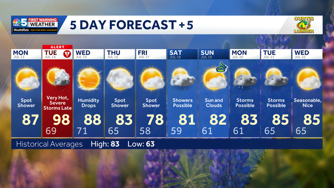
Our latest extended forecast.
Conditions will likely turn drier by sunrise Wednesday. It will still be warm, but lower humidity should make conditions feel much more comfortable.