
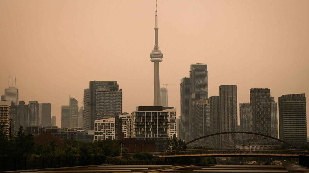
Smoke from a rash of wildfires in Canada and northeast Minnesota is sweeping into the Great Lakes and Northeast, leading to unhealthy air quality from the upper Midwest to the mid-Atlantic states and New England.
Conditions in Minneapolis and Detroit are especially unhealthy as of Thursday morning.
(MORE: The Weather Company Labs: active wildfires & fire weather tracker)

Weather in your inbox
By signing up you agree to the Terms & Privacy Policy. Unsubscribe at any time.Where the air quality alerts are right now
Smoke has been pouring across the U.S. border from Canada, affecting much of the Midwest and Northeast today. Here’s where smoke is right now and its thickness.
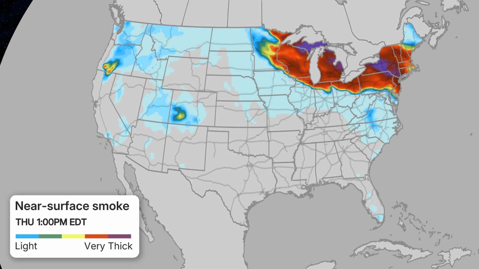
The Minnesota Pollution Control Agency has already issued an air quality alert for northeast Minnesota through Thursday.
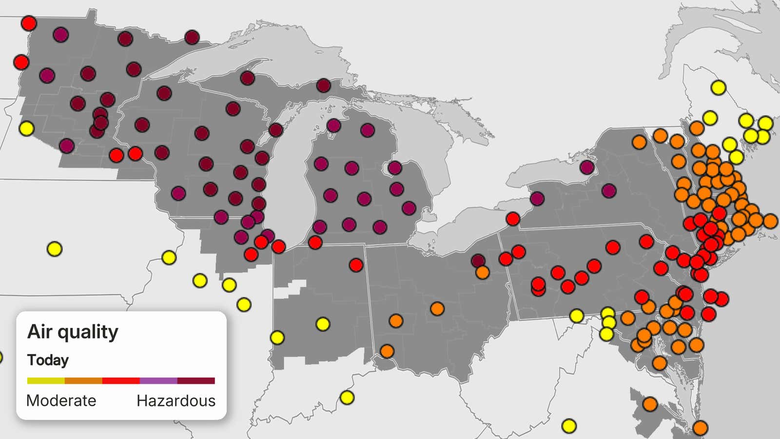
Air quality alerts have also been issued statewide in both Michigan, Wisconsin, New York, New Jersey and Delaware, as well as in parts of several other states throughout the Midwest and mid-Atlantic. They are shaded in grey on the map below.
 Midwest, Northeast smoke forecasts
Unfortunately, winds out of the northwest will push this wildfire smoke from Canada and northeast Minnesota into the Great Lakes and Northeast.
And this smoke may reach the ground in some areas, leading to potentially unhealthy air quality for several days. Here’s when surface wildfire smoke may be a problem:
(WATCH: What air quality index forecasts mean)
Thursday and beyond
Near-surface smoke may be more widespread from the upper Midwest through the Great Lakes and much of the Northeast Thursday, possibly as far south as northern Illinois, northern Indiana, Ohio, West Virginia, Virginia and Maryland.
Again, the surface smoke likely will be most dense in the northern Great Lakes.
Conditions in Minneapolis and Detroit are at hazardous levels, the worst level on the Air Quality Index, and are expected to remain at or near these unhealthy levels through the day on Thursday.
But at least some smoke could make the air unhealthy, at least for sensitive groups, along much of the Interstate 95 corridor, including New York, Philadelphia, Baltimore and Washington, D.C.
This ground smoke may also be unhealthy in Buffalo, Chicago, Cleveland, Milwaukee and Pittsburgh on Thursday.
Some unhealthy ground smoke may linger in parts of the Midwest and Northeast into Friday, with lighter smoke possible into the central Appalachians, Virginia and North Carolina.
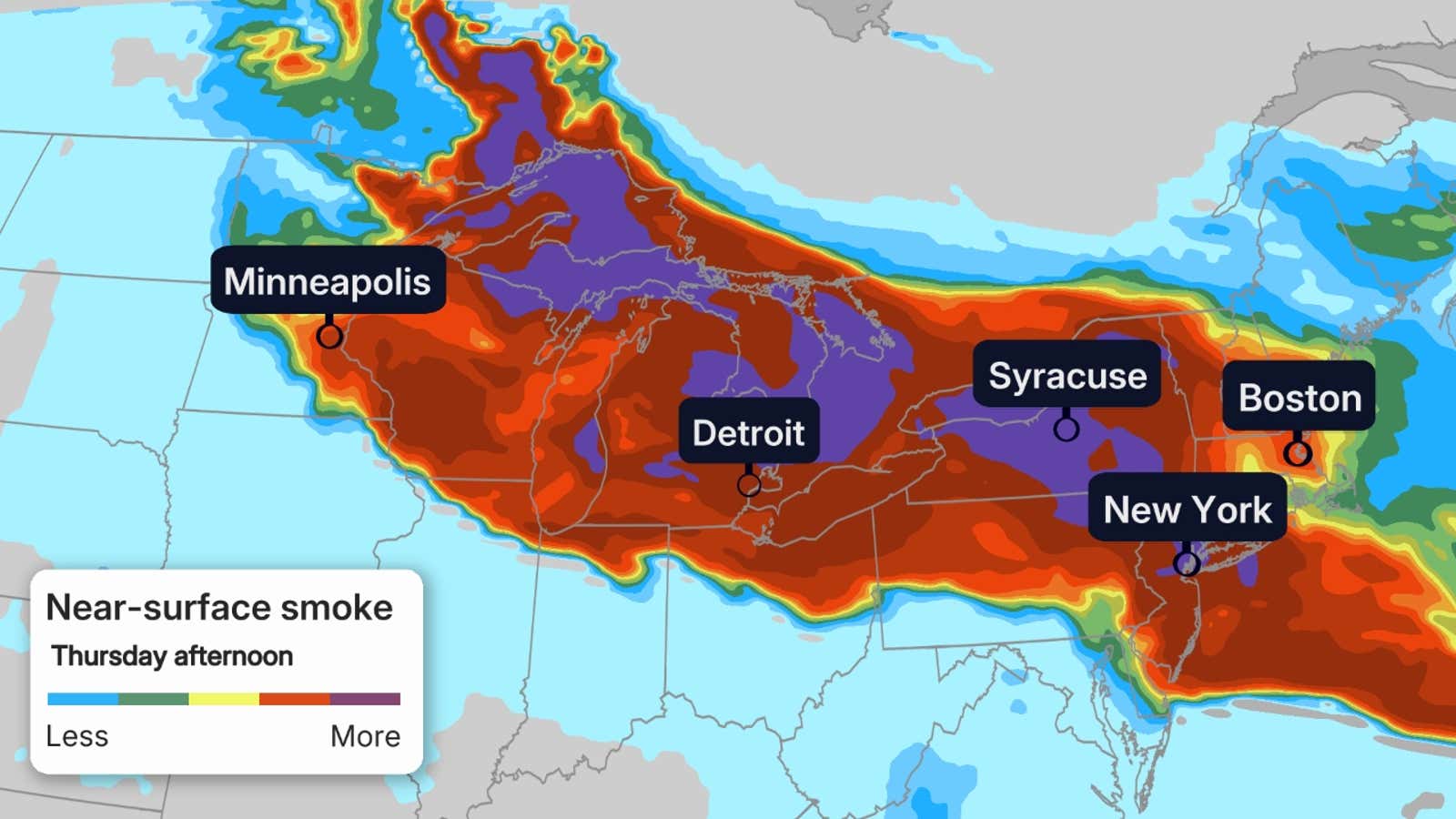
This is a forecast of smoke near the surface for the timeframe highlighted from the HRRR model. Areas in orange, red and purple contours may have significant wildfire smoke near the ground that could be unhealthy.
What you need to know to stay safe
Wildfire smoke is hazardous to breathe for several reasons.
It contains microscopic “particulate matter” much smaller than the width of a human hair that can lodge deep into the lungs and then enter your bloodstream.
It can lead to short-term effects, such as coughing, shortness of breath, a scratchy throat, runny nose and burning eyes.
Prolonged exposure to dense smoke can increase the risk of chronic lung issues and increase inflammation that could lead to heart attacks and strokes.
If you’re in these affected areas in the Midwest and Northeast, check your air quality forecast before heading outside.
You can do that on The Weather Channel app by going to your local forecast, then tapping the “Breathing” button. Or, from your local forecast page on weather.com, click on the “Air Quality” button at the top.
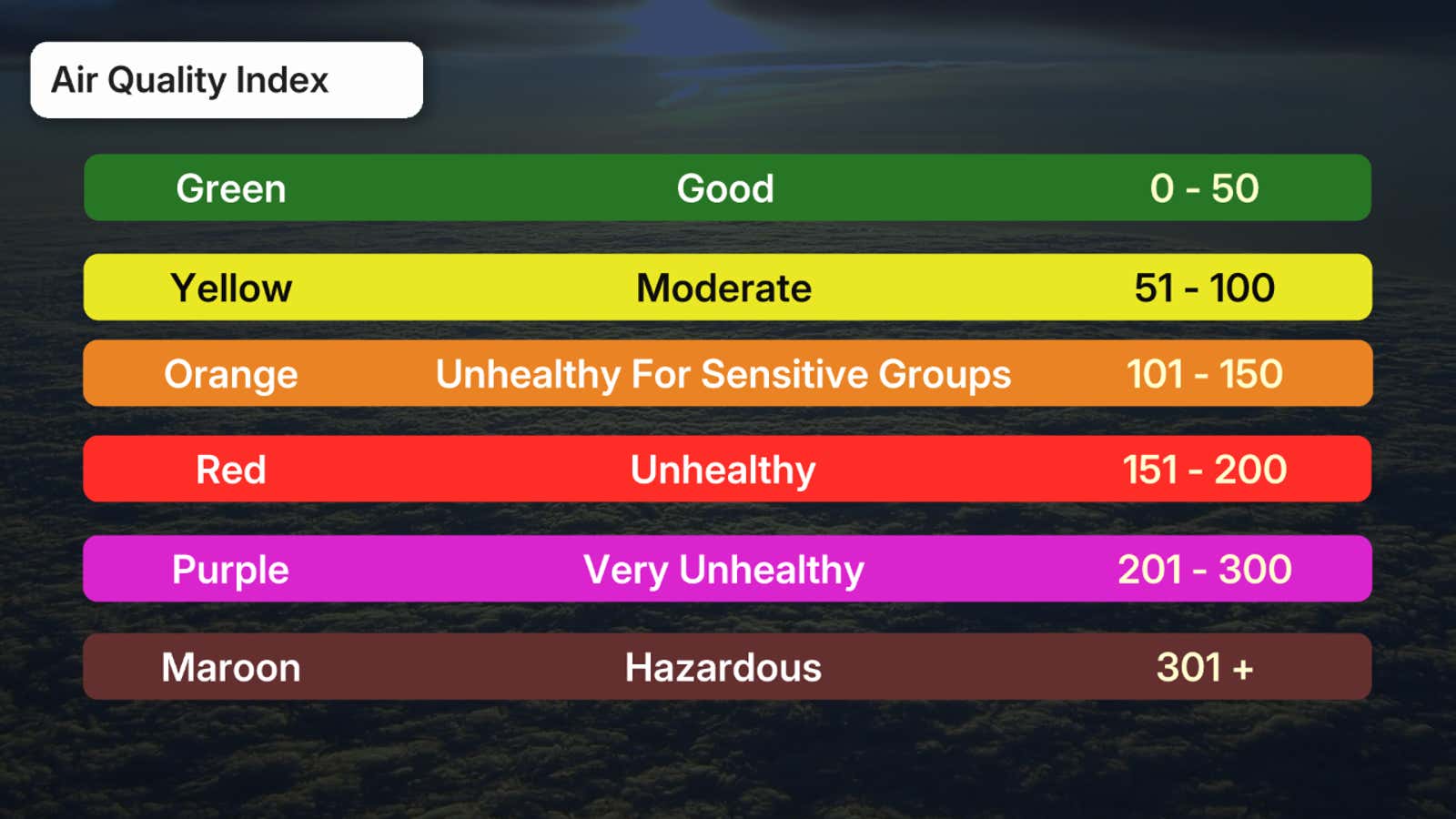
The index is color-coded from green (good) to maroon (hazardous).
If your air quality forecast is….
At least code orange: More sensitive groups such as those with respiratory or heart conditions, the elderly, children and those pregnant should avoid staying outside more than necessary. Code red, purple or maroon: Everyone should limit their time outdoors. Consider exercising indoors and if you need to walk your pet outside, do so as briefly as possible.
(MORE: How air pollution affects you)
 Why the smoke?
Plumes of smoke generated by larger wildfires are steered by winds from the ground to the top of the smoke plume.
On Monday, triple-digit heat, winds and low humidity triggered a major flare-up of wildfires that had been burning since May in northeast Minnesota, prompting a temporary closure of the Boundary Waters Canoe Area and a peacetime emergency declaration from Gov. Tim Walz.
The map below shows locations of 800 active Canadian wildfires, most numerous from the Northwest Territories to northern Saskatchewan, northern Manitoba, western Ontario, northern Quebec and Labrador.
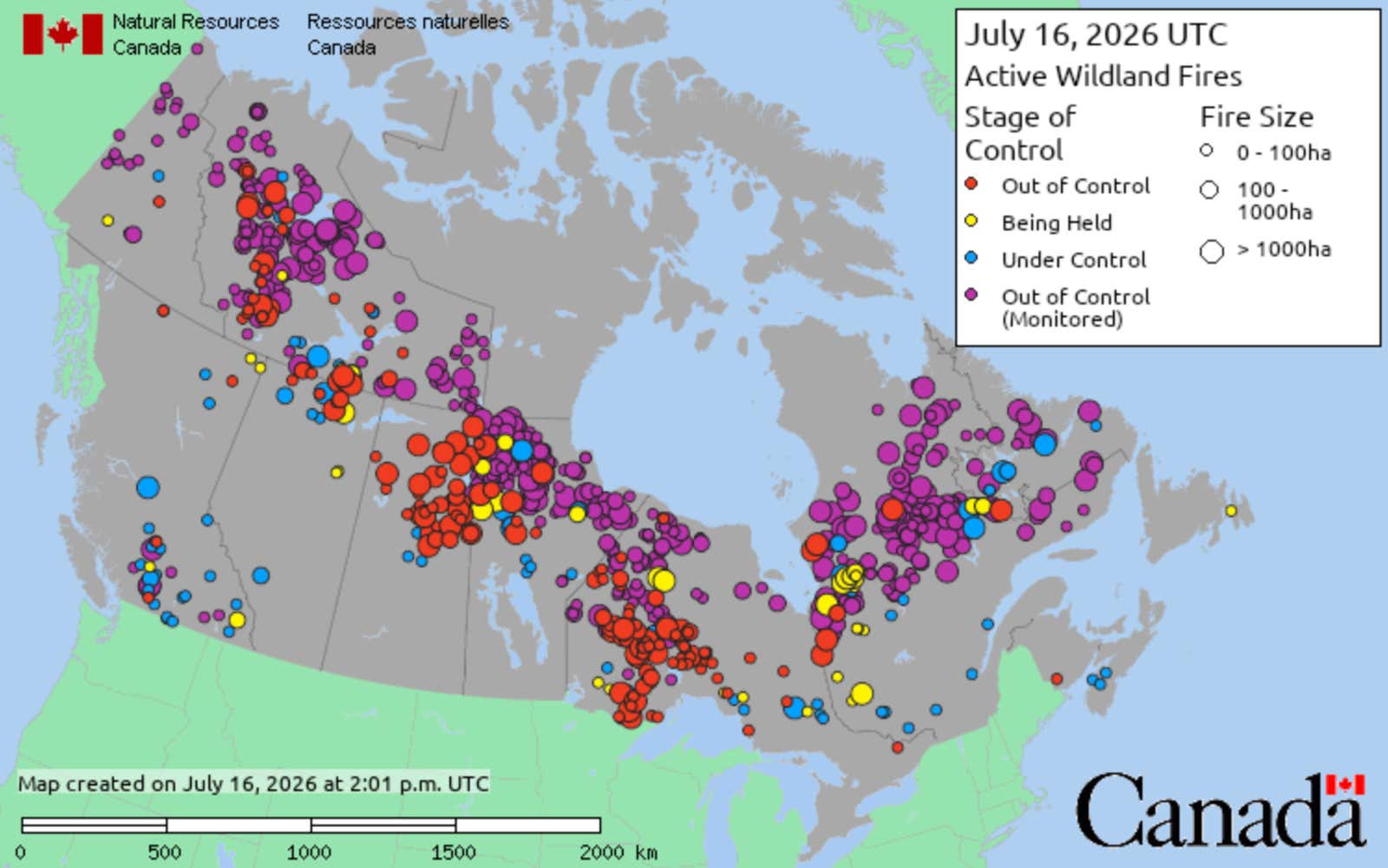
This map shows the locations of active wildfires in Canada on July 16, 2026.
(Canada Wildland Fire Information System)
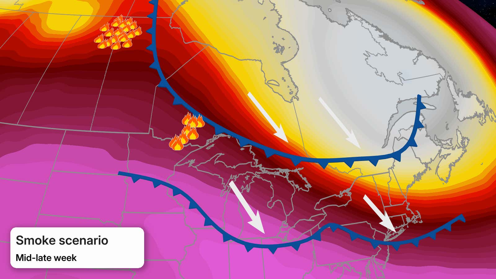
In this case, the heat dome responsible for the recent record heat in the northern U.S. will get squashed into the Carolinas, setting up a northwesterly wind flow in the upper levels of the atmosphere.
That will allow a pair of cold fronts to sag into the Midwest and Northeast.
Northwest winds behind those fronts will tap smoke from those wildfires not just in western Ontario and northeast Minnesota, but also potentially some lofted smoke from additional fires in northern Canada.
So, while these weaker cold fronts bring relief from heat and humidity, they may also usher in some wildfire smoke, both aloft and at the ground. This is a scenario that has occurred several past summers this decade and is a pattern we were concerned about this summer during a developing, strengthening El Niño.
(MORE: This $65 DIY air filter builds in just 15 minutes)
Jonathan Erdman is a senior meteorologist at weather.com and has been covering national and international weather since 1996. Extreme and bizarre weather are his favorite topics. Reach out to him on Bluesky, X (formerly Twitter) and Facebook.