
What to know:
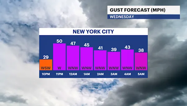
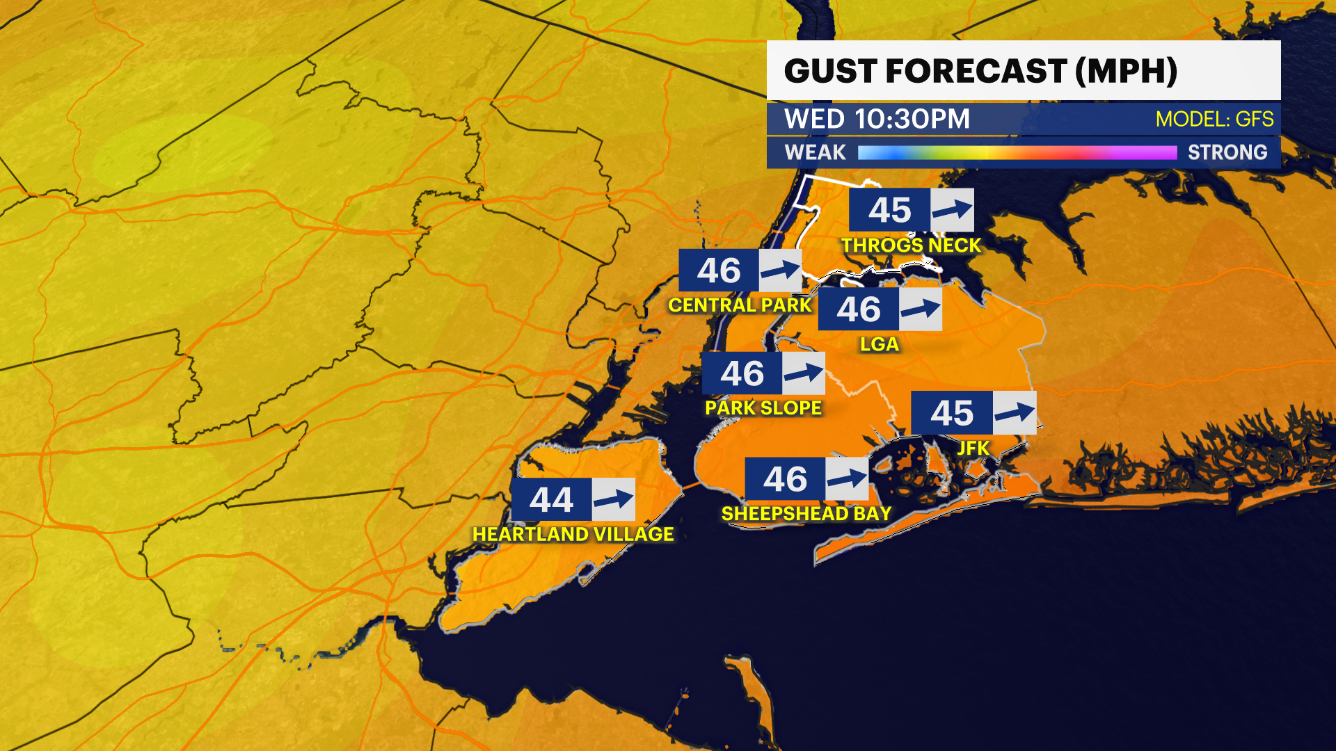
Wind ramps up! Gusts could be powerful and damaging, ranging from 40-60 mph.
A wind advisory has been issued overnight through early Thursday morning
These gusts could be strong enough to impact tree limbs and power lines
Charge up devices and power banks in case the power goes out overnight
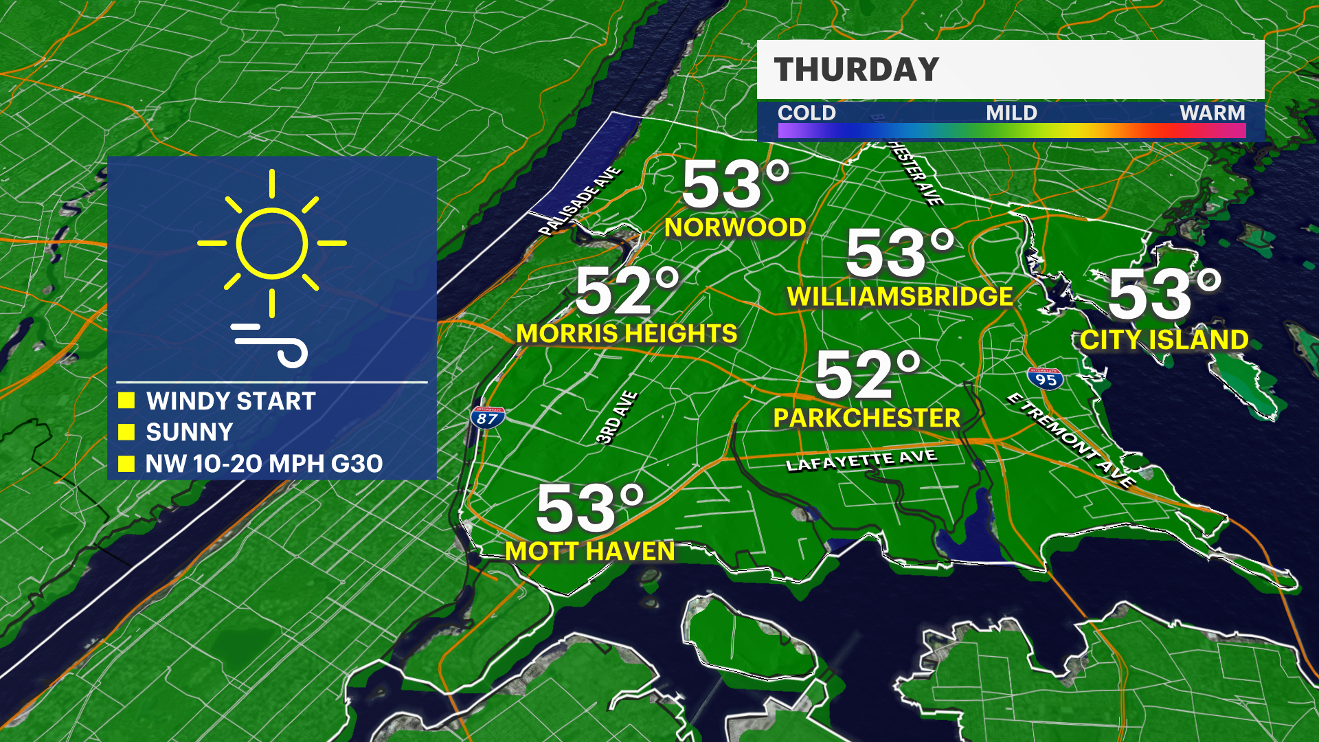
Wind will improve quickly throughout Thursday
A cold front moves through bringing a round of rain potentially between 9 p.m. – 1 a.m., light rain and brief
Dry for Thursday. Sunshine and much cooler temps, in the lower 50s.
A surge of “warmth” for the weekend before a drastic cool down next week
OVERNIGHT: Wind alert! Strong to damaging gusts possible along with a brief round of raindrops. Lows in the 40s.
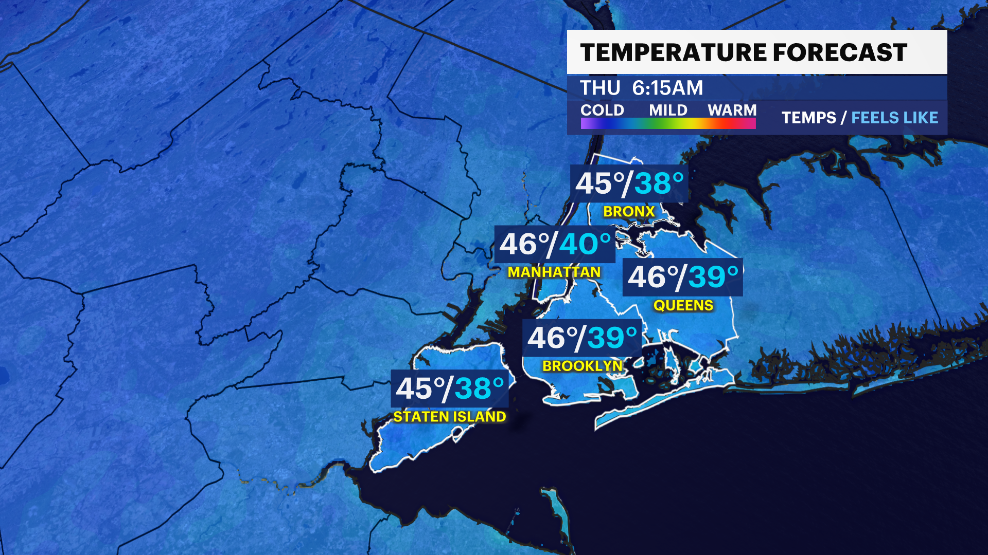
THURSDAY: Strong wind to start, improves by the afternoon. Highs in the low 50s, lows in the low 40s.
FRIDAY: Sun, clouds, and dry. Highs in the upper 50s, lows in the lower 50s.
SATURDAY: Overnight and early rain possible. Dries out by the afternoon. Highs in the low 60s, lows in the mid-40s.
SUNDAY: Sun and clouds with pm and late-night rain. Highs in the low 60s, lows in the mid-40s.
NEXT WEEK: COLD START! Highs only in the 40s with lows slightly above freezing.
