
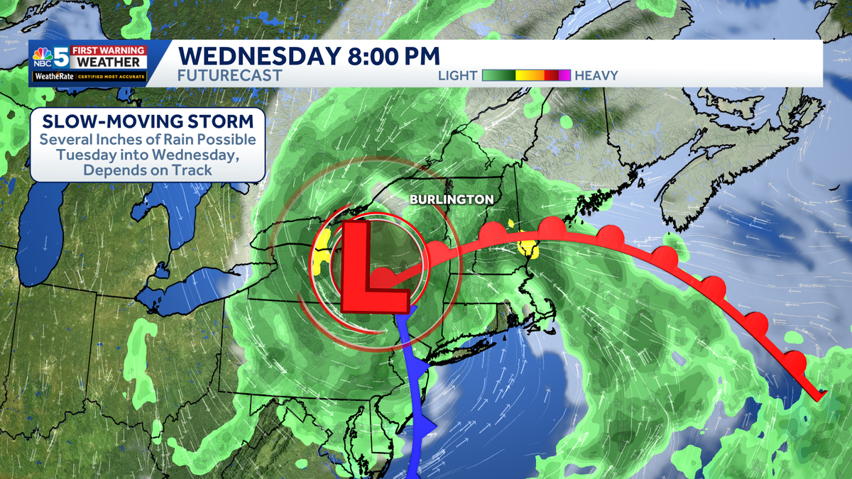
Slow-moving downpours bring localized flood risk to Vermont, New York this week
Not everyone gets hit, but several inches are possible under persistent areas of rain

An unsettled stretch of weather is ahead for northern New York and Vermont, with several opportunities for showers and thunderstorms through the end of the week.
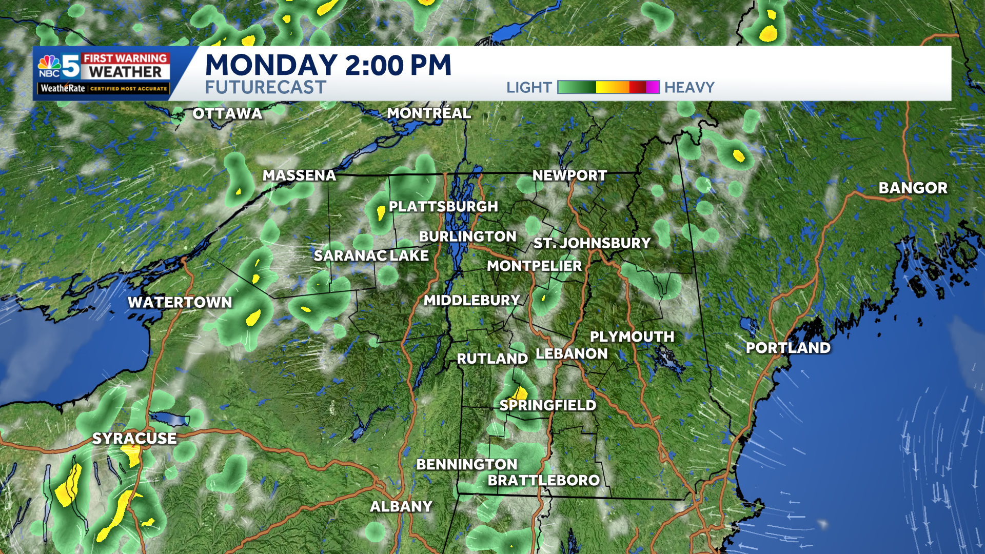
Scattered pop-up showers and downpours Monday afternoon.
Scattered storms are possible Monday afternoon, especially across the Adirondacks, where slow-moving downpours could produce localized flooding.
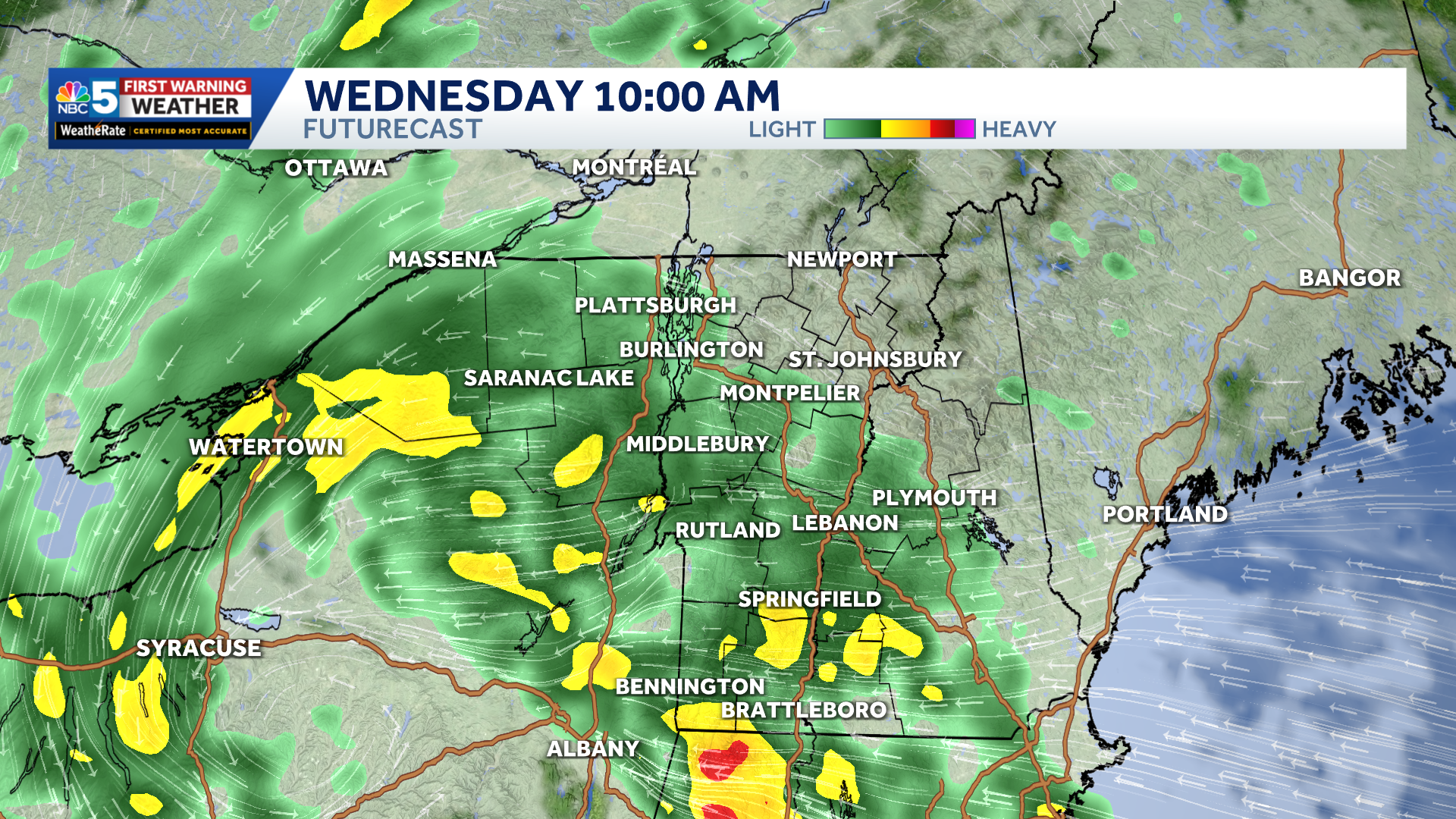
More widespread, heavier rain likely Tuesday night into Wednesday.
Rain will become more widespread Tuesday through Thursday as a sluggish storm system moves through the region.

Rain potential for Tuesday night and Wednesday only.
The heaviest rain is expected across northern New York on Tuesday and parts of southern Vermont on Wednesday, with repeated rounds of rain potentially leading to flash flooding and rising rivers.
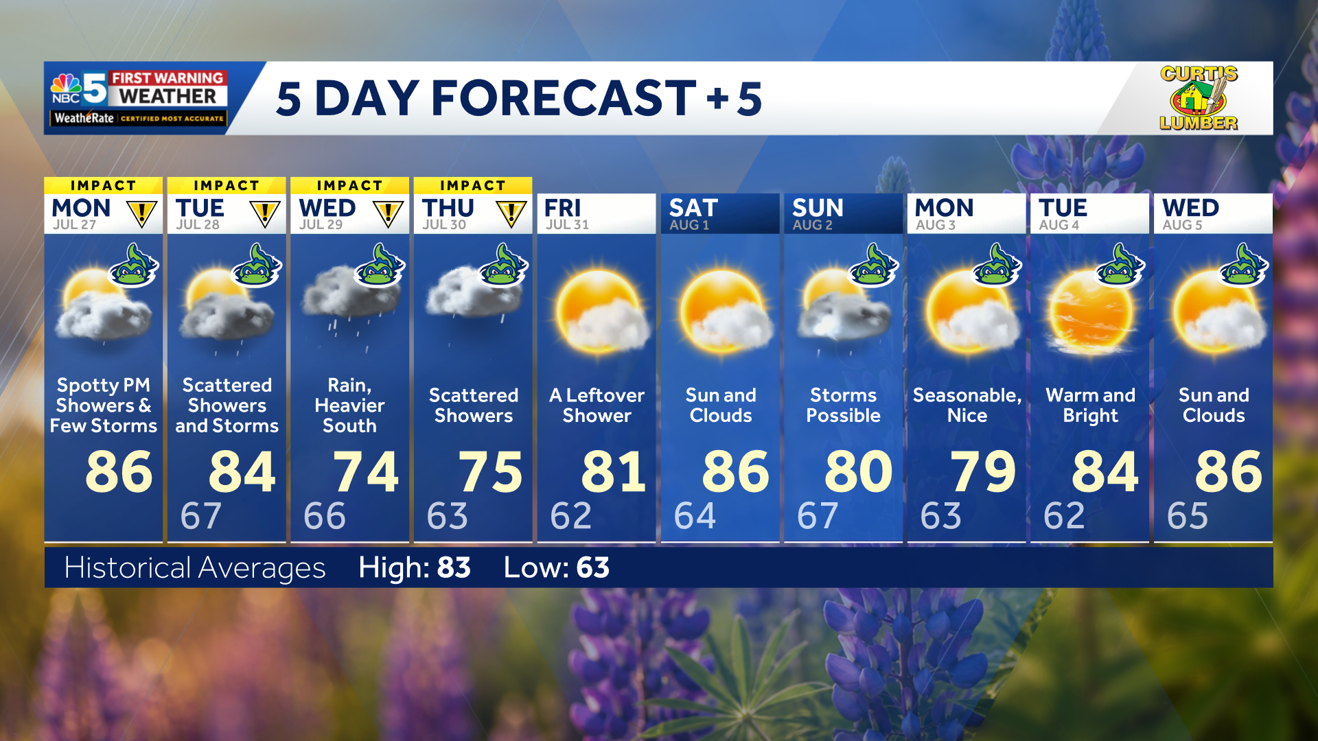
Our latest extended forecast.
Temperatures will remain in the upper 70s and 80s Monday and Tuesday before cooler air arrives Wednesday, holding highs mainly in the upper 60s and 70s. Lingering showers remain possible Thursday, and the unsettled pattern could continue into next weekend.