
Flooding possible in parts of Vermont, New York as torrential rain arrives late Tuesday night
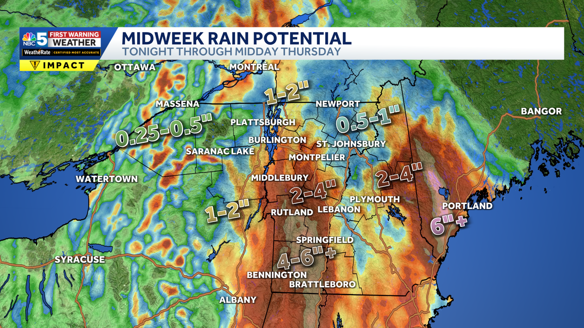
Over 4 inches of rain possible in parts of southern Vermont through Thursday morning


A slow-moving weather system will bring numerous showers and thunderstorms to the region Tuesday, followed by periods of rain continuing through Wednesday night.
The main concern will be localized heavy downpours, especially across northern New York and southern Vermont.
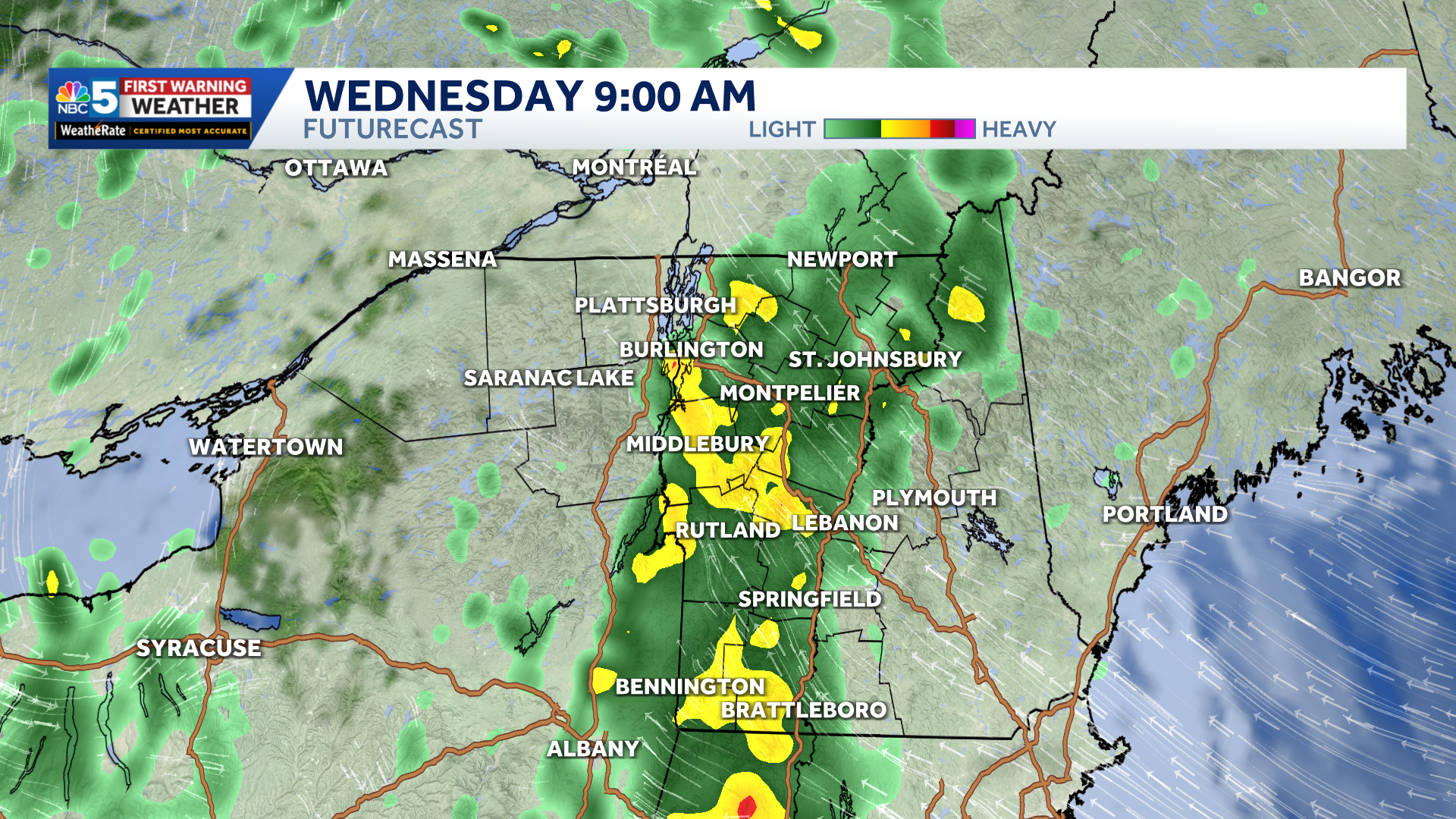
FutureCast at 9 AM Wednesday, with widespread downpours along the Green Mountain spine.
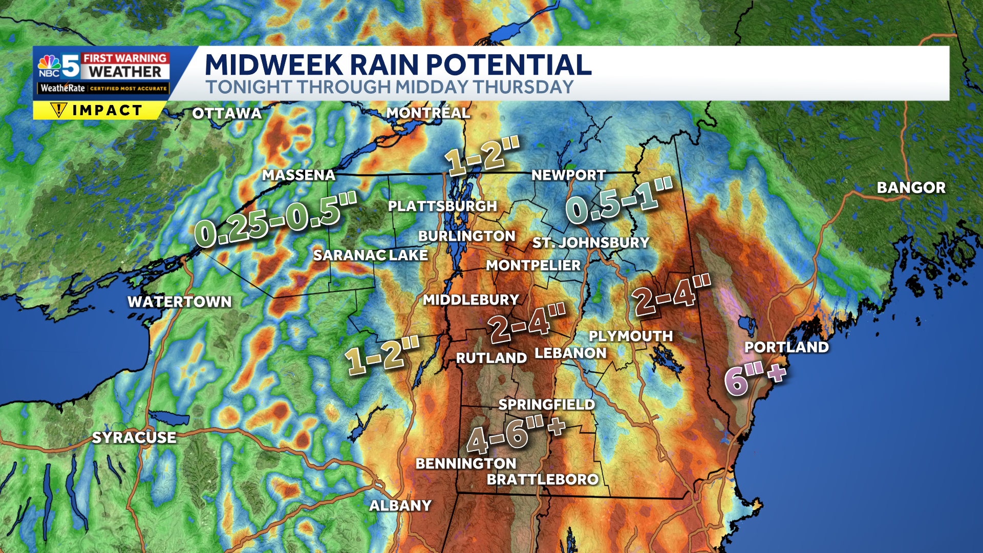
Rainfall forecast from Tuesday night through midday Thursday.
Heavy rain could lead to ponding on roads and in poor-drainage areas. The risk for more significant flooding is also relatively low because conditions have been dry recently, though isolated flash flooding cannot be ruled out, particularly Tuesday night into Wednesday.
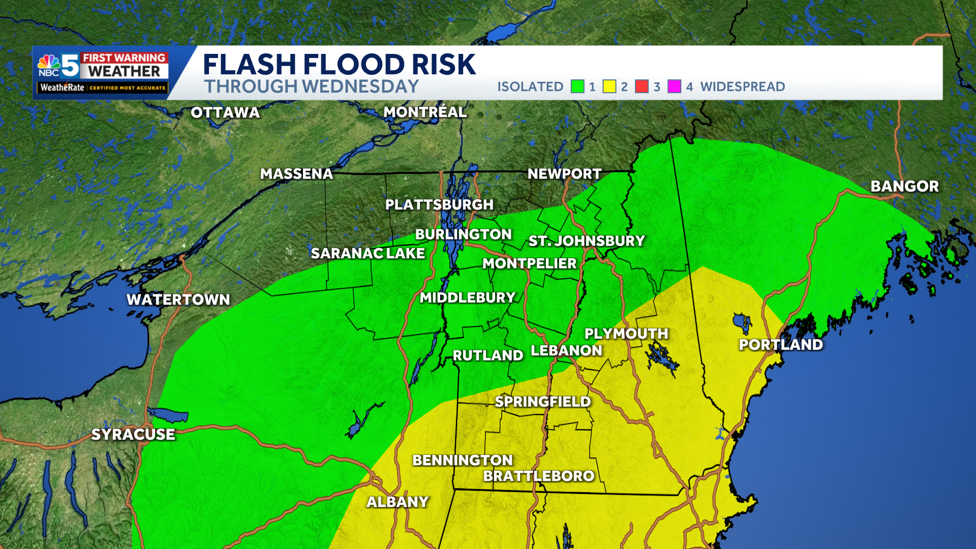
Flash flooding threat index Tuesday night through Wednesday. Yellow shading indicates a 15% chance for significant flash floods.
The greatest risk will be along the eastern slopes of the Adirondacks and the southern and central Green Mountains, where terrain could enhance rainfall.
Rain will continue at times Wednesday and Wednesday night, before winding down Thursday as the system weakens and moves away, though scattered showers may linger.
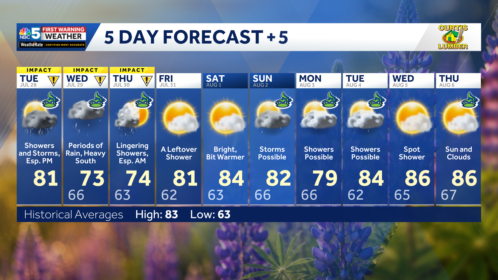
Our latest extended forecast.
Temperatures will generally remain above normal, with highs in the mid-70s to mid-80s and overnight lows in the upper 50s to upper 60s. Humidity will also stick around, but significant heat is not expected.