
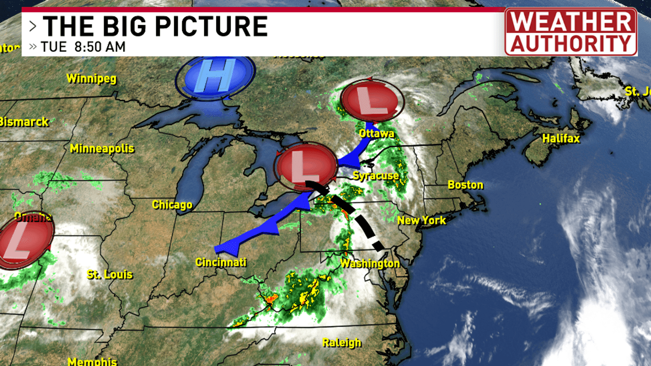
The National Weather Service has issued flood watches across the Catskills and southeastern portions of New York state to start at 11am Tuesday and run through Wednesday night.
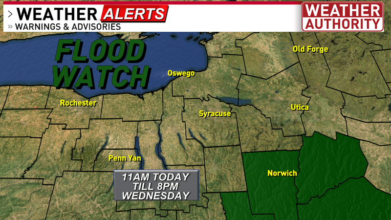
Flood Watch in effect today
A strong low-pressure system crossing the region will bring clusters of thunderstorms producing heavy rounds of heavy downpours through Wednesday night. Some of these storms may be able to drop 1-2+” of rainfall per hour. Training storms could result in flash flooding or ponding across poor drainage/low-lying areas.
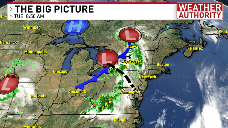
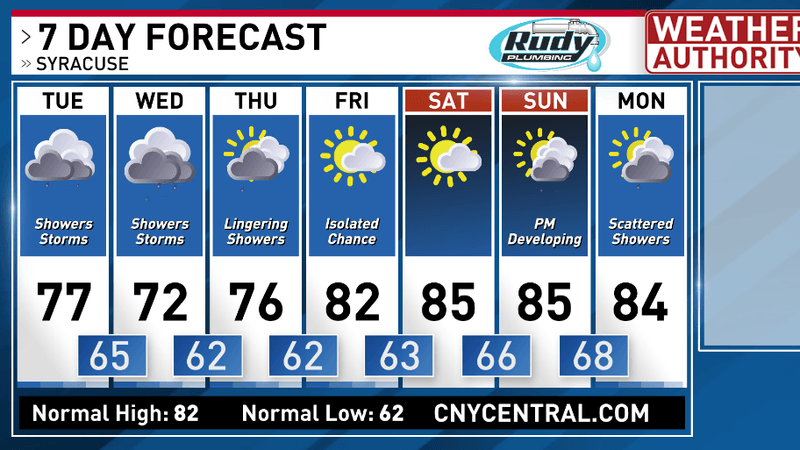
Predominantly cloudy skies combined with scattered storms will make for a rather gloomy Tuesday in central New York.
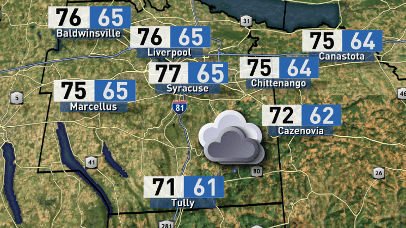
High and low temperatures
Here’s a quick check at our expected rainfall totals through Thursday night. The bullseye for the heaviest precipitation has shifted further eastward toward Albany and the Hudson River Valley.
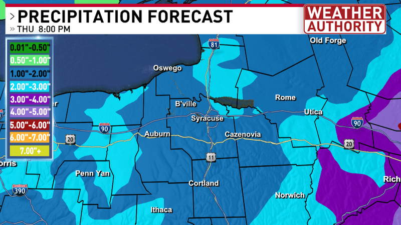
Precipitation forecast through Thursday night
This unsettled weather pattern breaks up a bit Thursday night into Friday morning as we’re looking to dry out just in time for the weekend! Although we’re watching another system developing Sunday that could bring more showers and storms to finish the weekend.
For the latest forecast and live local radar click HERE.