


NEW YORK CITY – The first real glimpse of winter is expected next week for parts of the New York City area.
Local perspective:
According to the FOX Forecast Center, an area of low pressure is expected to move out of Canada as the weekend approaches, ushering in the first taste of a La Niña winter for much of the U.S.
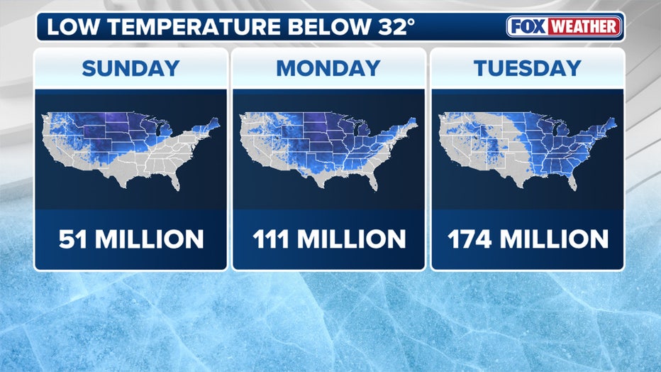
Amount of people below freezing Sunday through Tuesday. (FOX Weather)
Cold air from Canada will move south, settling in the Eastern half of the country Sunday and lasting through most of next week.
Big picture view:
As the cold air from the area of low pressure moves over the relatively warmer waters of the Great Lakes, lake-effect snow will once again return to the forecast, marking the first occurrence of the season for many areas.
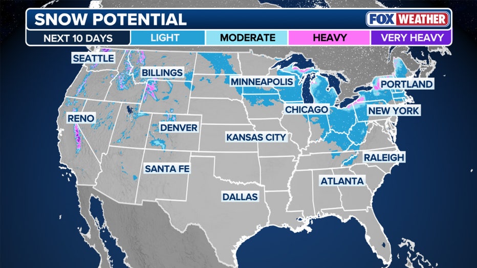
Potential snow forecast for next week. (FOX Weather)
What they’re saying:
“Next week, we’re going to be talking about some cold temperatures by the time we get to Tuesday and Wednesday, with your lows dropping down into the 30s,” FOX 5 NY’s Mike Woods said.
NYC weather forecast
Timeline:
Here are the temperatures to expect for next week, according to the National Weather Service:
Monday: A 40% chance of showers before 1 p.m. Partly sunny, with a high near 53. 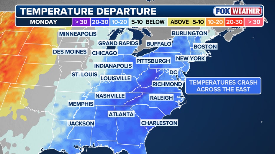
Temperature departure from average. (FOX Weather)
Monday night: Partly cloudy, with a low around 37.Tuesday: Mostly sunny, with a high near 45. Breezy.Tuesday night: Partly cloudy, with a low around 41.Wednesday: Partly sunny, with a high near 52.Wednesday night: Partly cloudy, with a low around 46.Thursday: Mostly sunny, with a high near 51. FOX Weather updates NYC weather radar
Click HERE for more information.