

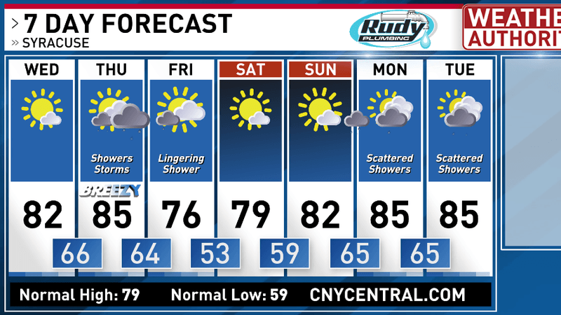
We’re looking ahead to a beautiful first day of The Great New York State Fair with plenty of sunshine today and high temperatures reaching into the low 80s!
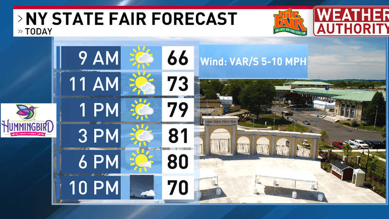
New York State Fair forecast
The beautiful weather holds true for the entire region of central New York as no one will see any chances for rain showers today.
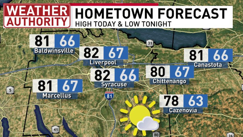
High and low temperatures
The low-pressure system developing across the northern Great Lakes will track eastward over the next 36 hours and bring the northeast our next chance of precipitation Thursday.
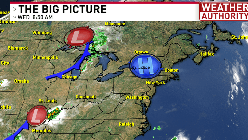
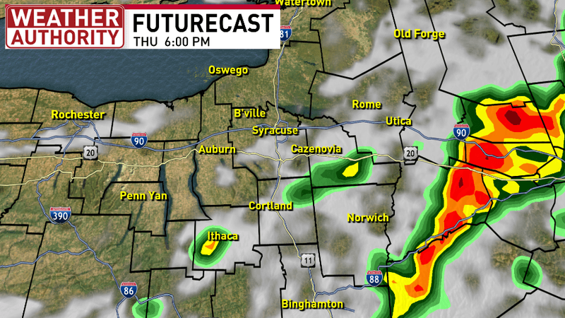
By early afternoon, showers and thunderstorms will likely be developing with the chance of a few strong to severe embedded thunderstorms possible.
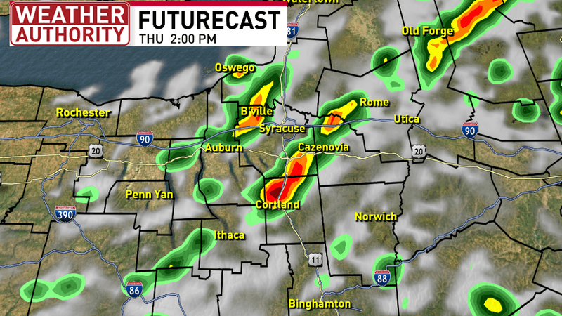
The further east these storms slide, the stronger they’ll get. Slight timing uncertainty exists with the exact departure of the thunderstorm threat so make sure to stay weather aware through the PM hours Thursday.
The Storm Prediction Center has draped a wide swath of CNY under the slight risk for severe storms which is a level 2 out of 5. The biggest threats are for damaging winds and large hail, but an isolated tornado also can’t be ruled out.
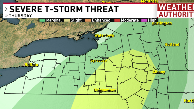
Storm prediction center threats for Thursday
The cold front producing these storms Thursday will also cool temperatures into the 70s Friday with a few isolated lingering showers possible Friday morning.
For the latest forecast and live local radar click HERE.