
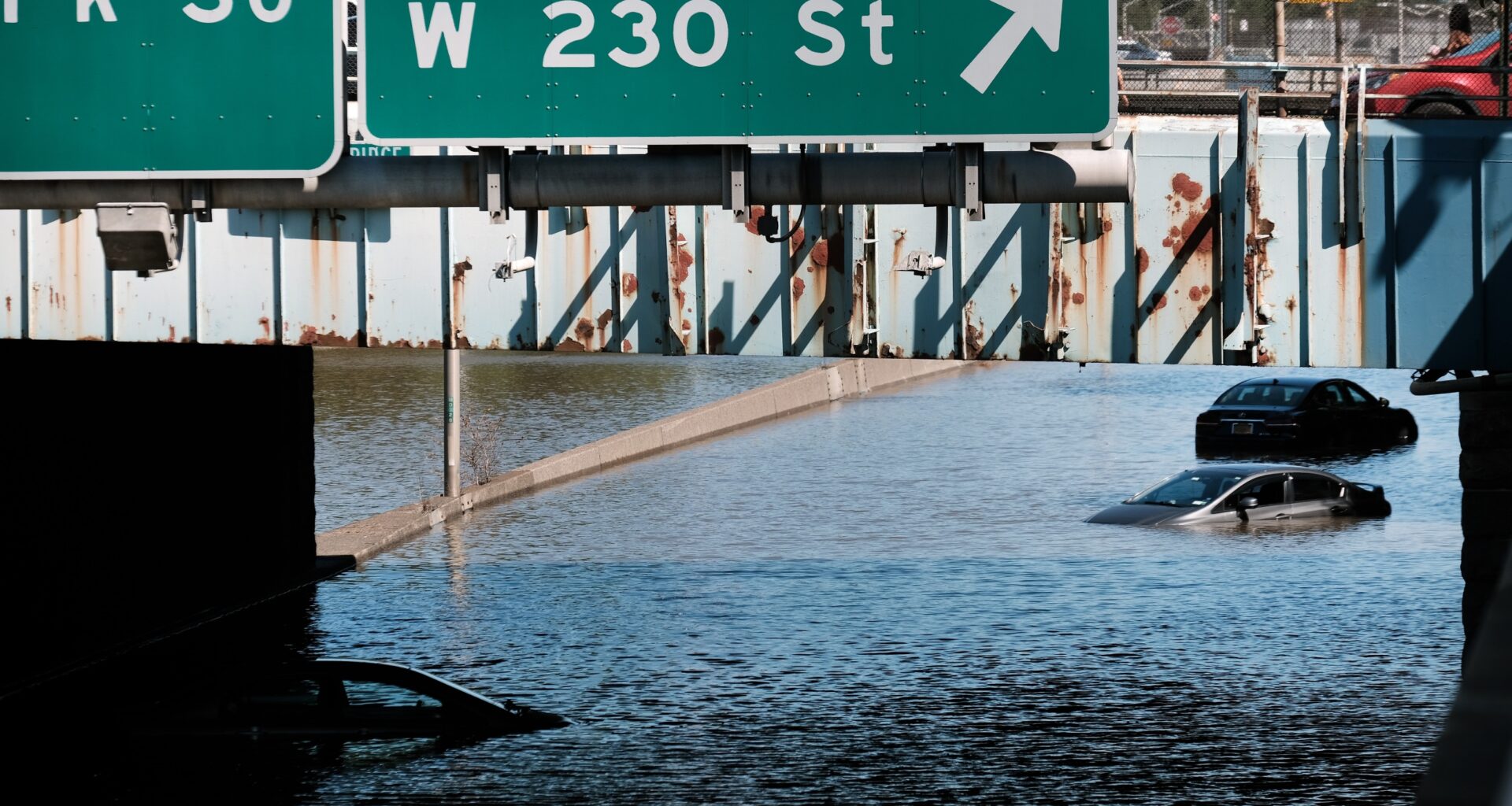
Cars sit abandoned on the flooded Major Deegan Expressway following a night of extremely heavy rain from the remnants of Hurricane Ida on September 02, 2021 in the Bronx borough of New York City.
Spencer Platt/Getty Images
A confirmed EF-1 tornado tore through Atlantic Beach, Nassau County on the evening of August 20, destroying 50 cabanas at the Sun and Surf Beach Club while 100 guests were inside — and it struck in the same three-minute window that flash flood warnings were cascading across all five New York City boroughs, the BQE and LIE were closing during peak commute hours, and LaGuardia Airport was temporarily shutting its gates. No serious injuries were reported from the tornado, but the storm left New York’s multi-layered transportation network in effective paralysis for hours, demonstrated that NYC’s stormwater system reliably floods whenever a Moderate Risk storm arrives, and confirmed that the region’s summer of extreme weather had found a new chapter.
What the National Weather Service Confirmed: An EF-1 Tornado at Atlantic Beach
The National Weather Service’s New York office issued its damage survey at 6:55 p.m. ET on August 21, the day after the storm. The EF-1 tornado — rated at peak winds of 97 mph (156 km/h) — touched down on the far western end of Atlantic Beach at 6:47 p.m. Thursday and dissipated just three minutes later, at 6:50 p.m., cutting a path approximately 0.36 miles (0.58 km) long and 100 yards (91 m) wide.
The NWS survey found that the tornado began as an eastward-moving waterspout that paralleled the far southeastern beachfront of the Rockaways before crossing the entrance to East Rockaway Inlet and coming ashore near the Sun and Surf Beach Club’s parking lot. Once onshore, it demolished a 30-yard length of sand fencing, shattered the rear and north-facing windows of nearly 30 cars, and then tore through the beach club itself — inflicting complete roof damage and partial wall damage on 25 to 30 bungalows and causing additional lighter damage up to 200 feet away from the primary path. The greatest winds, estimated at 85 to 97 mph (137 to 156 km/h), concentrated on the south and west sides of the easternmost three rows of bungalows.
It was the first confirmed tornado in Nassau County since 2021.
Nassau County Executive Bruce Blakeman declared a state of emergency, activating the county’s Emergency Operations Center. He surveyed the site the following morning. “Tornadoes form in an instant,” Blakeman said. “And in this case, it started off over the ocean, worked its way over the land here in Atlantic Beach.” Inwood Fire Chief Josiyah Green, whose department was among the first responders, noted that no one was trapped in the destroyed cabanas. “Best I can call it is luck,” Green said. “Just by the grace of luck that a lot of people weren’t hurt here because this beach club is a very popular place during the summer.”
The Sun and Surf Beach Club and Silver Point Beach Club were both temporarily closed following the event. The state of emergency was lifted Friday morning.
How the Storm Arrived — and Escalated
The August 20 storm was not produced by the same stalled-low mechanism that drove this summer’s earlier northeastern flood crises. It was a cold front — a moving system that generated flash flooding in central Ohio earlier the same morning before pushing into the New York metropolitan region by afternoon.
On August 19, NYC Emergency Management (NYCEM) had already issued a Weather Alert, triggering activation of the city’s Flash Flood Emergency Plan and raising the storm’s formal NWS risk designation to Slight Risk, Level 2 of 4. By August 20, with updated forecast data in hand, NYCEM upgraded to a Travel Advisory — and the National Weather Service Weather Prediction Center had escalated the city’s risk to Moderate Risk, Level 3 of 4, meaning the agency’s meteorologists had high confidence that numerous flash floods were possible, including potentially significant flooding in some locations.
A Flood Watch effective from 2 p.m. Thursday through 2 a.m. Friday covered all five NYC boroughs, Westchester, Rockland, Fairfield County in Connecticut, western Long Island, and New Jersey. Stronger thunderstorms were expected to produce rainfall rates of 1 to 2 inches hourly.
What the forecast correctly anticipated was the worst arriving during the evening commute. Flash flood warnings issued separately for Manhattan and Brooklyn and then for Queens, the Bronx, and Nassau County’s Hempstead cascaded through the early evening hours, with peak rainfall hitting around 2 inches per hour in the strongest cells. Central Park recorded 2.31 inches on the day, LaGuardia Airport measured 2.25 inches, and parts of the Bronx received approximately 2 inches, per NY1’s storm totals.
Why Does NYC Flood Whenever a Moderate Risk Storm Arrives?
NYC Emergency Management Commissioner Christina Farrell acknowledged the geographic uncertainty inherent in these events before the storm arrived: “Some neighborhoods may see limited impacts while others could experience intense rainfall and rapidly developing flooding.” But in neighborhoods like Hollis, Queens, the outcome was predictable — because it has been documented repeatedly.
The city’s stormwater drainage infrastructure was designed for a peak rainfall intensity of 1.75 inches per hour. The August 20 storm delivered approximately 2 inches per hour at its peak. This is not a rare failure — it is a design gap. A Moderate Risk storm (Level 3 of 4) now routinely generates rainfall rates that exceed what NYC’s sewer and drainage system was built to handle, and approximately 60 percent of New York City is served by a combined sewer system in which stormwater runoff and wastewater share the same pipes. When peak flow exceeds the system’s capacity, the overflow does not go to treatment — it routes back to streets and basements, where it carries contamination.
The result is structural. Flooding around 183rd Street in Hollis, Queens, was documented during the August 20 storm, repeating what FloodNet sensors had already recorded during a May 20, 2026 storm — nearly four feet deep in Hollis on that occasion. Community Board 12 member Amit Shivprasad, speaking to NY1 after the August 20 storm, was direct about what he believes the city needs: “We definitely want a buyout. We definitely have to look at long-term solutions, as well as short-term solutions. [New York City Emergency Management] has been a great partner with us here in Hollis, everything we need. Every phone call I make, we get the help we need. But, we need to find alternate ways, and ways we can stop this.” Hollis resident Amrita Bhagwandin echoed that call: “I’ve been advocating for a buyout of the neighborhood, which I think will save a lot of money coming to the streets for one, and just going down, literally, the drain.”
City Council Member Shaun Abreu documented flooding at the 137th Street 1 train station in Manhattan and called publicly for “further investment in climate-resilient mass transit.”
FloodNet, the city’s 400-sensor street-level flood monitoring network developed by NYU Tandon, CUNY, and NYC government, provides NYCEM with real-time flood data during events — allowing emergency managers to identify where flooding is occurring faster than was possible with 911 calls and social media monitoring alone. The NWS New York office also uses FloodNet data in flood warning decisions. The sensors cannot change the pipes beneath the street, but they give officials and residents a real-time picture of where the city’s design gap is expressing itself.
Roads Closed, Airports Grounded, Subways Flooded
The transportation impacts were among the most severe of the summer. The Brooklyn-Queens Expressway closed in both directions at Queens Boulevard shortly after 7 p.m., and the Long Island Expressway shut in both directions at Francis Lewis Boulevard shortly before 7:30 p.m. — two of the city’s primary highway arteries closed simultaneously during the height of the evening commute. Flooding-related delays struck the Grand Central Parkway at 82nd Street and the Jackie Robinson Parkway, with officials directing drivers to alternate routes. FDNY personnel were documented wading ankle-deep in water on the LIE as crews responded to the fast-developing emergency.
LaGuardia Airport temporarily shut down for several hours during the storm, closing its runways before reopening at 6 a.m. Friday, August 21 — with more than 210 cancellations recorded and some delays continuing into the morning. John F. Kennedy International Airport remained open but recorded 167 cancellations of its own. The Federal Aviation Administration issued ground delays for all three New York-area airports — JFK, LaGuardia, and Newark Liberty — simultaneously.
MTA service was disrupted across the subway system. The A, C, and E lines faced service disruptions that extended into early Friday morning. The No. 1, 2, and 3 lines were severely disrupted in both directions. Approximately 2,000 Long Island customers were without power early Friday morning, and a fallen tree was reported on Jefferson Avenue in Bushwick, Brooklyn, with no immediate reports of injuries.
A Dual Warning — and What to Do When Both Apply at Once
Thursday evening’s storm produced an unusual and important safety situation: a tornado warning and flash flood warnings were simultaneously in effect for overlapping areas, with Queens receiving both. Mayor Zohran Kwame Mamdani issued a public safety message that addressed the specific conflict directly: “The safest place to be is inside a sturdy building, away from windows, in a small interior room on the lowest floor. But do not shelter in an actively flooding basement or flood-prone room.”
This is the correct answer to the dual-warning dilemma — and it is worth understanding why. For a tornado warning, the standard guidance is to move to the lowest floor, an interior room, away from windows. For a flash flood warning, the standard guidance is to not shelter in a basement or below-grade space that could fill with water. When both warnings apply to the same location — as they did in Queens on August 20 — the resolution is the one Mamdani stated: a ground-floor interior room of a sturdy building satisfies the tornado requirement (lowest possible floor) while also satisfying the flood requirement (not a below-grade basement). The instruction is not contradictory — but it requires knowing both rules to resolve correctly. The NWS tornado safety guidance addresses this: the goal is the lowest interior floor away from windows, but not a space actively filling with water.
NYCEM’s Storm Response: The agency activated its Flash Flood Emergency Plan the day before the storm, coordinating pre-positioning of resources, targeted inspection and clearing of catch basins in flood-prone areas, and round-the-clock Watch Command monitoring of developing conditions.
Weekend Storms Return; Long-Term Pattern Persists
The August 20 storm cleared after roughly 10 p.m. Thursday, and Friday brought a welcome respite — mostly cloudy skies, temperatures in the mid-70s to around 80°F (26°C), and dry conditions. The NWS noted that no additional hazardous weather meeting warning criteria was expected through the following Wednesday.
However, the storm threat returned over the weekend, with additional storm chances forecast for Saturday and Sunday. Residents in the hardest-hit areas — particularly Hollis, Queens, and Nassau County’s south shore communities — were advised to monitor conditions closely.
New Yorkers who want to receive emergency alerts during future events can subscribe to Notify NYC by texting NOTIFYNYC to 692-692 and choose to receive special basement apartment flood alerts. Comprehensive preparedness guidance, including steps for residents of below-grade apartments who face the highest flood risk, is available at nyc.gov/beready.
The FloodNet public dashboard — maintained by the NYU/CUNY/NYC partnership — shows real-time and historical flood depth data from all active sensors, allowing residents to check conditions at specific locations during and after storms. Visit the FloodNet public flood dashboard — it is updated continuously during storms and provides both current and historical flood data by location.
Frequently Asked QuestionsDid a tornado actually touch down in New York City during the August 20 storm?
A confirmed EF-1 tornado touched down at Atlantic Beach in Nassau County — adjacent to Queens along Long Island’s South Shore — not within the five boroughs themselves. The National Weather Service confirmed the tornado through a ground-and-drone damage survey, radar data, eyewitness reports, and social media video. It was the first confirmed tornado in Nassau County since 2021. A separate tornado warning was issued for parts of Queens during the same storm, but the NWS had not confirmed a tornado touchdown within the borough as of the completion of its Atlantic Beach damage survey.
Why did NYC flood so severely during what was described as a Moderate Risk — not the highest-risk — storm?
NYC’s stormwater drainage infrastructure was designed for a peak rainfall intensity of approximately 1.75 inches per hour. The August 20 storm delivered roughly 2 inches per hour at its strongest cells. That gap — less than half an inch per hour above design capacity — is enough to overwhelm combined sewer systems serving approximately 60 percent of the city, sending water back onto streets rather than to treatment. A Moderate Risk designation (Level 3 of 4) now reliably exceeds what the system can handle in vulnerable neighborhoods, which is why Hollis, Queens and other low-lying areas flood repeatedly under storms that are not even classified as the most extreme. Closing that gap requires capital infrastructure investment — not just better forecasting or warning systems. The NYC Comptroller’s April 2024 investigation identified key preparedness and infrastructure gaps that persist into 2026.
If there is both a tornado warning and a flash flood warning for my area at the same time, where do I shelter?
Move to a ground-floor interior room of a sturdy building — away from windows. This satisfies both requirements simultaneously: for the tornado warning, you want the lowest possible floor with interior walls around you; for the flash flood warning, you want to avoid a basement or below-grade space that could fill with water. Do not shelter in an actively flooding basement under any circumstances. A first-floor bathroom, hallway, or interior closet in a permanent structure is the right answer when both warnings apply. Move there before conditions worsen and stay until both warnings expire. The NWS tornado safety page outlines the standard guidance in detail.
How can I get real-time alerts for future storms in New York City?
Text NOTIFYNYC to 692-692 to subscribe to Notify NYC, the city’s official emergency alert system. Residents of basement apartments can opt in to a special basement-alert tier, which delivers warnings specifically relevant to below-grade flooding risk. For real-time flood depth data from 400+ FloodNet sensors across the five boroughs, visit the FloodNet real-time sensor dashboard — it is updated continuously during storms and provides both current and historical flood data by location. Visit NYC emergency preparedness information for full preparedness guidance.