
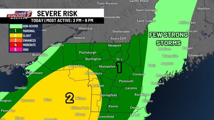
Our severe storm risk has been expanded and upgraded since yesterday’s forecast discussion. Here’s a fresh look at the overall timing and local impacts.

Afternoon: It will be most active between 2 PM and 9 PM today. The strong to severe storm action will pick up by the mid-afternoon. Any one storm will present with damaging wind gusts, heavy rain, and hail. There’s even the chance for a brief, localized tornado.

Evening: Our storm threat will start to diminish by sunset and thereafter. Lingering, late night downpours will continue across parts of southern Vermont. Essex County, New York and southern Vermont are at greatest risk for localized flash flooding. Outside of the flash flood threat, there’s also a chance for isolated power outages.

Overnight: Our cold front will continue to slowly scoot east Friday morning with mostly cloudy skies, damp conditions, and patchy dense fog. Sprinkles and showers will gradually come to an end for the most part by sunrise. Unfortunately, views of the partial lunar eclipse will be mostly blocked by our leftover clouds.

Copyright 2026 Nexstar Media, Inc. All rights reserved. This material may not be published, broadcast, rewritten, or redistributed.For the latest news, weather, sports, and streaming video, head to ABC22 & FOX44.