A severe storm threat will impact the Northeast on Tuesday, peaking on Wednesday. This severe storm threat could bring hail, wind and even a tornado threat to cities like New York City and Philadelphia.
Severe storms move in Tuesday
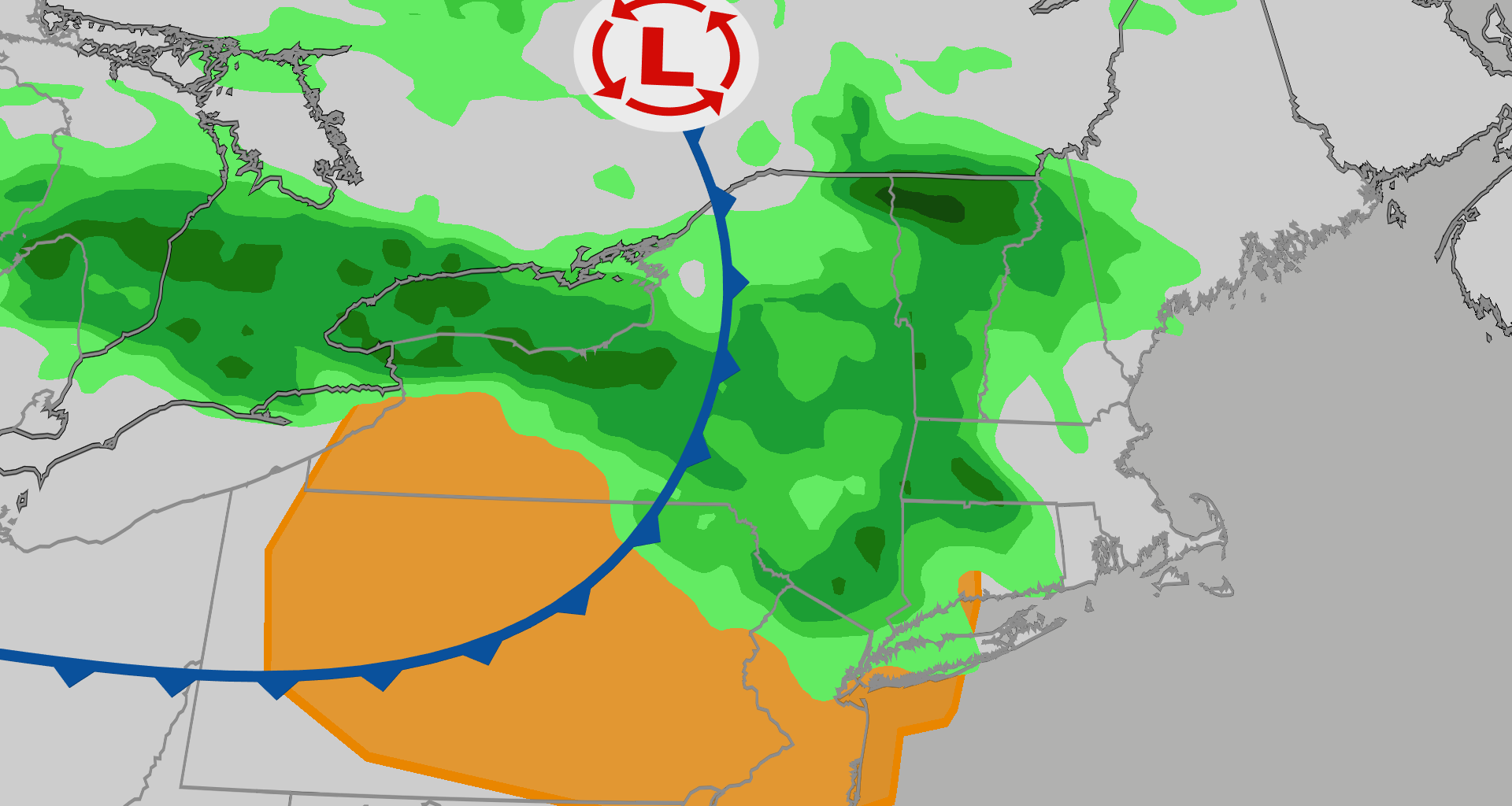
A low pressure system and its cold fronts will move through the Great Lakes on Monday and begin to bring rain and storms to the Northeast on Tuesday. While these storms are not expected to cause a lot of damage, their timing could be disruptive. With these storms potentially expected to start in the afternoon, we could see some problems around rush hour.
New York City and Philadelphia should expect longer travel times Tuesday afternoon and evening. The map below shows the current rainfall forecast around rush hour on Tuesday.

Weather in your inbox
By signing up you agree to the Terms & Privacy Policy. Unsubscribe at any time.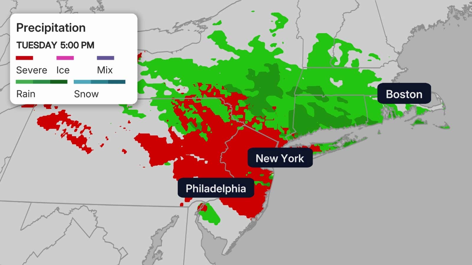 Wednesday peak?
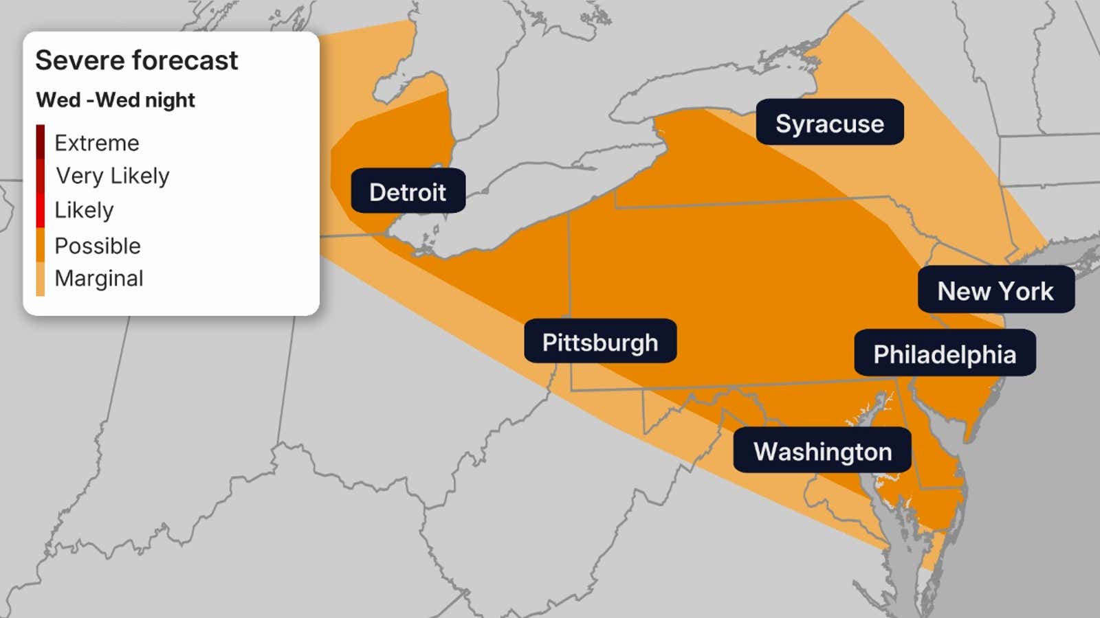
The Storm Prediction Center has highlighted a possible area of severe weather for Wednesday. Storms on Wednesday are again expected to flare up by the afternoon and continue through the night for cities like New York City, Washington, D.C., and Philadelphia.
The main threats will likely be heavy rain, damaging winds and hail.
 Later this week?
The Storm Prediction Center has also highlighted an area of severe weather for Thursday and Friday, so the threat will continue at least into then, though shifted slightly south. Whenever they issue severe threats this far out, there is a good chance that at least some severe storms, including hail, wind and maybe even a tornado, are possible.
Get More of Our News on Google
Set The Weather Company as a ‘Preferred Source’ to get quicker access to the news you value.

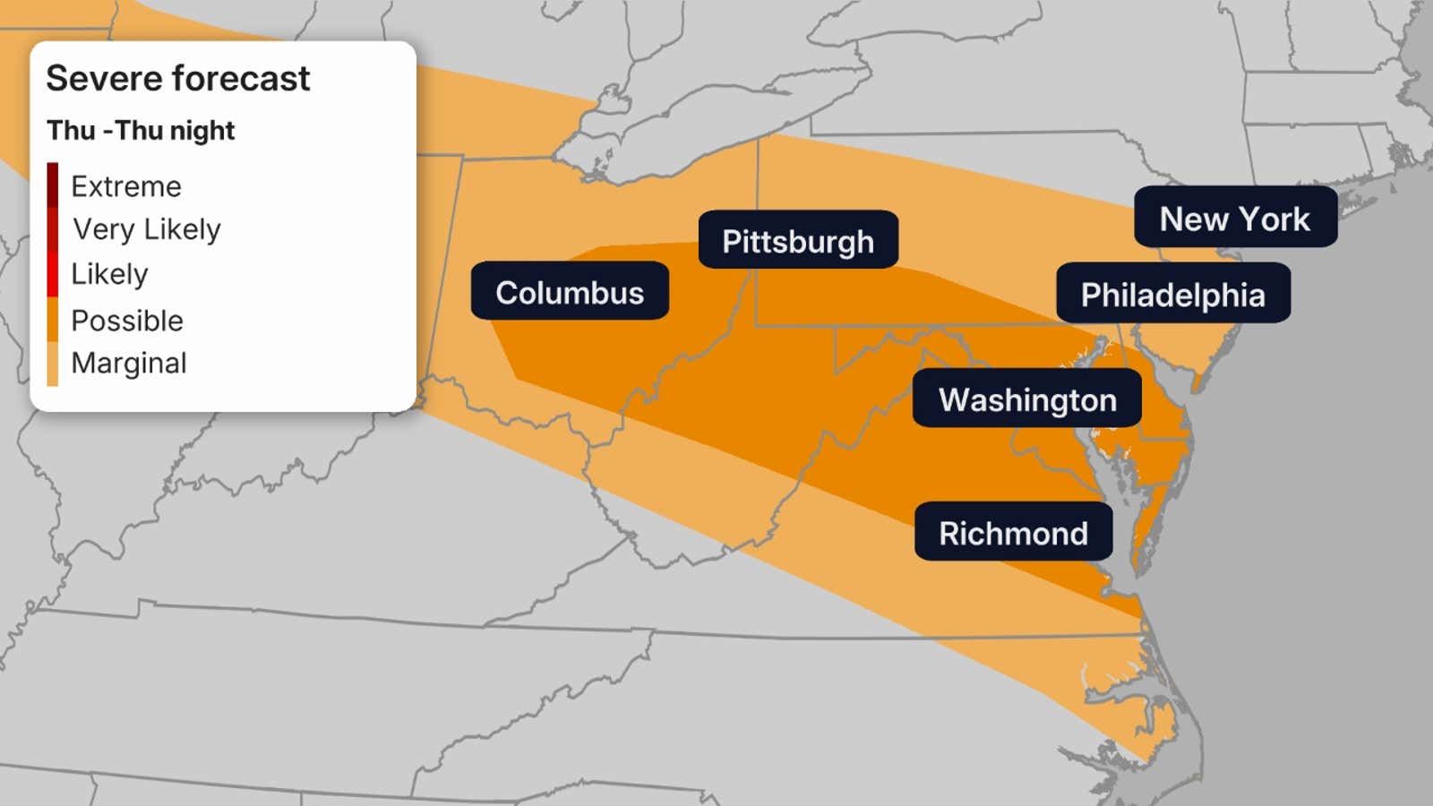
These storms are again situated around rush hour, so take precautions on the trip home.
This time, the threat will be focused more on Washington D.C. and Richmond, Virginia as well as Pittsburgh and Columbus, Ohio.
Flood threat?
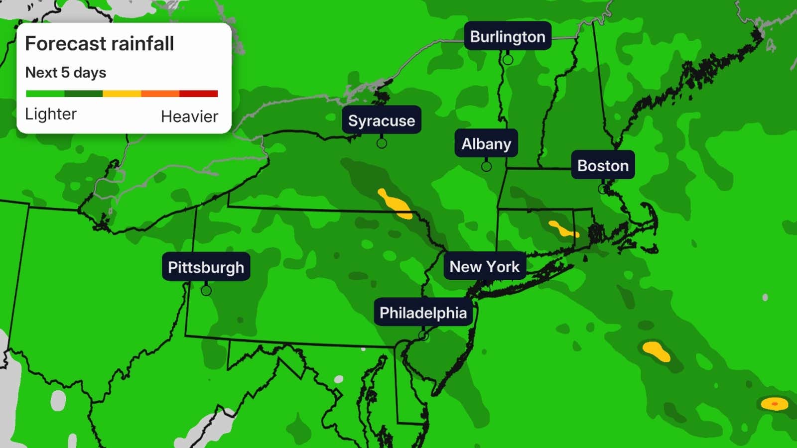
Days of rain and storms also bring the threat of flooding. While there are no flood watches in effect at this time, multiple days of heavy rainfall are possible. Rainfall totals of 1-3 inches are possible for multiple days, so the threat of isolated and urban flooding is not out of the question. These totals could be increased in the coming days as the forecast lines up.