
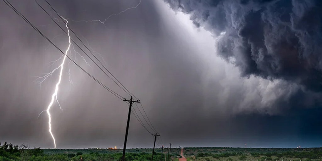
Another round of severe storms is expected Wednesday from New York to the central Plains. The storms could bring powerful wind gusts, heavy rain and flooding. A Level 2 out of 5 severe weather risk has been issued across parts of Ohio, Pennsylvania and New York.
THE TAKEAWAY
A cold front will bring rain and thunderstorms to the Mid-Atlantic, central Appalachians and Ohio Valley on Thursday.Flooding will be the main threat, especially in parts of Ohio, Pennsylvania and West Virginia.The front will move into the Southeast on Friday, bringing more showers and downpours.
A cold front will move south Thursday, bringing rain and thunderstorms to the Mid-Atlantic, central Appalachians and Ohio Valley. Storms will shift slightly south as a cold front ushers in wet weather.
Most storms will not be severe, but a few could produce wind gusts of 50 to 60 mph, especially in northern Arkansas and southern Missouri.
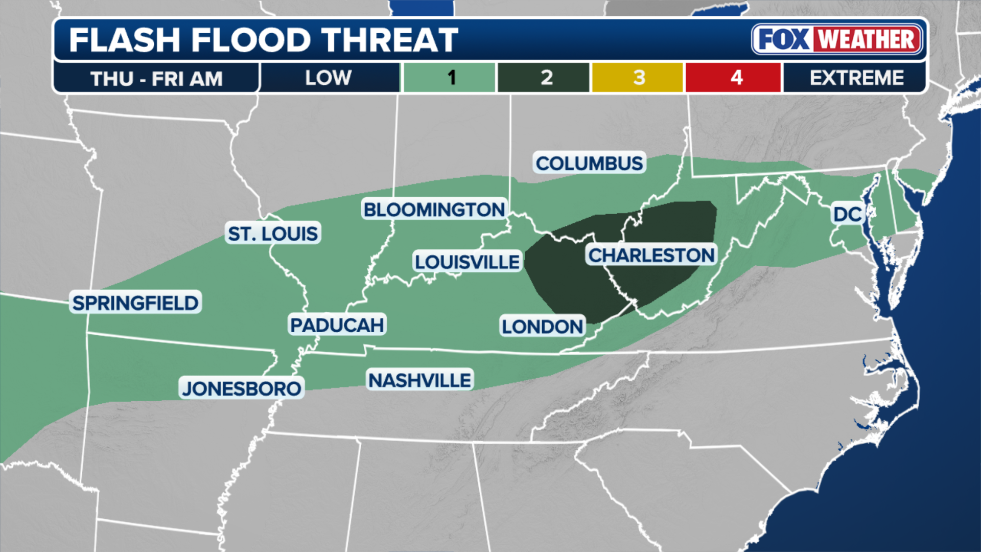 Flash flood threat for Thursday.
(FOX Weather)
Flooding will be the biggest threat as tropical moisture moves north from the Gulf of Mexico. Heavy rain could quickly cause flooding in mountain valleys, along rivers and in urban areas.
SEVERAL DAYS OF HEAVY RAIN AND THUNDERSTORMS TO PERSIST ACROSS THE GULF COAST
A Level 2 out of 4 flood risk is in place for parts of Ohio, Pennsylvania and West Virginia through Thursday afternoon.
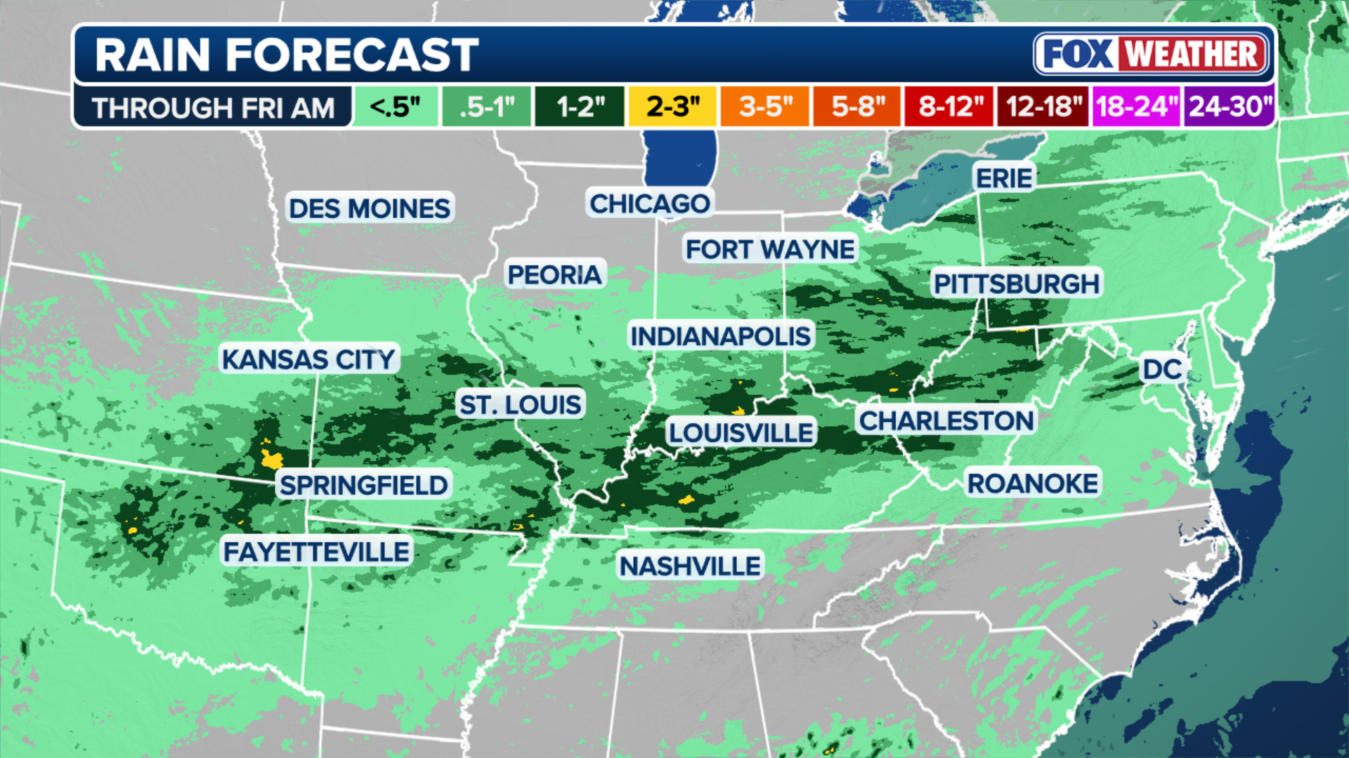 Rain expected through Friday.
(FOX Weather)
By Friday, the front will reach the Southeast, bringing more showers and downpours, the FOX Forecast Center said.
Cities across the region should also be aware of the potential for flooding as deep tropical moisture is pulled north from the Gulf.
KNOW YOUR FLOOD TERMINOLOGY: WHAT FLOOD WATCHES, WARNINGS AND EMERGENCIES REALLY MEAN
On Wednesday, severe storms developed across a 1,000-mile corridor from the Central Plains through the Great Lakes to western New York on Wednesday.
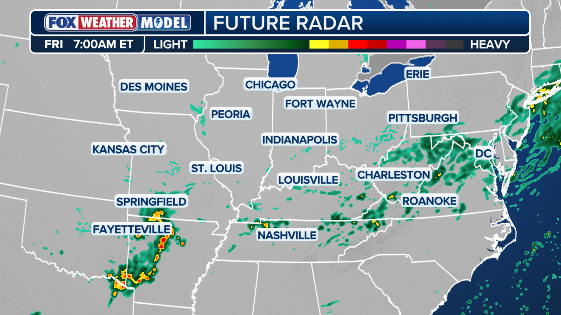 Future radar for Thursday.
(FOX Weather)
The massive, slow-moving cold front driving these storms could also bring heavy rain and trigger flash flooding across parts of the Midwest and Ohio Valley, which have been slammed by repeated rounds of flooding over the last month.
Intense severe weather developed Wednesday afternoon along the length of the cold front, with the strongest storms forming over the eastern Great Lakes.
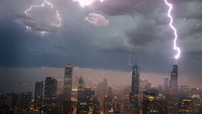
Lightning strikes the Willis Tower (formerly Sears Tower) in downtown on June 12, 2013 in Chicago, Illinois. A massive storm system with heavy rain, high winds, hail and possible tornadoes is expected to move into Illinois and much of the central part of the Midwest today. (Photo by Scott Olson/Getty Images)
(Scott Olson / Getty Images)
A Level 2 out of 5 risk of severe thunderstorms was issued across parts of northeastern Ohio, northwestern Pennsylvania and western New York, areas that were impacted by last week’s severe weather.
Farther south, flash flooding threatened southwestern Illinois, through southern Missouri, and into eastern Kansas. A Level 2 out of 4 flash flood risk covered this area.
A Level 2 flood risk was also issued for parts of Ohio, Pennsylvania and West Virginia.
Stay with FOX Weather for the latest forecast.