
Early season nor’easter possible with rain, wind, coastal flooding
A potential nor’easter could form off the northeast coast late this week, which could not only disrupt travel, but bring a threat of high surf, wind, rain and coastal erosion to the region.
What the forecast looks like
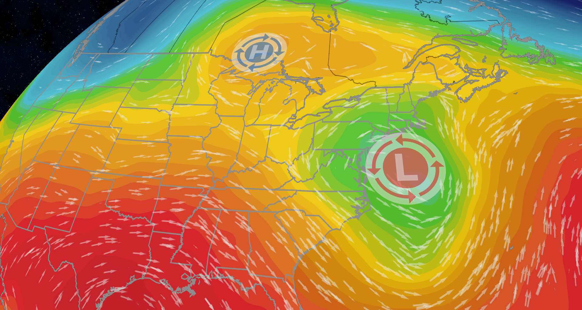
It is still far out, but we are seeing an interesting pattern setup this week across the eastern U.S. An area of high pressure will set up near the Great Lakes, as an area of low pressure moves from south to north along the East Coast. As the low gets closer to the high, winds will begin to strengthen.
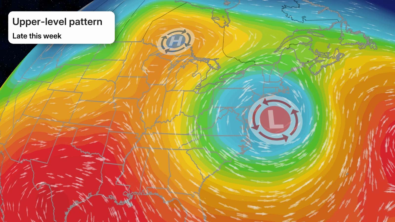
While it’s too early to say exactly how strong the winds will be, there will most likely be impacts felt across the Northeast.

Weather in your inbox
By signing up you agree to the Terms & Privacy Policy. Unsubscribe at any time.
We will know more in the next few days, but winds could start picking up late Tuesday, and unsettled weather could peak late week.
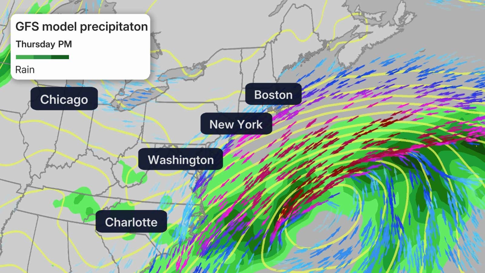
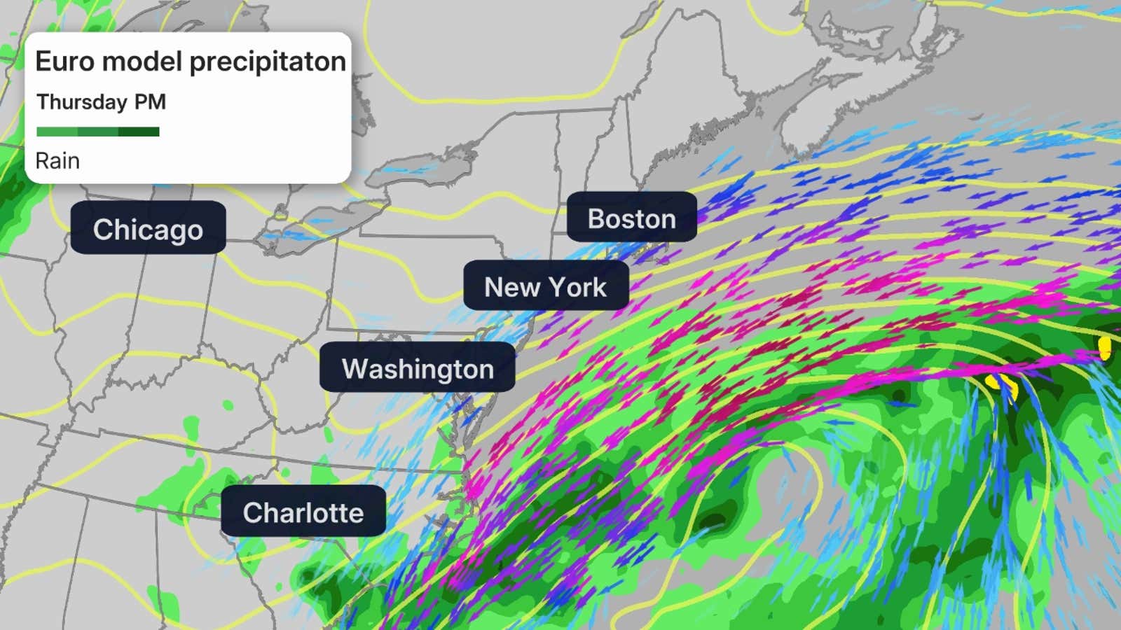
Both forecast models are picking up on the low, however, the placement of the low is quite different depending on which model you view. This will make a difference as to how great the impacts will be.
The GFS is being more bullish on the coastal low, and brings it closer to shore. This would mean higher winds, more rain and more coastal erosion for the Northeast. You can see the GFS model below.
Get More of Our News on Google
Set The Weather Company as a ‘Preferred Source’ to get quicker access to the news you value.

The European model is showing the low farther offshore, which would mean less impacts to the busy I-95 corridor. You can see the European model below.
We will have a clearer picture of what will happen in the coming days.
Regardless, we could see as much as several inches of rain across the region, so there could be disruptions to travel as well as flash flooding concerns, if heavy rain sets up along the coast.
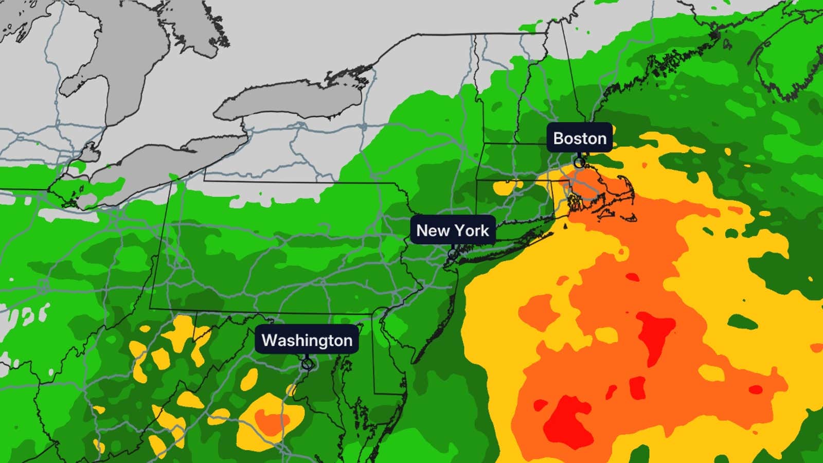
We also could see some gusty winds and larger waves across the Northeast from this storm. Gusty winds could cause power outages and travel delays along the coast and potentially inland, depending on how strong this low gets.
While even further out, models also have this system sticking around, and potentially strengthening as we head into the weekend. So make sure to check back often as the forecast becomes more clear.
What is a nor’easter?
I know you are thinking that it is too early to have a nor’easter, but the criteria for a nor’easter actually gets met more often than you would think.
A nor’easter just means that the winds come to an area from the northeast. For the Northeast, that usually means an area of low pressure is just off the coast, which brings the winds in this direction.
(More: What is a nor’easter?)
Most people usually think of snow and ice with Nor’easters and that is because nor’easter do tend to occur more in the late fall and winter.
The most notable nor’easters tend to bring heavy snow due to the fact that these lows move up along ocean currents called the Gulf Stream, tapping into the moisture. This warm, moist air then clashes with the cold air over the Northeast to create heavy snowfall. Fortunately, this one is occurring way earlier, so it is all rain this time.