

NEW YORK (WABC) — A powerful nor’easter will bring a soggy, windy weekend to the Tri-State area, with the greatest impacts expected along the coast, where flooding concerns continue to grow.
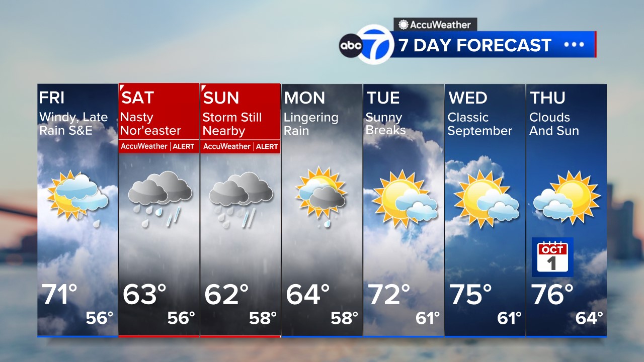
While conditions remained quiet Friday morning, rain is expected to begin developing later in the afternoon, first arriving south and east of New York City before spreading across the region Friday evening. Temperatures will climb into the upper 60s and lower 70s, but persistent northeast winds will make it feel noticeably cooler.
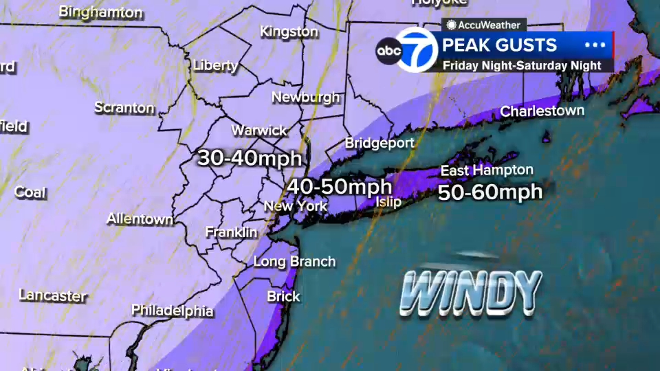
The strongest impacts from the storm are expected from Friday night through Sunday morning as the nor’easter tracks nearby. Winds will increase throughout the day Friday, with gusts approaching 40 mph in and around New York City. Along the I-95 corridor and parts of northeastern New Jersey, gusts could reach 40 to 50 mph. The highest wind speeds are forecast for eastern Suffolk County and the Jersey Shore, where gusts of 50 to 60 mph, and possibly higher on the East End of Long Island, could occur.
The storm’s greatest threat remains along the coast. Days of persistent onshore winds have already elevated water levels, and stronger winds this weekend are expected to worsen coastal flooding and beach erosion. Forecasters warn that some locations could see two to three feet of coastal flooding inundation, pushing several shoreline communities into major flood stage.
Coastal flood warnings have been issued for much of the region’s shoreline, including Nassau and Suffolk counties on Long Island, Brooklyn, Queens, the Jersey Shore, coastal Connecticut and southern Westchester. Advisories remain in effect for Manhattan and parts of northeastern New Jersey.
Flooding is expected to worsen through the weekend, particularly around high tide cycles. Major coastal flooding is forecast for parts of the Great South Bay near Lindenhurst, as well as areas surrounding Freeport, Inwood and Great Kills Harbor on Staten Island. Officials are also monitoring wave heights of 10 to 12 feet offshore, which could contribute to additional beach erosion and coastal impacts.
Rainfall will pick up Saturday morning as the storm strengthens, bringing multiple rounds of moderate to heavy rain through the weekend. While there will be periods of lighter precipitation and occasional breaks, wet weather is expected to persist into Sunday. Another heavier band of rain may wrap into the region Sunday as the storm’s circulation shifts near the Jersey Shore.
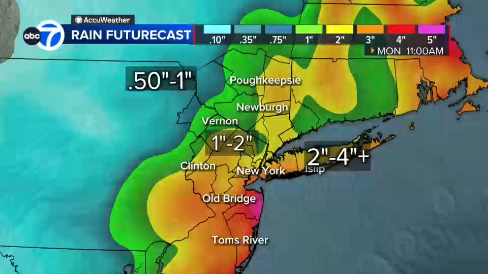
Most locations are forecast to receive 1 to 2 inches of rain, although higher totals of 2 to 4 inches are possible across Staten Island, Brooklyn, Queens, Long Island and parts of central New Jersey. Isolated areas could see even greater amounts. While widespread inland flooding is not expected, localized flooding could develop in areas that receive the heaviest rainfall, with some concern for river flooding later on.
Conditions will gradually improve late Sunday into Monday as the storm pulls away. Showers will become more scattered before tapering off, with clearing skies expected Monday afternoon. Drier weather and intervals of sunshine return Tuesday, while temperatures rebound into the mid-70s by the middle of next week.
Stay with the Eyewitness News AccuWeather team for continuing updates on the nor’easter.RELATED | Watches, warnings and advisories from the National Weather Service
Please fill out the form below to submit weather photos and videos.
MORE ACCUWEATHER RESOURCES
Check AccuTrack Radar
NWS Advisories, Watches and Warnings
School closings and delays
Follow chief meteorologist Lee Goldberg, Sam Champion, meteorologist Brittany Bell, meteorologist Jeff Smith, and meteorologist Dani Beckstrom on social media.